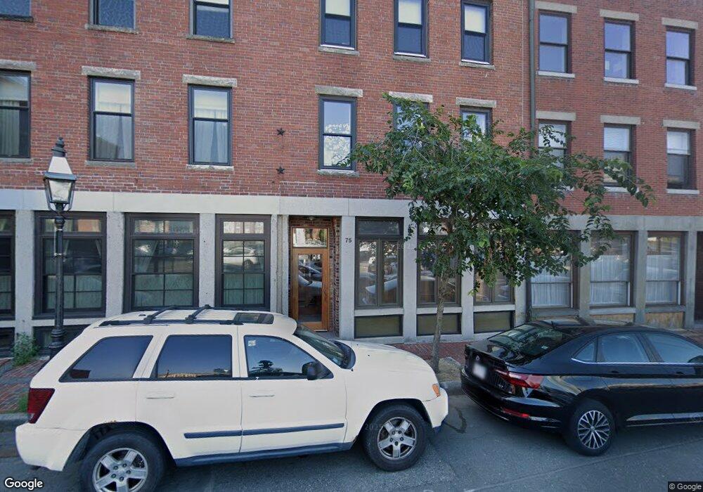
75 Fulton St Unit 12 Boston, MA 02109
North End NeighborhoodEstimated Value: $811,000 - $977,000
1
Bed
2
Baths
1,050
Sq Ft
$823/Sq Ft
Est. Value
About This Home
This home is located at 75 Fulton St Unit 12, Boston, MA 02109 and is currently estimated at $863,866, approximately $822 per square foot. 75 Fulton St Unit 12 is a home located in Suffolk County with nearby schools including St John School, Boston Children's School, and Torit Montessori School.
Ownership History
Date
Name
Owned For
Owner Type
Purchase Details
Closed on
Aug 19, 2008
Sold by
Flynn Christopher L
Bought by
Abbott David H and Tibolt Whitney P
Current Estimated Value
Purchase Details
Closed on
Jul 9, 1992
Sold by
Frank T Parrish Jr Rvt
Bought by
Flynn Christopher L
Create a Home Valuation Report for This Property
The Home Valuation Report is an in-depth analysis detailing your home's value as well as a comparison with similar homes in the area
Home Values in the Area
Average Home Value in this Area
Purchase History
| Date | Buyer | Sale Price | Title Company |
|---|---|---|---|
| Abbott David H | $542,000 | -- | |
| Flynn Christopher L | $114,000 | -- |
Source: Public Records
Mortgage History
| Date | Status | Borrower | Loan Amount |
|---|---|---|---|
| Open | Flynn Christopher L | $407,000 | |
| Closed | Flynn Christopher L | $409,500 |
Source: Public Records
Tax History Compared to Growth
Tax History
| Year | Tax Paid | Tax Assessment Tax Assessment Total Assessment is a certain percentage of the fair market value that is determined by local assessors to be the total taxable value of land and additions on the property. | Land | Improvement |
|---|---|---|---|---|
| 2025 | $8,096 | $699,100 | $0 | $699,100 |
| 2024 | $7,531 | $690,900 | $0 | $690,900 |
| 2023 | $7,211 | $671,400 | $0 | $671,400 |
| 2022 | $7,275 | $668,700 | $0 | $668,700 |
| 2021 | $7,135 | $668,700 | $0 | $668,700 |
| 2020 | $7,236 | $685,200 | $0 | $685,200 |
| 2019 | $6,687 | $634,410 | $0 | $634,410 |
| 2018 | $6,332 | $604,200 | $0 | $604,200 |
| 2017 | $6,212 | $586,635 | $0 | $586,635 |
| 2016 | $6,146 | $558,700 | $0 | $558,700 |
| 2015 | $5,888 | $486,200 | $0 | $486,200 |
| 2014 | $5,501 | $437,300 | $0 | $437,300 |
Source: Public Records
Map
Nearby Homes
- 110-112 Commercial St Unit 2
- 110-112 Commercial St Unit 5
- 142 Commercial St Unit 503
- 170 Commercial St Unit 4
- 120 Fulton St Unit DE
- 120 Fulton St Unit 5 C&D
- 122-130 Fulton Unit 13
- 130 Fulton St Unit 16
- 63 Atlantic Ave Unit 9B
- 63 Atlantic Ave Unit 7E
- 220 Commercial St Unit 5A
- 59 Commercial Wharf Unit 1
- 290 North St Unit 4
- 1 Lewis Wharf
- 21 Moon St Unit 2
- 28 Atlantic Ave Unit 638
- 28 Atlantic Ave Unit 424
- 28 Atlantic Ave Unit 534
- 115 Salem St Unit 16
- 11 Wiget St Unit 11-4
- 75 Fulton St Unit 62
- 75 Fulton St Unit 61
- 75 Fulton St Unit 52
- 75 Fulton St Unit 51
- 75 Fulton St Unit 42
- 75 Fulton St Unit 41
- 75 Fulton St Unit 32
- 75 Fulton St Unit 31
- 75 Fulton St Unit 22
- 75 Fulton St Unit 21
- 75 Fulton St Unit 14
- 75 Fulton St Unit 11
- 75 Fulton St Unit 1
- 65-67 Fulton St Unit 4
- 65-67 Fulton St Unit 3
- 65 Fulton St Unit 4
- 77 Fulton St Unit Two
- 77 Fulton St Unit Four
- 77 Fulton St Unit Suite 1
- 77 Fulton St Unit Suite 4