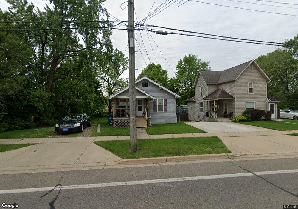
75 Goguac St W Battle Creek, MI 49015
Central Battle Creek NeighborhoodEstimated Value: $69,000 - $89,927
2
Beds
1
Bath
864
Sq Ft
$97/Sq Ft
Est. Value
About This Home
This home is located at 75 Goguac St W, Battle Creek, MI 49015 and is currently estimated at $83,482, approximately $96 per square foot. 75 Goguac St W is a home located in Calhoun County with nearby schools including Ann J. Kellogg School, Springfield Middle School, and Battle Creek Central High School.
Ownership History
Date
Name
Owned For
Owner Type
Purchase Details
Closed on
Apr 16, 2025
Sold by
Krieg Elizabeth Ann
Bought by
Demski Robert J
Current Estimated Value
Purchase Details
Closed on
Jan 22, 2021
Sold by
Demski Robert J
Bought by
Demski Robert Jon and Krieg Elizabeth Ann
Purchase Details
Closed on
Feb 2, 2006
Sold by
Va
Bought by
Demski Robert J and Demski Deborah J
Purchase Details
Closed on
Sep 23, 2004
Sold by
Flowers James H and Grier Amy C
Bought by
Va
Purchase Details
Closed on
Apr 26, 1996
Bought by
Flowers
Create a Home Valuation Report for This Property
The Home Valuation Report is an in-depth analysis detailing your home's value as well as a comparison with similar homes in the area
Home Values in the Area
Average Home Value in this Area
Purchase History
| Date | Buyer | Sale Price | Title Company |
|---|---|---|---|
| Demski Robert J | -- | None Listed On Document | |
| Demski Robert J | -- | None Listed On Document | |
| Demski Robert Jon | -- | None Available | |
| Demski Robert J | -- | Fatic | |
| Va | -- | -- | |
| Flowers | $36,000 | -- |
Source: Public Records
Tax History Compared to Growth
Tax History
| Year | Tax Paid | Tax Assessment Tax Assessment Total Assessment is a certain percentage of the fair market value that is determined by local assessors to be the total taxable value of land and additions on the property. | Land | Improvement |
|---|---|---|---|---|
| 2025 | -- | $27,900 | $0 | $0 |
| 2024 | $819 | $23,108 | $0 | $0 |
| 2023 | $1,043 | $21,963 | $0 | $0 |
| 2022 | $741 | $17,059 | $0 | $0 |
| 2021 | $991 | $16,105 | $0 | $0 |
| 2020 | $980 | $16,059 | $0 | $0 |
| 2019 | $933 | $18,182 | $0 | $0 |
| 2018 | $933 | $17,639 | $595 | $17,044 |
| 2017 | $904 | $14,386 | $0 | $0 |
| 2016 | $901 | $14,945 | $0 | $0 |
| 2015 | $883 | $14,682 | $2,948 | $11,734 |
| 2014 | $883 | $13,748 | $2,948 | $10,800 |
Source: Public Records
Map
Nearby Homes
- 96 Battle Creek Ave
- 17 Tennyson Ave
- 57 Boulder St
- 171 Goguac St W
- 210 Battle Creek Ave
- 21 Spring St
- 66 Cleveland St
- 212 Goguac St W
- 71 Burnham St W
- 35 Eldred St
- 178 Webber St
- 30 Harris St
- 111 Burnham St W
- 296 Meachem Ave
- 39 Harris St
- 100 Eldred St
- 131 Spring St
- 180 Upton Ave
- 207 Upton Ave Unit V/L
- 211 Upton Ave Unit V/L