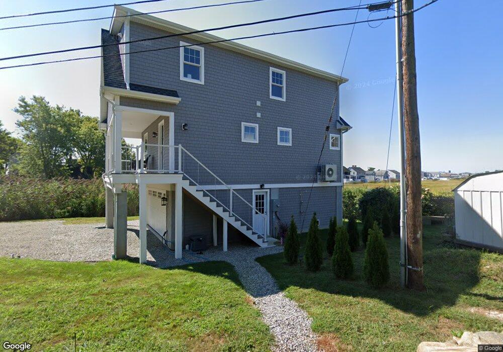
75 Old Pent Rd Westbrook, CT 06498
Estimated Value: $748,000 - $1,063,894
2
Beds
2
Baths
1,540
Sq Ft
$556/Sq Ft
Est. Value
About This Home
This home is located at 75 Old Pent Rd, Westbrook, CT 06498 and is currently estimated at $856,724, approximately $556 per square foot. 75 Old Pent Rd is a home located in Middlesex County with nearby schools including Daisy Ingraham School, Westbrook Middle School, and Westbrook High School.
Ownership History
Date
Name
Owned For
Owner Type
Purchase Details
Closed on
Jul 11, 2024
Sold by
Tetrault Robert L and Landsberg Karen J
Bought by
Oph Property Llc
Current Estimated Value
Purchase Details
Closed on
Mar 23, 2022
Sold by
Tetrault Robert L and Kiah James E
Bought by
Tetrault Robert L and Kiah James E
Purchase Details
Closed on
Mar 5, 2019
Sold by
Coffey Nancy L and Coffey Constance E
Bought by
Chanda Eleanor N and Dengler Margaret E
Create a Home Valuation Report for This Property
The Home Valuation Report is an in-depth analysis detailing your home's value as well as a comparison with similar homes in the area
Home Values in the Area
Average Home Value in this Area
Purchase History
| Date | Buyer | Sale Price | Title Company |
|---|---|---|---|
| Oph Property Llc | -- | None Available | |
| Oph Property Llc | -- | None Available | |
| Tetrault Robert L | -- | None Available | |
| Tetrault Robert L | -- | None Available | |
| Chanda Eleanor N | $160,000 | -- | |
| Chanda Eleanor N | $160,000 | -- |
Source: Public Records
Tax History
| Year | Tax Paid | Tax Assessment Tax Assessment Total Assessment is a certain percentage of the fair market value that is determined by local assessors to be the total taxable value of land and additions on the property. | Land | Improvement |
|---|---|---|---|---|
| 2025 | $8,858 | $393,700 | $193,230 | $200,470 |
| 2024 | $8,543 | $393,700 | $193,230 | $200,470 |
| 2023 | $3,475 | $163,015 | $154,600 | $8,415 |
| 2022 | $3,545 | $170,740 | $154,600 | $16,140 |
| 2021 | $3,285 | $131,410 | $117,050 | $14,360 |
| 2020 | $3,285 | $131,410 | $117,050 | $14,360 |
| 2019 | $3,242 | $131,410 | $117,050 | $14,360 |
| 2018 | $5,018 | $205,900 | $175,670 | $30,230 |
| 2017 | $5,018 | $205,900 | $175,670 | $30,230 |
| 2016 | $3,514 | $151,850 | $118,610 | $33,240 |
| 2015 | $3,418 | $151,850 | $118,610 | $33,240 |
| 2014 | $3,309 | $151,850 | $118,610 | $33,240 |
Source: Public Records
Map
Nearby Homes
- 0 Boston Post Rd Unit 24080344
- 40 Hammock Rd S
- 328 Hammock Rd N
- 951 Old Clinton Rd Unit 15
- 41 Trolley Rd
- 29 Salt Island Rd
- 11a/11b Pond Circle Rd
- 86 Grove Beach Rd N
- 85 McVeagh Rd
- 19 Old Forge Rd
- 44 Linden Ave N
- 5 Meadow Point Rd
- 8 Cook Terrace
- 407 Grove Beach Rd N
- 39 Sagamore Terrace Rd
- 5 Robin Ln
- 40 Beach Rd
- 37 Nolin Rd
- 10 Winterberry Cir
- 0 Causeway
Your Personal Tour Guide
Ask me questions while you tour the home.