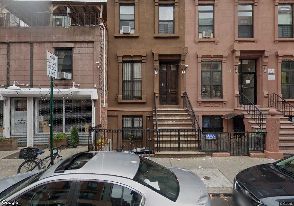
75 W 131st St New York, NY 10037
Central Harlem NeighborhoodEstimated Value: $666,000 - $1,989,000
--
Bed
--
Bath
3,456
Sq Ft
$369/Sq Ft
Est. Value
About This Home
This home is located at 75 W 131st St, New York, NY 10037 and is currently estimated at $1,276,543, approximately $369 per square foot. 75 W 131st St is a home located in New York County with nearby schools including Ps 175 Henry H Garnet, Urban Assembly Academy for Future Leaders, and Harlem Children's Zone Promise Academy II Middle School Charter School.
Ownership History
Date
Name
Owned For
Owner Type
Purchase Details
Closed on
Dec 29, 2011
Sold by
Lasoeur Brownstones Llc
Bought by
Anderson Heather
Current Estimated Value
Home Financials for this Owner
Home Financials are based on the most recent Mortgage that was taken out on this home.
Original Mortgage
$694,869
Outstanding Balance
$476,382
Interest Rate
3.98%
Mortgage Type
Purchase Money Mortgage
Estimated Equity
$800,161
Purchase Details
Closed on
Nov 17, 2005
Sold by
City Of New York
Bought by
Lasoeur Brownstones Llc
Home Financials for this Owner
Home Financials are based on the most recent Mortgage that was taken out on this home.
Original Mortgage
$1,323,682
Interest Rate
6.28%
Mortgage Type
Commercial
Create a Home Valuation Report for This Property
The Home Valuation Report is an in-depth analysis detailing your home's value as well as a comparison with similar homes in the area
Home Values in the Area
Average Home Value in this Area
Purchase History
| Date | Buyer | Sale Price | Title Company |
|---|---|---|---|
| Anderson Heather | $893,718 | -- | |
| Lasoeur Brownstones Llc | -- | -- |
Source: Public Records
Mortgage History
| Date | Status | Borrower | Loan Amount |
|---|---|---|---|
| Open | Anderson Heather | $694,869 | |
| Previous Owner | Lasoeur Brownstones Llc | $1,323,682 | |
| Closed | Lasoeur Brownstones Llc | $2,988,314 |
Source: Public Records
Tax History Compared to Growth
Tax History
| Year | Tax Paid | Tax Assessment Tax Assessment Total Assessment is a certain percentage of the fair market value that is determined by local assessors to be the total taxable value of land and additions on the property. | Land | Improvement |
|---|---|---|---|---|
| 2025 | $16,836 | $85,225 | $13,495 | $71,730 |
| 2024 | $16,836 | $85,224 | $21,900 | $69,870 |
| 2023 | $16,877 | $84,499 | $16,909 | $67,590 |
| 2022 | $15,643 | $108,600 | $21,900 | $86,700 |
| 2021 | $15,540 | $116,700 | $21,900 | $94,800 |
| 2020 | $14,737 | $132,900 | $21,900 | $111,000 |
| 2019 | $14,564 | $113,820 | $21,900 | $91,920 |
| 2018 | $14,057 | $70,416 | $12,994 | $57,422 |
| 2017 | $13,256 | $66,498 | $14,422 | $52,076 |
| 2016 | $12,231 | $62,734 | $17,573 | $45,161 |
| 2015 | $2,000 | $59,184 | $12,833 | $46,351 |
| 2014 | $2,000 | $59,184 | $15,404 | $43,780 |
Source: Public Records
Map
Nearby Homes
- 430 Lenox Ave Unit 2R
- 51 W 131st St Unit 4-A
- 57 W 130th St Unit GARDEN
- 57 W 130th St Unit DUPLEX
- 57 W 130th St Unit PHA
- 106 W 131st St
- 108 W 131st St
- 111 W 132nd St
- 380 Lenox Ave Unit 8D
- 380 Lenox Ave Unit PHK
- 380 Lenox Ave Unit PHC
- 122 W 132nd St
- 124 W 131st St
- 129 W 131st St Unit 1
- 130 W 132nd St
- 370 Lenox Ave Unit 603
- 370 Lenox Ave Unit 501
- 370 Lenox Ave Unit 401
- 370 Lenox Ave Unit PH1
- 370 Lenox Ave Unit 606
- 75 W 131st St Unit 2
- 75 W 131st St Unit 3
- 73 W 131st St
- 71 W 131st St
- 424 Malcolm x Blvd
- 426 Malcolm x Blvd
- 422 Malcolm x Blvd
- 420 Lenox Ave
- 420 Lenox Ave Unit BUILDING
- 420 Lenox Ave Unit 1
- 445 Malcolm x Blvd
- 438 Malcolm x Blvd
- 420 Malcolm x Blvd Unit 1
- 420 Malcolm x Blvd
- 67-69 W 131st St
- 430 Malcolm x Blvd
- 430 Malcolm x Blvd Unit 3
- 430 Lenox Ave Unit 2F
- 430 Lenox Ave Unit 3
- 428 Malcolm x Blvd