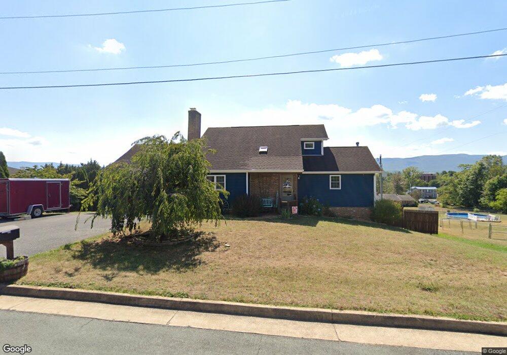
75 W High St Stuarts Draft, VA 24477
Estimated Value: $378,000 - $420,689
3
Beds
4
Baths
3,813
Sq Ft
$103/Sq Ft
Est. Value
About This Home
This home is located at 75 W High St, Stuarts Draft, VA 24477 and is currently estimated at $393,172, approximately $103 per square foot. 75 W High St is a home located in Augusta County with nearby schools including Guy K. Stump Elementary School, Stuarts Draft Middle School, and Stuarts Draft High School.
Ownership History
Date
Name
Owned For
Owner Type
Purchase Details
Closed on
Oct 15, 2014
Sold by
May Richard L and Ay Kerrie A
Bought by
May Richard L
Current Estimated Value
Purchase Details
Closed on
Mar 10, 2005
Sold by
Patterson Michael A and Patterson Tammy K
Bought by
Patterson Michael A
Home Financials for this Owner
Home Financials are based on the most recent Mortgage that was taken out on this home.
Original Mortgage
$145,000
Interest Rate
5.7%
Mortgage Type
New Conventional
Create a Home Valuation Report for This Property
The Home Valuation Report is an in-depth analysis detailing your home's value as well as a comparison with similar homes in the area
Home Values in the Area
Average Home Value in this Area
Purchase History
| Date | Buyer | Sale Price | Title Company |
|---|---|---|---|
| May Richard L | -- | None Available | |
| Patterson Michael A | -- | -- |
Source: Public Records
Mortgage History
| Date | Status | Borrower | Loan Amount |
|---|---|---|---|
| Previous Owner | Patterson Michael A | $145,000 |
Source: Public Records
Tax History Compared to Growth
Tax History
| Year | Tax Paid | Tax Assessment Tax Assessment Total Assessment is a certain percentage of the fair market value that is determined by local assessors to be the total taxable value of land and additions on the property. | Land | Improvement |
|---|---|---|---|---|
| 2025 | $1,899 | $365,200 | $60,000 | $305,200 |
| 2024 | $1,899 | $365,200 | $60,000 | $305,200 |
| 2023 | $1,603 | $254,400 | $60,000 | $194,400 |
| 2022 | $1,603 | $254,400 | $60,000 | $194,400 |
| 2021 | $1,603 | $254,400 | $60,000 | $194,400 |
| 2020 | $1,603 | $254,400 | $60,000 | $194,400 |
| 2019 | $1,603 | $254,400 | $60,000 | $194,400 |
| 2018 | $1,492 | $236,866 | $60,000 | $176,866 |
| 2017 | $1,374 | $236,866 | $60,000 | $176,866 |
| 2016 | $1,374 | $236,866 | $60,000 | $176,866 |
| 2015 | -- | $236,866 | $60,000 | $176,866 |
| 2014 | -- | $236,866 | $60,000 | $176,866 |
| 2013 | -- | $222,000 | $60,000 | $162,000 |
Source: Public Records
Map
Nearby Homes
- 2735 Stuarts Draft Hwy
- 51 Meriwether Cir
- 81 Meriwether Cir
- 0 Johnson Dr
- 39 Forest Springs Dr
- 203 Howardsville Turnpike
- 176 Locust Grove Ln
- 112 Arrowhead Ln
- 45 Gemstone Dr
- Mitchell Plan at Overlook
- Kemper Plan at Overlook - The Hills
- Kemper Plan at Overlook
- Drew I Plan at Overlook
- Brooke Plan at Overlook - The Hills
- Wingate Plan at Overlook - The Hills
- Chesapeake Plan at Overlook - The Hills
- 62 Fossil Dr
- 68 Fossil Dr
- 66 Fossil Dr
- 157 Lookover Terrace