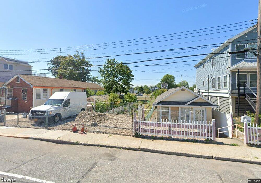
750 Seaview Ave Unit 1 Staten Island, NY 10305
Ocean Breeze NeighborhoodEstimated Value: $19,437 - $376,000
1
Bed
1
Bath
630
Sq Ft
$327/Sq Ft
Est. Value
About This Home
This home is located at 750 Seaview Ave Unit 1, Staten Island, NY 10305 and is currently estimated at $206,109, approximately $327 per square foot. 750 Seaview Ave Unit 1 is a home located in Richmond County with nearby schools including P.S. 052 John C. Thompson, Is 2 George L Egbert, and New Dorp High School.
Ownership History
Date
Name
Owned For
Owner Type
Purchase Details
Closed on
Nov 21, 2019
Sold by
Housing Trust Fund Corporation
Bought by
Xu Jin Hua
Current Estimated Value
Purchase Details
Closed on
Feb 15, 2001
Sold by
Dauria Nancy and Dauria Sebastian J
Bought by
Goldstone Tina J
Home Financials for this Owner
Home Financials are based on the most recent Mortgage that was taken out on this home.
Original Mortgage
$55,800
Interest Rate
7.15%
Purchase Details
Closed on
Apr 8, 1999
Sold by
Dauria Nancy
Bought by
Dauria Nancy and Dauria Sebastian J
Create a Home Valuation Report for This Property
The Home Valuation Report is an in-depth analysis detailing your home's value as well as a comparison with similar homes in the area
Home Values in the Area
Average Home Value in this Area
Purchase History
| Date | Buyer | Sale Price | Title Company |
|---|---|---|---|
| Xu Jin Hua | $15,000 | Westcor Land Title Ins Co | |
| Goldstone Tina J | $70,000 | Fidelity National Title Ins | |
| Dauria Nancy | -- | Nations Title Insurance |
Source: Public Records
Mortgage History
| Date | Status | Borrower | Loan Amount |
|---|---|---|---|
| Previous Owner | Goldstone Tina J | $55,800 |
Source: Public Records
Tax History Compared to Growth
Tax History
| Year | Tax Paid | Tax Assessment Tax Assessment Total Assessment is a certain percentage of the fair market value that is determined by local assessors to be the total taxable value of land and additions on the property. | Land | Improvement |
|---|---|---|---|---|
| 2025 | $868 | $5,880 | $4,579 | $1,301 |
| 2024 | $868 | $4,800 | $4,320 | $480 |
| 2023 | $865 | $4,320 | $4,320 | $0 |
| 2022 | $5 | $4,500 | $4,500 | $0 |
| 2021 | $851 | $4,620 | $4,620 | $0 |
| 2020 | $808 | $4,140 | $4,140 | $0 |
| 2019 | $0 | $3,600 | $3,600 | $0 |
| 2018 | $0 | $3,879 | $3,581 | $298 |
| 2017 | $0 | $3,660 | $3,600 | $60 |
| 2016 | -- | $3,660 | $3,600 | $60 |
| 2015 | $1,776 | $9,777 | $4,425 | $5,352 |
| 2014 | $1,776 | $9,254 | $4,189 | $5,065 |
Source: Public Records
Map
Nearby Homes
- 762 Seaview Ave
- 0 Quincy Ave
- 000 Quincy Ave
- 431 Patterson Ave
- 602 Seaview Ave
- 795 Father Capodanno Blvd
- 797 Father Capodanno Blvd
- 799 Father Capodanno Blvd
- 498 Dongan Hills Ave
- 521 Buel Ave
- 517 Buel Ave
- 473 Dongan Hills Ave
- 467 Dongan Hills Ave
- 9 Iroquois St
- 929 Father Capodanno Blvd
- 197 Slater Blvd
- 00 Baden Place
- 0 Baden Place Unit 2503276
- 188 Graham Blvd Unit B
- 665 Hunter Ave
- 750 Seaview Ave
- 752 Seaview Ave
- 748 Seaview Ave
- 754 Seaview Ave
- 742 Seaview Ave Unit 2
- 742 Seaview Ave
- 756 Seaview Ave
- 760 Seaview Ave
- 738 Seaview Ave
- 719 Liberty Ave
- 717 Liberty Ave
- 721 Liberty Ave
- 736 Seaview Ave
- 715 Liberty Ave
- 725 Liberty Ave
- 711 Liberty Ave
- 723 Liberty Ave
- 764 Seaview Ave
- 727 Liberty Ave
- 568 Quincy Ave