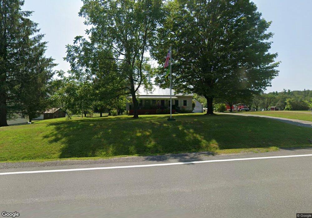
7502 State Route 55 Neversink, NY 12765
Estimated Value: $225,373 - $400,000
4
Beds
1
Bath
1,584
Sq Ft
$198/Sq Ft
Est. Value
About This Home
This home is located at 7502 State Route 55, Neversink, NY 12765 and is currently estimated at $313,593, approximately $197 per square foot. 7502 State Route 55 is a home located in Sullivan County with nearby schools including Tri-Valley Elementary School and Tri-Valley Secondary School.
Ownership History
Date
Name
Owned For
Owner Type
Purchase Details
Closed on
Aug 20, 2018
Sold by
Debra Redman Timothy and Debra Lewkiewics
Bought by
Meade Andrew and Meade April
Current Estimated Value
Home Financials for this Owner
Home Financials are based on the most recent Mortgage that was taken out on this home.
Original Mortgage
$181,390
Outstanding Balance
$157,530
Interest Rate
4.5%
Mortgage Type
Purchase Money Mortgage
Estimated Equity
$156,063
Purchase Details
Closed on
Aug 20, 2007
Sold by
Benton Lisa M
Bought by
Redman Timothy
Home Financials for this Owner
Home Financials are based on the most recent Mortgage that was taken out on this home.
Original Mortgage
$175,500
Interest Rate
6.78%
Mortgage Type
Purchase Money Mortgage
Purchase Details
Closed on
Jun 27, 2000
Sold by
Shaffer Martha P
Bought by
Benton Lisa M
Create a Home Valuation Report for This Property
The Home Valuation Report is an in-depth analysis detailing your home's value as well as a comparison with similar homes in the area
Home Values in the Area
Average Home Value in this Area
Purchase History
| Date | Buyer | Sale Price | Title Company |
|---|---|---|---|
| Meade Andrew | $187,000 | -- | |
| Redman Timothy | $195,000 | Gary Sobo | |
| Benton Lisa M | $95,000 | Robert Lander |
Source: Public Records
Mortgage History
| Date | Status | Borrower | Loan Amount |
|---|---|---|---|
| Open | Meade Andrew | $181,390 | |
| Previous Owner | Redman Timothy | $175,500 |
Source: Public Records
Tax History Compared to Growth
Tax History
| Year | Tax Paid | Tax Assessment Tax Assessment Total Assessment is a certain percentage of the fair market value that is determined by local assessors to be the total taxable value of land and additions on the property. | Land | Improvement |
|---|---|---|---|---|
| 2024 | $3,167 | $3,600 | $250 | $3,350 |
| 2023 | $3,115 | $3,600 | $250 | $3,350 |
| 2022 | $3,272 | $3,600 | $250 | $3,350 |
| 2021 | $3,373 | $3,600 | $250 | $3,350 |
| 2020 | $1,475 | $3,600 | $250 | $3,350 |
| 2019 | $2,678 | $3,600 | $250 | $3,350 |
| 2018 | $2,678 | $3,600 | $250 | $3,350 |
| 2017 | $2,694 | $3,600 | $250 | $3,350 |
| 2016 | $2,644 | $3,600 | $250 | $3,350 |
| 2015 | -- | $3,600 | $250 | $3,350 |
| 2014 | -- | $3,600 | $250 | $3,350 |
Source: Public Records
Map
Nearby Homes
- 15 Deans Way
- 497 Myers Rd
- 518 Myers Rd
- 109 Mutton Hill Rd
- 34 Overlook Rd
- 45 Overlook Rd
- 1 Lake View Dr
- 0 Benton Hollow Rd Unit KEY836200
- 382 Benton Hollow Rd
- 107 Overlook Rd
- 32 Brookside Dr
- 114 Wagners Rd
- 4 Cole Dr
- 650 Thunder Hill Rd
- 117 Moore Rd
- 113 Moore Rd
- 115 Moore Rd
- 30 Soho Cir
- 148 Moore Rd
- 203 Skyline Dr
- 7506 State Route 55
- 7510 State Route 55
- 7505 State Route 55
- 7505 State Route 55
- 7516 State Route 55
- 7513 State Route 55
- 7480 State Route 55
- 7520 State Route 55
- 46 Bungalow Brook Rd
- 211 Thunder Hill Rd
- 7479 State Route 55
- 7474 State Route 55
- 7527 State Route 55
- 7473 State Route 55
- 7472 State Route 55
- 7 Mutton Hill Rd
- 7 Mutton Hill Rd
- 15 Mutton Hill Rd
- 7535 State Route 55
- 7466 State Route 55