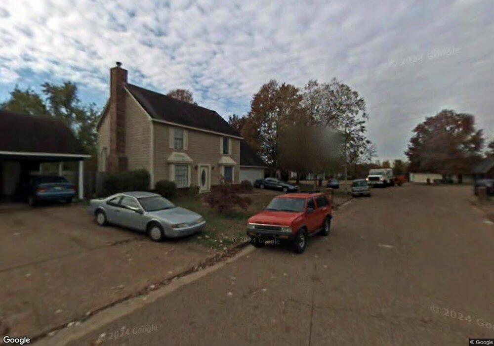
7509 Val Marie Ln Memphis, TN 38133
Estimated Value: $216,000 - $222,896
3
Beds
2
Baths
1,275
Sq Ft
$172/Sq Ft
Est. Value
About This Home
This home is located at 7509 Val Marie Ln, Memphis, TN 38133 and is currently estimated at $219,724, approximately $172 per square foot. 7509 Val Marie Ln is a home located in Shelby County with nearby schools including Kate Bond Elementary School, Kate Bond Middle School, and Cordova High School.
Ownership History
Date
Name
Owned For
Owner Type
Purchase Details
Closed on
Apr 24, 2005
Sold by
Sumers Scotty
Bought by
Sumers Mirika
Current Estimated Value
Home Financials for this Owner
Home Financials are based on the most recent Mortgage that was taken out on this home.
Original Mortgage
$111,447
Outstanding Balance
$57,586
Interest Rate
5.8%
Mortgage Type
Purchase Money Mortgage
Estimated Equity
$162,138
Purchase Details
Closed on
Jul 23, 1999
Sold by
Bill Hargrave and Bill Lisa A
Bought by
Johnson Scott and Chambers Mirika K
Home Financials for this Owner
Home Financials are based on the most recent Mortgage that was taken out on this home.
Original Mortgage
$106,945
Interest Rate
7.7%
Mortgage Type
FHA
Create a Home Valuation Report for This Property
The Home Valuation Report is an in-depth analysis detailing your home's value as well as a comparison with similar homes in the area
Home Values in the Area
Average Home Value in this Area
Purchase History
| Date | Buyer | Sale Price | Title Company |
|---|---|---|---|
| Sumers Mirika | -- | -- | |
| Johnson Scott | $107,000 | -- |
Source: Public Records
Mortgage History
| Date | Status | Borrower | Loan Amount |
|---|---|---|---|
| Open | Sumers Mirika | $111,447 | |
| Previous Owner | Johnson Scott | $106,945 |
Source: Public Records
Tax History Compared to Growth
Tax History
| Year | Tax Paid | Tax Assessment Tax Assessment Total Assessment is a certain percentage of the fair market value that is determined by local assessors to be the total taxable value of land and additions on the property. | Land | Improvement |
|---|---|---|---|---|
| 2025 | $1,193 | $55,675 | $8,750 | $46,925 |
| 2024 | $1,193 | $35,200 | $6,125 | $29,075 |
| 2023 | $2,144 | $35,200 | $6,125 | $29,075 |
| 2022 | $2,144 | $35,200 | $6,125 | $29,075 |
| 2021 | $2,169 | $35,200 | $6,125 | $29,075 |
| 2020 | $1,775 | $24,500 | $6,125 | $18,375 |
| 2019 | $1,775 | $24,500 | $6,125 | $18,375 |
| 2018 | $1,775 | $24,500 | $6,125 | $18,375 |
| 2017 | $1,007 | $24,500 | $6,125 | $18,375 |
| 2016 | $1,047 | $23,950 | $0 | $0 |
| 2014 | $1,047 | $23,950 | $0 | $0 |
Source: Public Records
Map
Nearby Homes
- 2376 Pate Rd
- 2554 Appling Glen Dr
- 2566 Austin Green Bay
- 7723 Reese Rd
- 2518 Bassfield Dr
- 7270 Rose Trail Dr
- 7551 Meadowland Dr
- 2633 Sleepy Bend Cove
- 2739 Lakeside Dr
- 2789 Arbor Lane Dr
- 7153 Tulip Trail Dr
- 7118 Reese Rd
- 7828 Deerfield Trace
- 7183 Polder Dr
- 2718 Kate Bond Rd
- 7078 Tulip Trail Dr
- 2412 Kate Bond Rd
- 2065 Steeplebrook Dr
- 2547 Reese Lake Cir
- 7070 Texel Cove
- 7515 Val Marie Ln
- 7501 Val Marie Ln
- 7508 Burnstown Ln
- 7512 Burnstown Ln
- 7523 Val Marie Ln
- 7500 Val Marie Ln
- 7520 Burnstown Ln
- 7512 Val Marie Ln
- 7498 Burnstown Ln
- 7504 Val Marie Ln
- 7518 Val Marie Ln
- 7529 Val Marie Ln
- 7528 Burnstown Ln
- 7526 Val Marie Ln
- 7507 Burnstown Ln
- 7513 Burnstown Ln
- 7511 Tory Hill Ln
- 7537 Val Marie Ln
- 7521 Burnstown Ln
- 7534 Burnstown Ln