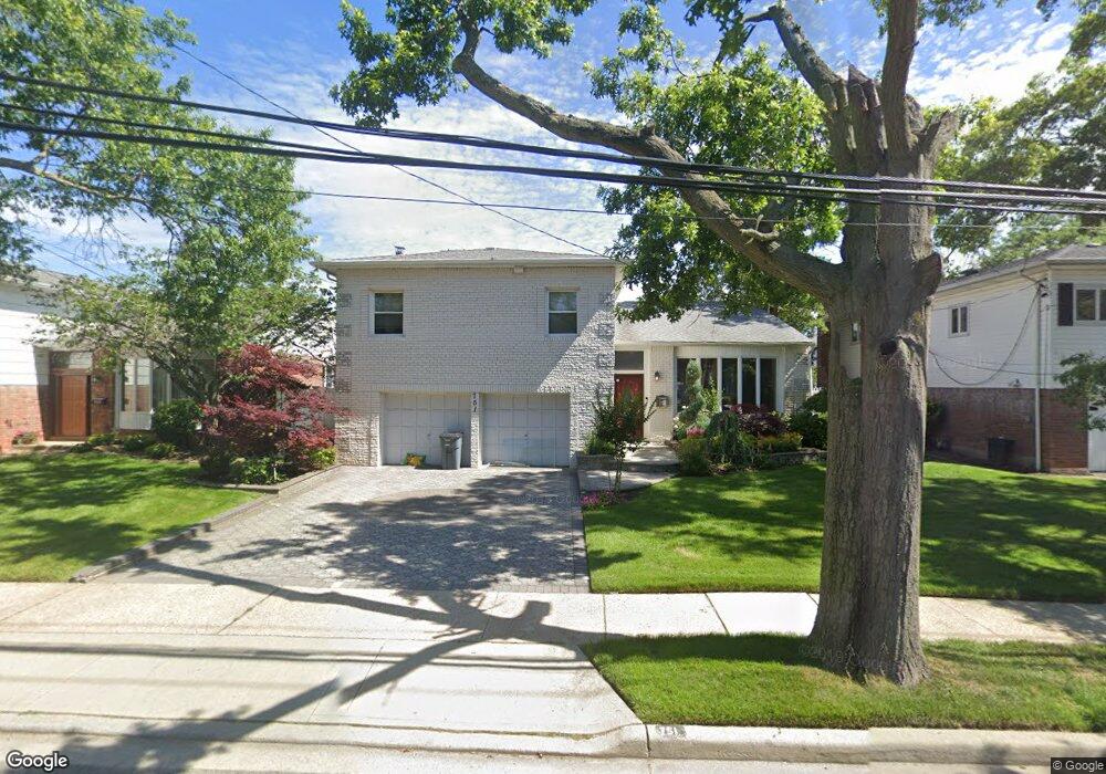
751 Bonnie Dr Baldwin, NY 11510
Estimated Value: $756,466 - $838,000
Studio
3
Baths
1,785
Sq Ft
$447/Sq Ft
Est. Value
About This Home
This home is located at 751 Bonnie Dr, Baldwin, NY 11510 and is currently estimated at $797,233, approximately $446 per square foot. 751 Bonnie Dr is a home located in Nassau County with nearby schools including Baldwin Senior High School.
Ownership History
Date
Name
Owned For
Owner Type
Purchase Details
Closed on
Aug 14, 2007
Sold by
Lawrence Wayne
Current Estimated Value
Purchase Details
Closed on
Mar 16, 2005
Sold by
Manmohan Richard
Bought by
Lawrence Wayne
Purchase Details
Closed on
Jul 30, 2003
Sold by
Lamour Mousslin
Bought by
Manmohan Richard
Purchase Details
Closed on
Dec 20, 1996
Sold by
Citibank N A
Bought by
Lamour Mousslin
Purchase Details
Closed on
Jan 4, 1996
Sold by
Bard Robert Ref
Bought by
Citibank N A
Create a Home Valuation Report for This Property
The Home Valuation Report is an in-depth analysis detailing your home's value as well as a comparison with similar homes in the area
Home Values in the Area
Average Home Value in this Area
Purchase History
| Date | Buyer | Sale Price | Title Company |
|---|---|---|---|
| -- | -- | -- | |
| -- | -- | -- | |
| Lawrence Wayne | $514,000 | -- | |
| Lawrence Wayne | $514,000 | -- | |
| Manmohan Richard | $450,000 | -- | |
| Manmohan Richard | $450,000 | -- | |
| Lamour Mousslin | $217,000 | -- | |
| Lamour Mousslin | $217,000 | -- | |
| Citibank N A | $238,191 | -- | |
| Citibank N A | $238,191 | -- |
Source: Public Records
Tax History
| Year | Tax Paid | Tax Assessment Tax Assessment Total Assessment is a certain percentage of the fair market value that is determined by local assessors to be the total taxable value of land and additions on the property. | Land | Improvement |
|---|---|---|---|---|
| 2025 | $14,211 | $496 | $187 | $309 |
| 2024 | $4,035 | $496 | $187 | $309 |
Source: Public Records
Map
Nearby Homes
- 746 Vivian Ct Unit 1
- 739 Bonnie Dr
- 3186 Grand Ave
- 3051 Grand Ave
- 820 Jefferson St
- 3029 Ann St
- 3522 Frederick St
- 3066 Ann St
- 702 Fishermans Rd
- 3004 Harbor St
- 3066 Western Blvd
- 3483 Frederick St
- 880 Washington St
- 647 Lincoln St
- 2962 Grand Ave
- 3014 Western Blvd
- 528 Carpenter Ave
- 613 Smith Place
- 3249 Wolfson Dr
- 882 Ocean St
Your Personal Tour Guide
Ask me questions while you tour the home.