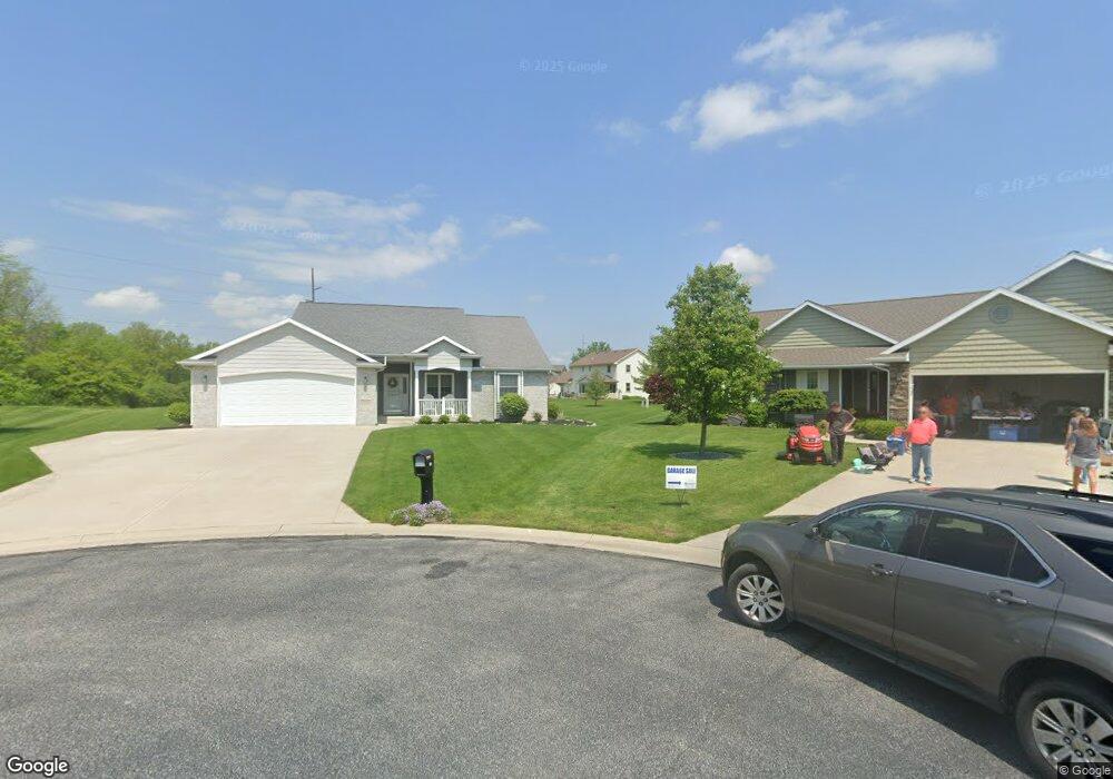
751 Burning Tree Dr Defiance, OH 43512
Estimated Value: $312,000 - $374,810
2
Beds
3
Baths
1,664
Sq Ft
$205/Sq Ft
Est. Value
About This Home
This home is located at 751 Burning Tree Dr, Defiance, OH 43512 and is currently estimated at $340,953, approximately $204 per square foot. 751 Burning Tree Dr is a home with nearby schools including Noble Elementary School, Tinora Elementary School, and Tinora Middle School.
Ownership History
Date
Name
Owned For
Owner Type
Purchase Details
Closed on
Apr 25, 2005
Sold by
Hayco & Associates Inc
Bought by
Seibel Peter and Seibel Karen D
Current Estimated Value
Create a Home Valuation Report for This Property
The Home Valuation Report is an in-depth analysis detailing your home's value as well as a comparison with similar homes in the area
Home Values in the Area
Average Home Value in this Area
Purchase History
| Date | Buyer | Sale Price | Title Company |
|---|---|---|---|
| Seibel Peter | $26,925 | None Available |
Source: Public Records
Tax History Compared to Growth
Tax History
| Year | Tax Paid | Tax Assessment Tax Assessment Total Assessment is a certain percentage of the fair market value that is determined by local assessors to be the total taxable value of land and additions on the property. | Land | Improvement |
|---|---|---|---|---|
| 2024 | $3,858 | $116,320 | $15,680 | $100,640 |
| 2023 | $3,858 | $116,320 | $15,680 | $100,640 |
| 2022 | $3,677 | $93,620 | $15,680 | $77,940 |
| 2021 | $3,677 | $93,620 | $15,680 | $77,940 |
| 2020 | $3,692 | $93,620 | $15,680 | $77,940 |
| 2019 | $3,241 | $84,490 | $15,700 | $68,790 |
| 2018 | $3,339 | $84,490 | $15,700 | $68,790 |
| 2017 | $2,995 | $84,487 | $15,701 | $68,786 |
| 2016 | $2,677 | $75,075 | $15,624 | $59,451 |
| 2015 | $1,395 | $75,075 | $15,624 | $59,451 |
| 2014 | $1,395 | $75,075 | $15,624 | $59,451 |
| 2013 | $1,395 | $75,075 | $15,624 | $59,451 |
| 2012 | $1,395 | $75,075 | $15,624 | $59,451 |
Source: Public Records
Map
Nearby Homes
- 1275 Pinehurst Dr
- 846 Deerwood Dr
- 850 Deerwood Dr
- 679 Burning Tree Dr
- 673 Burning Tree Dr
- 1365 Heatherdowns Dr
- 655 Burning Tree Dr
- 1459 Deerwood Dr
- 1408 Heatherdowns Dr
- 649 Burning Tree Dr
- 0 Domersville Rd
- 0 Carpenter Rd Unit 10001359
- 00 Carpenter Rd
- 1744 Lora Ln
- 1613 E 2nd St
- 512 Tiedeman Ave
- 230 Adams St
- 600 Euclid St
- 250 Gray St
- 262 Broadway Ave
- 755 Burning Tree Dr
- 1245 Hilton Head Ct
- 739 Burning Tree Dr
- 748 Burning Tree Dr
- 760 Burning Tree Dr
- 1275 Hilton Head Ct
- 732 Burning Tree Dr
- 733 Burning Tree Dr
- 1238 Hilton Head Ct
- 1287 Hilton Head Ct
- 726 Burning Tree Dr
- 727 Burning Tree Dr
- 760 Inverness Dr
- 770 Inverness Dr
- 1301 Hilton Head Ct
- 1262 Hilton Head Ct
- 1246 Hilton Head Ct
- 748 Inverness Dr
- 780 Inverness Dr
- 1276 Hilton Head Ct