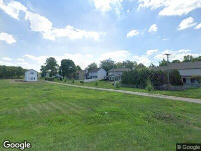
7510 Maysville Rd Unit 1 Fort Wayne, IN 46815
Kensington Downs NeighborhoodEstimated Value: $192,000 - $267,496
2
Beds
1
Bath
1,152
Sq Ft
$199/Sq Ft
Est. Value
About This Home
This home is located at 7510 Maysville Rd Unit 1, Fort Wayne, IN 46815 and is currently estimated at $228,874, approximately $198 per square foot. 7510 Maysville Rd Unit 1 is a home located in Allen County with nearby schools including J Wilbur Haley Elementary School, Blackhawk Middle School, and R Nelson Snider High School.
Ownership History
Date
Name
Owned For
Owner Type
Purchase Details
Closed on
Nov 21, 2024
Sold by
Burnett Jamar Montrel
Bought by
Burnett Jamar Montrel and Burnett Nakia J
Current Estimated Value
Home Financials for this Owner
Home Financials are based on the most recent Mortgage that was taken out on this home.
Original Mortgage
$96,000
Outstanding Balance
$95,839
Interest Rate
6.54%
Mortgage Type
Construction
Estimated Equity
$185,398
Purchase Details
Closed on
Jun 9, 2006
Sold by
Bruick Alice M
Bought by
Bruick Mark A and Bruick Randall G
Create a Home Valuation Report for This Property
The Home Valuation Report is an in-depth analysis detailing your home's value as well as a comparison with similar homes in the area
Home Values in the Area
Average Home Value in this Area
Purchase History
| Date | Buyer | Sale Price | Title Company |
|---|---|---|---|
| Burnett Jamar Montrel | -- | None Listed On Document | |
| Bruick Mark A | -- | None Available |
Source: Public Records
Mortgage History
| Date | Status | Borrower | Loan Amount |
|---|---|---|---|
| Open | Burnett Jamar Montrel | $96,000 | |
| Previous Owner | Burnett Jamar Montrel | $239,000 | |
| Previous Owner | Burnett Jamar Montrel | $260,000 | |
| Previous Owner | Burnett Jamar Montrel | $750,000 |
Source: Public Records
Tax History Compared to Growth
Tax History
| Year | Tax Paid | Tax Assessment Tax Assessment Total Assessment is a certain percentage of the fair market value that is determined by local assessors to be the total taxable value of land and additions on the property. | Land | Improvement |
|---|---|---|---|---|
| 2024 | $952 | $227,400 | $56,600 | $170,800 |
| 2023 | $947 | $40,900 | $40,800 | $100 |
| 2022 | $933 | $40,800 | $40,800 | $0 |
| 2021 | $935 | $40,800 | $40,800 | $0 |
| 2020 | $923 | $40,800 | $40,800 | $0 |
| 2019 | $64 | $2,700 | $2,700 | $0 |
| 2018 | $66 | $2,800 | $2,800 | $0 |
| 2017 | $76 | $3,200 | $3,200 | $0 |
| 2016 | $79 | $3,400 | $3,400 | $0 |
| 2014 | $75 | $3,600 | $3,600 | $0 |
| 2013 | -- | $3,100 | $3,100 | $0 |
Source: Public Records
Map
Nearby Homes
- 7619 Preakness Cove
- 7618 Preakness Cove
- 7609 Preakness Cove
- 7735 Greymoor Dr
- 7807 Tipperary Trail
- 3010 Sandarac Ln
- 2520 Repton Dr
- 2626 Repton Dr
- 2704 Busche Dr
- 7304 Antebellum Blvd
- 3222 Wakashan Place
- 7109 Antebellum Dr
- 8319 Asher Dr
- 7321 Kern Valley Dr
- 3323 Kiowa Ct
- 6932 White Eagle Dr
- 8130 Park State Dr
- 2513 Darwood Grove
- 2005 Forest Valley Dr
- 3126 Marias Dr
- 7510 Maysville Rd Unit 1
- 7609 Welshire Blvd
- 7617 Welshire Blvd
- 7617 Weshire Blvd
- 7526 Maysville Rd
- 7625 Welshire Blvd
- 7633 Welshire Blvd
- 7623 Preakness Cove
- 7621 Preakness Cove
- 7617 Preakness Cove
- 7707 Preakness Cove
- 7536 Maysville Rd
- 7715 Welshire Blvd
- 7711 Preakness Cove
- 7615 Preakness Cove
- 7447 Maysville Rd
- 7622 Preakness Cove
- 7723 Welshire Blvd
- 7715 Preakness Cove
- 7613 Preakness Cove
