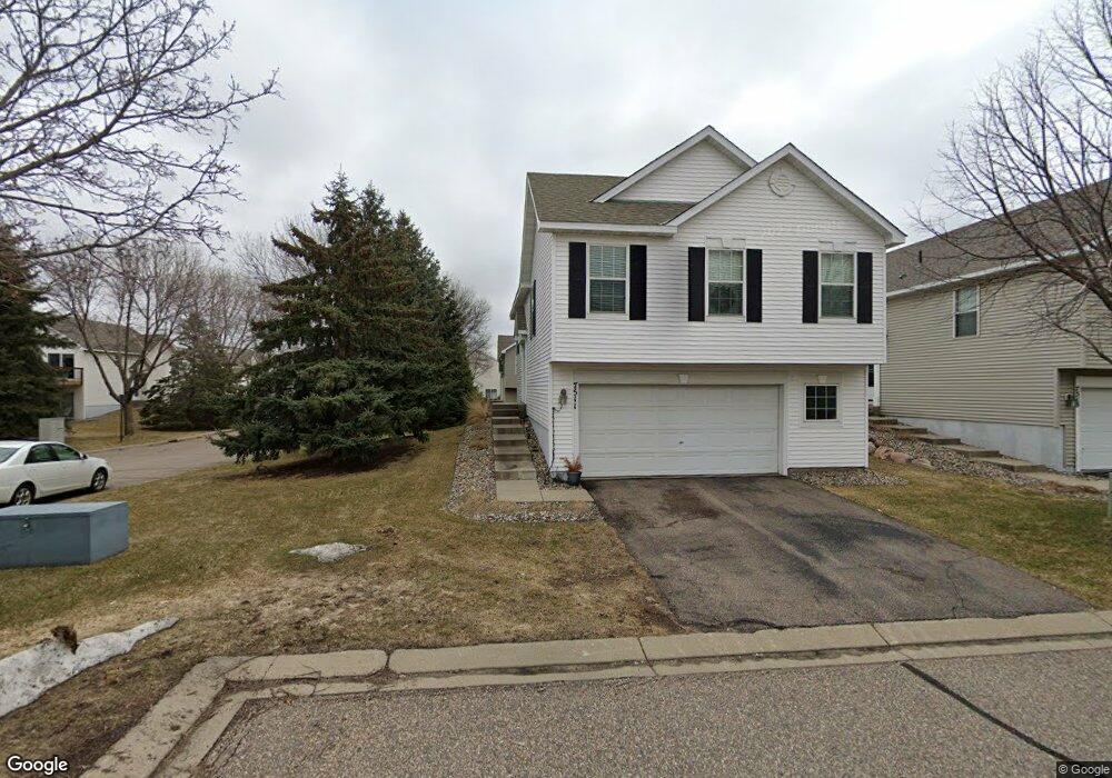
7511 Hampton Ln Shakopee, MN 55379
Estimated Value: $331,459 - $354,000
About This Home
This home is located at 7511 Hampton Ln, Shakopee, MN 55379 and is currently estimated at $340,615, approximately $186 per square foot. 7511 Hampton Ln is a home located in Scott County with nearby schools including Red Oak Elementary School, Shakopee West Middle School, and Shakopee Senior High School.
Ownership History
We collect this data history from publicly available records. To have your information removed, we recommend requesting removal directly through your county’s website.
Purchase Details
Purchase Details
Purchase Details
Purchase Details
Home Values in the Area
Average Home Value in this Area
Purchase History
We collect this data history from publicly available records. To have your information removed, we recommend requesting removal directly through your county’s website.
| Date | Buyer | Sale Price | Title Company |
|---|---|---|---|
| -- | None Available | ||
| -- | None Available | ||
| $205,240 | -- | ||
| $1,400,000 | -- |
Tax History
We collect this data history from publicly available records. To have your information removed, we recommend requesting removal directly through your county’s website.
| Year | Tax Paid | Tax Assessment Tax Assessment Total Assessment is a certain percentage of the fair market value that is determined by local assessors to be the total taxable value of land and additions on the property. | Land | Improvement |
|---|---|---|---|---|
| 2026 | $3,212 | $333,200 | $114,100 | $219,100 |
| 2025 | $3,212 | $334,400 | $114,100 | $220,300 |
| 2024 | $2,802 | $319,100 | $108,700 | $210,400 |
| 2023 | $2,878 | $271,700 | $63,900 | $207,800 |
| 2022 | $3,022 | $274,500 | $65,500 | $209,000 |
| 2021 | $2,666 | $249,500 | $51,300 | $198,200 |
| 2020 | $2,952 | $243,000 | $47,300 | $195,700 |
| 2019 | $2,822 | $237,300 | $50,000 | $187,300 |
| 2018 | $2,564 | $0 | $0 | $0 |
| 2016 | $2,440 | $0 | $0 | $0 |
| 2014 | -- | $0 | $0 | $0 |
Map
- 7466 Derby Ln Unit 1807
- 7559 Derby Ln
- 1370 Preston Ln Unit 1508
- 7378 Windsor Dr N
- 7407 Derby Ln Unit 801
- 1575 Windsor Dr S
- 7944 Stratford Cir N Unit 1301
- 8000 Stratford Cir S Unit 806
- 1672 Windsor Dr S
- 1693 Windsor Dr S
- 1774 Fox Run
- 8507 Grove Cir
- 1767 Fescue Ct
- 1671 Riverside Dr
- 1718 Riverside Dr
- 1724 Riverside Dr
- 6453 Oxford Rd N
- 1828 Fescue Cir
- 1760 Riverside Dr
- 1773 Grove Dr
- 7515 Hampton Ln
- 7519 Hampton Ln
- 1460 Yorkshire Ln
- 1464 Yorkshire Ln
- 7537 Devin Ln
- 7523 Hampton Ln
- 1468 Yorkshire Ln
- 7507 Hampton Ln
- 7503 Hampton Ln
- 7499 Hampton Ln
- 1412 Yorkshire Ln
- 1472 Yorkshire Ln
- 7533 Devin Ln
- 7527 Hampton Ln
- 7501 Devin Ln
- 7495 Hampton Ln
- 1408 Yorkshire Ln
- 1476 Yorkshire Ln
- 7529 Devin Ln
- 7505 Devin Ln
Ask me questions while you tour the home.