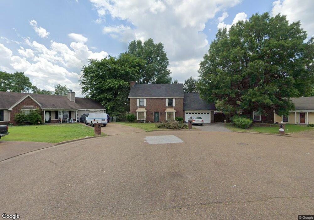
7512 Port Albert Ln Memphis, TN 38133
Estimated Value: $147,000 - $248,000
3
Beds
3
Baths
1,798
Sq Ft
$119/Sq Ft
Est. Value
About This Home
This home is located at 7512 Port Albert Ln, Memphis, TN 38133 and is currently estimated at $213,563, approximately $118 per square foot. 7512 Port Albert Ln is a home located in Shelby County with nearby schools including Kate Bond Elementary School, Kate Bond Middle School, and Cordova High School.
Ownership History
Date
Name
Owned For
Owner Type
Purchase Details
Closed on
Jun 26, 2019
Sold by
Your Home Llc
Bought by
Crestcore Ii Llc
Current Estimated Value
Purchase Details
Closed on
Dec 3, 2010
Sold by
Brighton Bank
Bought by
Your Home Llc
Home Financials for this Owner
Home Financials are based on the most recent Mortgage that was taken out on this home.
Original Mortgage
$73,800
Interest Rate
4.31%
Mortgage Type
Seller Take Back
Purchase Details
Closed on
Sep 17, 2010
Sold by
Johnson George W and Johnson Annie Y
Bought by
Brighton Bank
Purchase Details
Closed on
Mar 23, 1999
Sold by
Smith James S
Bought by
Hud
Purchase Details
Closed on
Aug 7, 1997
Sold by
Douklias Vasilios D and Douklias Georgia K
Bought by
Smith James Samuel
Home Financials for this Owner
Home Financials are based on the most recent Mortgage that was taken out on this home.
Original Mortgage
$107,924
Interest Rate
7.5%
Mortgage Type
FHA
Create a Home Valuation Report for This Property
The Home Valuation Report is an in-depth analysis detailing your home's value as well as a comparison with similar homes in the area
Home Values in the Area
Average Home Value in this Area
Purchase History
| Date | Buyer | Sale Price | Title Company |
|---|---|---|---|
| Crestcore Ii Llc | -- | None Available | |
| Your Home Llc | $82,000 | None Available | |
| Brighton Bank | $62,500 | None Available | |
| Hud | $117,436 | -- | |
| Smith James Samuel | $107,500 | -- |
Source: Public Records
Mortgage History
| Date | Status | Borrower | Loan Amount |
|---|---|---|---|
| Previous Owner | Your Home Llc | $73,800 | |
| Previous Owner | Smith James Samuel | $107,924 |
Source: Public Records
Tax History Compared to Growth
Tax History
| Year | Tax Paid | Tax Assessment Tax Assessment Total Assessment is a certain percentage of the fair market value that is determined by local assessors to be the total taxable value of land and additions on the property. | Land | Improvement |
|---|---|---|---|---|
| 2025 | $1,240 | $60,900 | $8,750 | $52,150 |
| 2024 | $1,240 | $36,575 | $6,125 | $30,450 |
| 2023 | $2,228 | $36,575 | $6,125 | $30,450 |
| 2022 | $2,228 | $36,575 | $6,125 | $30,450 |
| 2021 | $1,262 | $36,575 | $6,125 | $30,450 |
| 2020 | $1,862 | $25,700 | $6,125 | $19,575 |
| 2019 | $821 | $25,700 | $6,125 | $19,575 |
| 2018 | $821 | $25,700 | $6,125 | $19,575 |
| 2017 | $841 | $25,700 | $6,125 | $19,575 |
| 2016 | $874 | $20,000 | $0 | $0 |
| 2014 | $874 | $20,000 | $0 | $0 |
Source: Public Records
Map
Nearby Homes
- 2554 Appling Glen Dr
- 2566 Austin Green Bay
- 2376 Pate Rd
- 7723 Reese Rd
- 7551 Meadowland Dr
- 2518 Bassfield Dr
- 2739 Lakeside Dr
- 2633 Sleepy Bend Cove
- 2789 Arbor Lane Dr
- 7270 Rose Trail Dr
- 7828 Deerfield Trace
- 2718 Kate Bond Rd
- 7183 Polder Dr
- 7118 Reese Rd
- 2412 Kate Bond Rd
- 7153 Tulip Trail Dr
- 2547 Reese Lake Cir
- 7078 Tulip Trail Dr
- 7070 Texel Cove
- 2799 Maryland Cir W
- 7517 Port Albert Ln
- 7516 Port Albert Ln
- 7521 Port Albert Ln
- 7520 Port Albert Ln
- 7512 Tory Hill Ln
- 7527 Port Albert Ln
- 7526 Port Albert Ln
- 7508 Tory Hill Ln
- 7518 Tory Hill Ln
- 7513 Reese Rd
- 7521 Reese Rd
- 7535 Port Albert Ln
- 7526 Tory Hill Ln
- 7527 Reese Rd
- 7505 Tory Hill Ln
- 7532 Tory Hill Ln
- 7543 Port Albert Ln
- 7535 Reese Rd
- 7517 Tory Hill Ln
- 7540 Tory Hill Ln