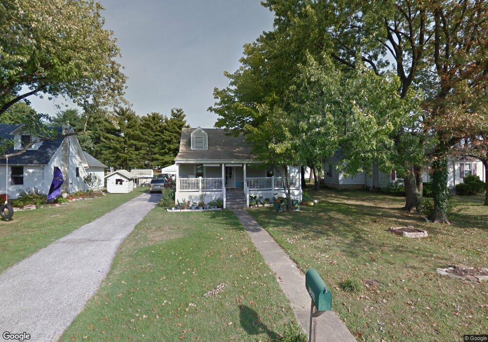
7519 Battle Grove Cir Baltimore, MD 21222
Estimated Value: $308,643 - $335,000
--
Bed
1
Bath
1,248
Sq Ft
$261/Sq Ft
Est. Value
About This Home
This home is located at 7519 Battle Grove Cir, Baltimore, MD 21222 and is currently estimated at $325,661, approximately $260 per square foot. 7519 Battle Grove Cir is a home located in Baltimore County with nearby schools including Battle Grove Elementary, Sparrows Point Middle School, and Sparrows Point High School.
Ownership History
Date
Name
Owned For
Owner Type
Purchase Details
Closed on
Aug 14, 2020
Sold by
Noss Linda L
Bought by
Herrera Albania S Cruz
Current Estimated Value
Home Financials for this Owner
Home Financials are based on the most recent Mortgage that was taken out on this home.
Original Mortgage
$220,825
Outstanding Balance
$195,522
Interest Rate
2.9%
Mortgage Type
FHA
Estimated Equity
$130,139
Purchase Details
Closed on
Nov 23, 1965
Sold by
Trawitz George Edward
Bought by
Noss Robert E and Noss Linda L
Create a Home Valuation Report for This Property
The Home Valuation Report is an in-depth analysis detailing your home's value as well as a comparison with similar homes in the area
Home Values in the Area
Average Home Value in this Area
Purchase History
| Date | Buyer | Sale Price | Title Company |
|---|---|---|---|
| Herrera Albania S Cruz | $224,900 | Kensington Realty Title Llc | |
| Noss Robert E | $10,500 | -- |
Source: Public Records
Mortgage History
| Date | Status | Borrower | Loan Amount |
|---|---|---|---|
| Open | Herrera Albania S Cruz | $220,825 |
Source: Public Records
Tax History Compared to Growth
Tax History
| Year | Tax Paid | Tax Assessment Tax Assessment Total Assessment is a certain percentage of the fair market value that is determined by local assessors to be the total taxable value of land and additions on the property. | Land | Improvement |
|---|---|---|---|---|
| 2025 | $3,400 | $239,433 | -- | -- |
| 2024 | $3,400 | $219,167 | $0 | $0 |
| 2023 | $3,953 | $198,900 | $74,300 | $124,600 |
| 2022 | $2,601 | $179,567 | $0 | $0 |
| 2021 | $1,708 | $160,233 | $0 | $0 |
| 2020 | $1,708 | $140,900 | $74,300 | $66,600 |
| 2019 | $1,708 | $140,900 | $74,300 | $66,600 |
| 2018 | $2,164 | $140,900 | $74,300 | $66,600 |
| 2017 | $1,943 | $142,400 | $0 | $0 |
| 2016 | -- | $142,400 | $0 | $0 |
| 2015 | $1,956 | $142,400 | $0 | $0 |
| 2014 | $1,956 | $148,000 | $0 | $0 |
Source: Public Records
Map
Nearby Homes
- 7431 Saint Patricia Ct
- 4015 Saint Augustine Ln
- 7706 Village Park Dr
- 7723 Town View Dr
- 7607 Town View Dr
- 7842 Saint Boniface Ln
- 7656 Old Battle Grove Rd
- 7808 Deboy Ave
- 8216 Beach Dr
- 7849 Saint Claire Ln
- 7817 Saint Claire Ln
- 1605 Evergreen Dr
- 7865 Saint Bridget Ln
- 8325 Bear Creek Dr
- 3933 N Point Rd
- 1704 Melbourne Rd
- 8169 Park Haven Rd
- 7719 Charlesmont Rd
- 8146 Gray Haven Rd
- 1711 Woodland Dr
- 7519 Old Battle Grove Rd
- 7517 Old Battle Grove Rd
- 7521 Battle Grove Cir
- 7517 Battle Grove Cir
- 7515 Old Battle Grove Rd
- 7525 Old Battle Grove Rd
- 7525 Battle Grove Cir
- 7526 Old Battle Grove Rd
- 7526 Battle Grove Cir
- 7526 Battle Grove Cir
- 7513 Battle Grove Cir
- 7522 Old Battle Grove Rd
- 7524 Old Battle Grove Rd
- 7511 Old Battle Grove Rd
- 7529 Old Battle Grove Rd
- 7514 Old Battle Grove Rd
- 7528 Old Battle Grove Rd
- 7530 Battle Grove Cir
- 7530 Battle Grove Cir
- 7822 Saint Patricia Ln