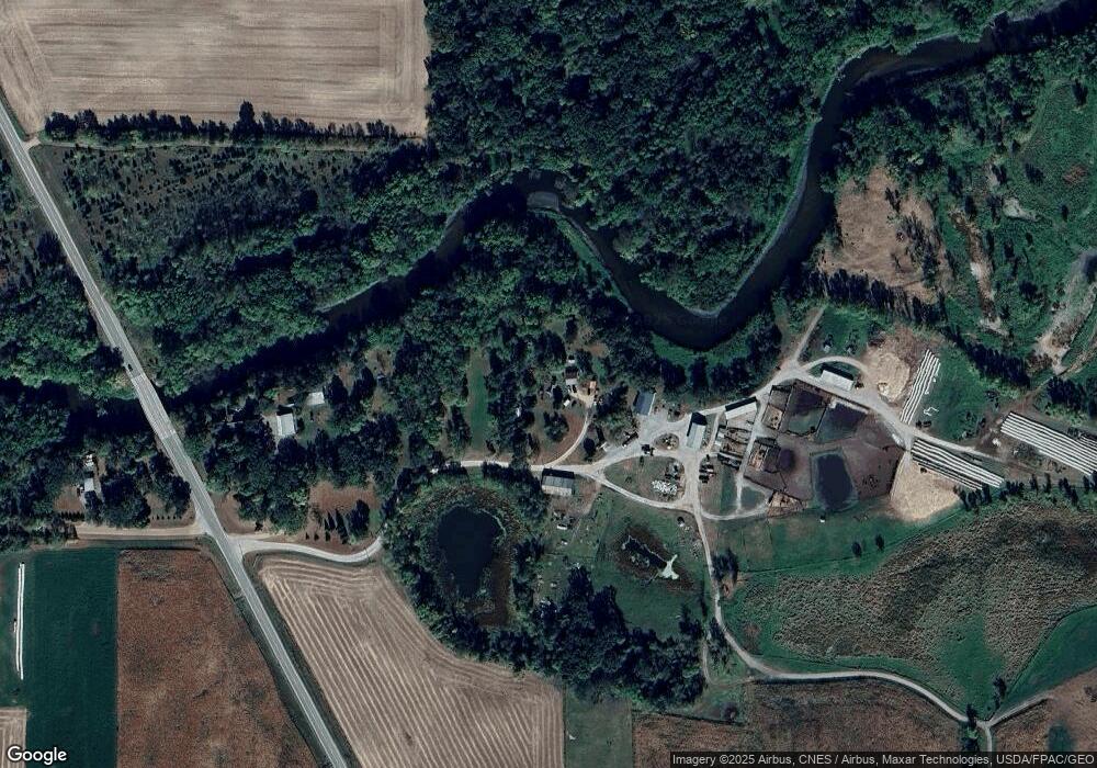
752 Rhoades Ave NW Cokato, MN 55321
Estimated Value: $287,000 - $395,000
5
Beds
1
Bath
1,333
Sq Ft
$253/Sq Ft
Est. Value
About This Home
This home is located at 752 Rhoades Ave NW, Cokato, MN 55321 and is currently estimated at $337,039, approximately $252 per square foot. 752 Rhoades Ave NW is a home located in Wright County with nearby schools including Dassel-Cokato Senior High School.
Ownership History
Date
Name
Owned For
Owner Type
Purchase Details
Closed on
Jan 31, 2012
Sold by
Not Provided
Bought by
Anderson Gordan David and Kaminsky Danielle Rebecca
Current Estimated Value
Purchase Details
Closed on
Apr 22, 2010
Sold by
Anderson Viola and Anderson Brian
Bought by
Anderson Gordan David and Kaminsky Danielle Rebecca
Purchase Details
Closed on
Feb 24, 2000
Sold by
Anderson Wayland H and Anderson Viola M
Bought by
Schaefer Terry R
Create a Home Valuation Report for This Property
The Home Valuation Report is an in-depth analysis detailing your home's value as well as a comparison with similar homes in the area
Home Values in the Area
Average Home Value in this Area
Purchase History
| Date | Buyer | Sale Price | Title Company |
|---|---|---|---|
| Anderson Gordan David | -- | -- | |
| Anderson Gordan David | $119,000 | -- | |
| Schaefer Terry R | $165,000 | -- |
Source: Public Records
Mortgage History
| Date | Status | Borrower | Loan Amount |
|---|---|---|---|
| Closed | Schaefer Terry R | -- |
Source: Public Records
Tax History Compared to Growth
Tax History
| Year | Tax Paid | Tax Assessment Tax Assessment Total Assessment is a certain percentage of the fair market value that is determined by local assessors to be the total taxable value of land and additions on the property. | Land | Improvement |
|---|---|---|---|---|
| 2025 | $1,872 | $241,200 | $131,200 | $110,000 |
| 2024 | $1,712 | $226,400 | $126,100 | $100,300 |
| 2023 | $1,616 | $218,900 | $126,100 | $92,800 |
| 2022 | $1,460 | $185,300 | $98,600 | $86,700 |
| 2021 | $1,456 | $167,400 | $87,600 | $79,800 |
| 2020 | $1,242 | $159,800 | $87,600 | $72,200 |
| 2019 | $1,154 | $138,700 | $0 | $0 |
| 2018 | $854 | $106,900 | $0 | $0 |
| 2017 | $838 | $94,300 | $0 | $0 |
| 2016 | $788 | $0 | $0 | $0 |
| 2015 | $752 | $0 | $0 | $0 |
| 2014 | -- | $0 | $0 | $0 |
Source: Public Records
Map
Nearby Homes
- 28059 742nd Ave
- 27729 742nd Ave
- 3665 Pleason Ave NW
- 74308 323rd St
- 4629 Reardon Ave NW
- 31033 724th Ave
- 30901 724th Ave
- 30945 724th Ave
- 12814 County Road 35 W
- 72698 318th St
- 345 County Highway 4 SW
- 5461 Quimby Ave NW
- 431 County Highway 4 SW
- 25162 729th Ave
- 33381 743rd Ave
- 6032 Quinn Ave NW
- 6157 Quinn Ave NW
- 2945 County Road 4 #144 SW
- 2945 County Road 4 #63 SW
- 6070 Pilger Ave NW
- 786 Rhoades Ave NW
- 17156 7th St NW
- 17001 12th St NW
- 963 Rhoades Ave NW
- 16751 12th St NW
- 17247 County Road 35 W
- XXX 7th St SW
- 17200 12th St NW
- 969 Rhoades Ave NW
- 16984 12th St NW
- 16864 12th St NW
- XXXX County Road 35 W
- 17371 County Road 35 W
- 1215 Rhoades Ave NW
- 17043 County Road 35 W
- 1663x County Road 35 W
- 17037 County Road 35 W
- 16750 12th St NW
- 17339 County Road 35 W
- xxxxx County Rd 2 W (Parcel #2)
