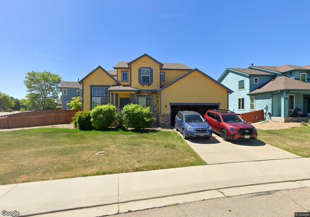
753 Memory Ln Longmont, CO 80504
East Side NeighborhoodEstimated Value: $660,177 - $778,000
5
Beds
3
Baths
2,372
Sq Ft
$296/Sq Ft
Est. Value
About This Home
This home is located at 753 Memory Ln, Longmont, CO 80504 and is currently estimated at $702,794, approximately $296 per square foot. 753 Memory Ln is a home located in Boulder County with nearby schools including Timberline Pk-8, Skyline High School, and Longmont Christian School.
Ownership History
Date
Name
Owned For
Owner Type
Purchase Details
Closed on
Dec 8, 2014
Sold by
Schroeder Jeffrey P and Schroeder Laralee T
Bought by
Schroeder Holdings At Memory Llc
Current Estimated Value
Purchase Details
Closed on
Jun 23, 2003
Sold by
Wl Homes Llc
Bought by
Schroeder Jeffrey P
Home Financials for this Owner
Home Financials are based on the most recent Mortgage that was taken out on this home.
Original Mortgage
$197,250
Outstanding Balance
$83,201
Interest Rate
5.27%
Mortgage Type
Purchase Money Mortgage
Estimated Equity
$619,593
Create a Home Valuation Report for This Property
The Home Valuation Report is an in-depth analysis detailing your home's value as well as a comparison with similar homes in the area
Home Values in the Area
Average Home Value in this Area
Purchase History
We collect this data history from publicly available records. To have your information removed, we recommend requesting removal directly through your county’s website.
| Date | Buyer | Sale Price | Title Company |
|---|---|---|---|
| Schroeder Holdings At Memory Llc | -- | None Available | |
| Schroeder Jeffrey P | $263,000 | Land Title Guarantee Company |
Source: Public Records
Mortgage History
We collect this data history from publicly available records. To have your information removed, we recommend requesting removal directly through your county’s website.
| Date | Status | Borrower | Loan Amount |
|---|---|---|---|
| Open | Schroeder Jeffrey P | $197,250 |
Source: Public Records
Tax History
| Year | Tax Paid | Tax Assessment Tax Assessment Total Assessment is a certain percentage of the fair market value that is determined by local assessors to be the total taxable value of land and additions on the property. | Land | Improvement |
|---|---|---|---|---|
| 2025 | $4,503 | $46,669 | $10,418 | $36,251 |
| 2024 | $4,034 | $42,894 | $9,575 | $33,319 |
| 2023 | $3,979 | $42,177 | $10,566 | $35,296 |
| 2022 | $3,575 | $36,126 | $7,944 | $28,182 |
| 2021 | $3,621 | $37,165 | $8,172 | $28,993 |
| 2020 | $3,149 | $32,419 | $6,078 | $26,341 |
| 2019 | $3,100 | $32,419 | $6,078 | $26,341 |
| 2018 | $2,749 | $28,944 | $6,120 | $22,824 |
| 2017 | $2,712 | $35,056 | $6,766 | $28,290 |
| 2016 | $2,695 | $28,194 | $8,358 | $19,836 |
| 2015 | $2,568 | $22,726 | $5,015 | $17,711 |
| 2014 | $2,123 | $22,726 | $5,015 | $17,711 |
Source: Public Records
Map
Nearby Homes
- 651 Americana Rd
- 1717 Polo Way
- 615 Americana Rd
- 1710 Polo Way
- 907 Sanctuary Cir
- 1750 Preston Dr
- 1703 Whitehall Dr Unit 4A
- 1464 Cherrywood Way
- 493 E 16th Ave
- 1633 Deerwood Dr
- 1224 Snowbank Ct
- 984 Glenarbor Cir
- 879 Glenarbor Cir
- 1677 Metropolitan Dr
- 831 Glenarbor Cir
- 1624 Golden Bear Dr
- 1319 Monarch Dr
- 1104 Fall River Cir
- 1147 Trout Creek Cir
- 212 E Mountain View Ave
Your Personal Tour Guide
Ask me questions while you tour the home.