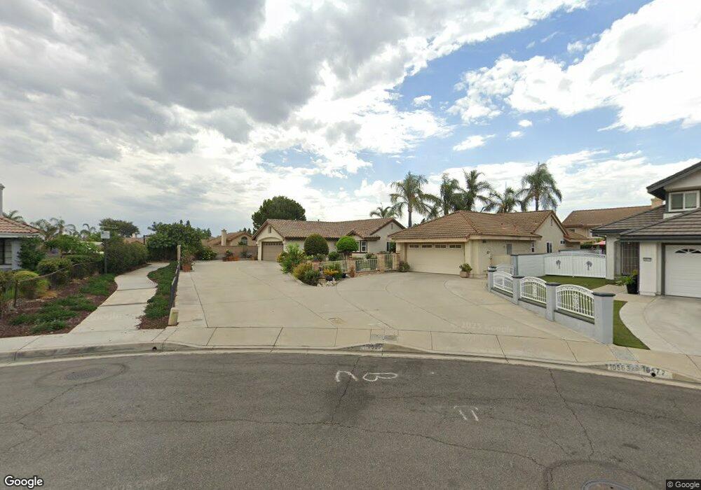
7535 Brookside Rd Rancho Cucamonga, CA 91730
Terra Vista NeighborhoodEstimated Value: $695,000 - $710,000
3
Beds
2
Baths
1,186
Sq Ft
$592/Sq Ft
Est. Value
About This Home
This home is located at 7535 Brookside Rd, Rancho Cucamonga, CA 91730 and is currently estimated at $702,389, approximately $592 per square foot. 7535 Brookside Rd is a home located in San Bernardino County with nearby schools including Ruth Musser Middle, Coyote Canyon Elementary, and Rancho Cucamonga High School.
Ownership History
Date
Name
Owned For
Owner Type
Purchase Details
Closed on
Jan 4, 2024
Sold by
Montini Jill
Bought by
Jill Montini Living Trust and Montini
Current Estimated Value
Purchase Details
Closed on
Mar 3, 1999
Sold by
Mcindoe Gregg J and Mcindoe Gregg
Bought by
Montini Jill
Home Financials for this Owner
Home Financials are based on the most recent Mortgage that was taken out on this home.
Original Mortgage
$133,947
Interest Rate
6.79%
Mortgage Type
FHA
Create a Home Valuation Report for This Property
The Home Valuation Report is an in-depth analysis detailing your home's value as well as a comparison with similar homes in the area
Home Values in the Area
Average Home Value in this Area
Purchase History
| Date | Buyer | Sale Price | Title Company |
|---|---|---|---|
| Jill Montini Living Trust | -- | None Listed On Document | |
| Montini Jill | $146,000 | Southland Title |
Source: Public Records
Mortgage History
| Date | Status | Borrower | Loan Amount |
|---|---|---|---|
| Previous Owner | Montini Jill | $133,947 |
Source: Public Records
Tax History
| Year | Tax Paid | Tax Assessment Tax Assessment Total Assessment is a certain percentage of the fair market value that is determined by local assessors to be the total taxable value of land and additions on the property. | Land | Improvement |
|---|---|---|---|---|
| 2025 | $3,368 | $248,686 | $57,223 | $191,463 |
| 2024 | $3,270 | $243,810 | $56,101 | $187,709 |
| 2023 | $3,180 | $239,029 | $55,001 | $184,028 |
| 2022 | $3,107 | $234,343 | $53,923 | $180,420 |
| 2021 | $3,105 | $229,748 | $52,866 | $176,882 |
| 2020 | $3,032 | $227,392 | $52,324 | $175,068 |
| 2019 | $3,019 | $222,933 | $51,298 | $171,635 |
| 2018 | $2,949 | $218,562 | $50,292 | $168,270 |
| 2017 | $2,905 | $214,277 | $49,306 | $164,971 |
| 2016 | $2,897 | $210,075 | $48,339 | $161,736 |
| 2015 | $2,861 | $206,920 | $47,613 | $159,307 |
| 2014 | $2,785 | $202,866 | $46,680 | $156,186 |
Source: Public Records
Map
Nearby Homes
- 7613 Haven Ave Unit B
- 7407 Ambrosia Rd
- 10634 Countryside Dr
- 10751 Spyglass Dr
- 10438 Palo Alto St
- 10430 Palo Alto St
- 10453 Ironwood St
- 10554 Cannon Dr
- 7323 Ambrosia Rd
- 7297 Meadowlark Place
- 10532 Wilding Dr
- 7774 Haywood Place
- 7803 Paxton Place
- 10591 Huxley Dr
- 10375 Church St Unit 100
- 10375 Church St Unit 124
- 10350 Base Line Rd Unit 128
- 7552 Paramount Ct
- 10350 Baseline Rd Unit 55
- 10210 Base Line Rd Unit 253
- 10583 Creekbridge St
- 7531 Brookside Rd
- 10577 Creekbridge St
- 10588 Oakdale Dr
- 10594 Oakdale Dr
- 10582 Oakdale Dr
- 7527 Brookside Rd
- 10571 Creekbridge St
- 10576 Oakdale Dr
- 7521 Brookside Rd
- 10570 Oakdale Dr
- 7572 Plymouth Way
- 7566 Plymouth Way
- 7526 Brookside Rd
- 7578 Plymouth Way
- 7560 Plymouth Way
- 7515 Brookside Rd
- 7582 Plymouth Way
- 7520 Brookside Rd
- 7554 Plymouth Way
Your Personal Tour Guide
Ask me questions while you tour the home.