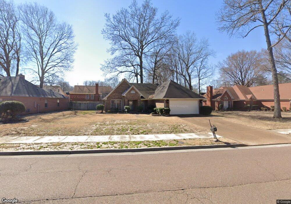
7537 Lowrance Rd Memphis, TN 38125
Southern Shelby County NeighborhoodEstimated Value: $235,000 - $249,122
3
Beds
2
Baths
1,570
Sq Ft
$155/Sq Ft
Est. Value
About This Home
This home is located at 7537 Lowrance Rd, Memphis, TN 38125 and is currently estimated at $243,531, approximately $155 per square foot. 7537 Lowrance Rd is a home located in Shelby County with nearby schools including Lowrance Elementary School, Southwind High School, and Power Center Academy - Southeast.
Ownership History
Date
Name
Owned For
Owner Type
Purchase Details
Closed on
Apr 20, 2007
Sold by
Porter Tony
Bought by
Jenious Yvonne
Current Estimated Value
Home Financials for this Owner
Home Financials are based on the most recent Mortgage that was taken out on this home.
Original Mortgage
$108,000
Outstanding Balance
$65,156
Interest Rate
6.11%
Mortgage Type
Purchase Money Mortgage
Estimated Equity
$178,375
Purchase Details
Closed on
Nov 8, 2005
Sold by
Porter Helen M
Bought by
Porter Tony
Create a Home Valuation Report for This Property
The Home Valuation Report is an in-depth analysis detailing your home's value as well as a comparison with similar homes in the area
Home Values in the Area
Average Home Value in this Area
Purchase History
| Date | Buyer | Sale Price | Title Company |
|---|---|---|---|
| Jenious Yvonne | $135,000 | None Available | |
| Porter Tony | -- | None Available |
Source: Public Records
Mortgage History
| Date | Status | Borrower | Loan Amount |
|---|---|---|---|
| Open | Jenious Yvonne | $108,000 |
Source: Public Records
Tax History Compared to Growth
Tax History
| Year | Tax Paid | Tax Assessment Tax Assessment Total Assessment is a certain percentage of the fair market value that is determined by local assessors to be the total taxable value of land and additions on the property. | Land | Improvement |
|---|---|---|---|---|
| 2025 | $1,203 | $60,600 | $11,500 | $49,100 |
| 2024 | $1,203 | $35,500 | $6,800 | $28,700 |
| 2023 | $1,203 | $35,500 | $6,800 | $28,700 |
| 2022 | $1,203 | $35,500 | $6,800 | $28,700 |
| 2021 | $1,225 | $35,500 | $6,800 | $28,700 |
| 2020 | $1,063 | $26,250 | $6,800 | $19,450 |
| 2019 | $1,063 | $26,250 | $6,800 | $19,450 |
| 2018 | $1,063 | $26,250 | $6,800 | $19,450 |
| 2017 | $1,079 | $26,250 | $6,800 | $19,450 |
| 2016 | $1,102 | $25,225 | $0 | $0 |
| 2014 | $1,102 | $25,225 | $0 | $0 |
Source: Public Records
Map
Nearby Homes
- 7561 Shelby Cross Cir
- 7579 Baysweet Dr
- 7527 Wilsford Cove
- 4028 Long Creek Rd
- 3912 Autumn Harvest Ln
- 4294 Thunderstone Cir W
- 7386 Eggleston Rd
- 7296 Germanshire Ln
- 4310 Coral Creek Ln
- 4056 Clovis Cove
- 7380 Isherwood Rd
- 7218 Barnstable Rd
- 7266 Woodshire Rd
- 7421 Richmond Rd
- 7124 Old Dr N
- 4350 Oak Chase Cove
- 4316 Barry Meadows Cove
- 4471 Hughes Meadow Dr
- 4419 Berkley Woods Dr
- 7286 New Britain Dr
- 7545 Lowrance Rd
- 7529 Lowrance Rd
- 4100 Misty Forest Cove
- 4096 Misty Forest Cove
- 7557 Lowrance Rd
- 4065 Cedar Trace Cove
- 7519 Lowrance Rd
- 7548 Lowrance Rd
- 4106 Misty Forest Cove
- 7496 Shelby Cross Cir
- 7526 Lowrance Rd
- 7565 Lowrance Rd
- 7556 Lowrance Rd
- 7500 Shelby Cross Cir
- 4095 Misty Forest Cove
- 4110 Misty Forest Cove
- 7518 Lowrance Rd
- 4057 Cedar Trace Cove
- 4058 Cedar Trace Cove
- 7564 Lowrance Rd