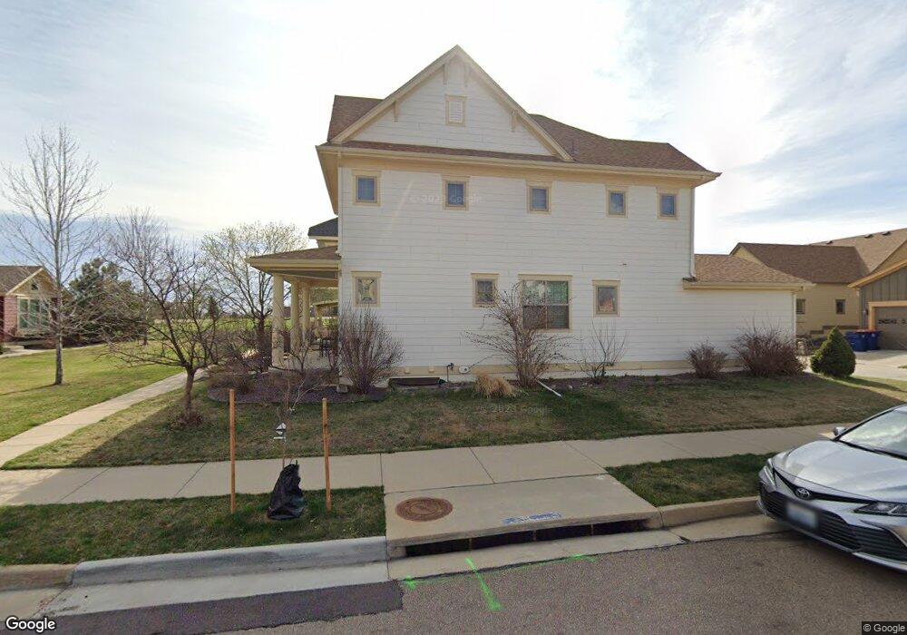
754 Furrow Way Lafayette, CO 80026
Estimated Value: $728,000 - $765,000
3
Beds
3
Baths
2,877
Sq Ft
$258/Sq Ft
Est. Value
About This Home
This home is located at 754 Furrow Way, Lafayette, CO 80026 and is currently estimated at $741,399, approximately $257 per square foot. 754 Furrow Way is a home located in Boulder County with nearby schools including Lafayette Elementary School, Angevine Middle School, and Centaurus High School.
Ownership History
Date
Name
Owned For
Owner Type
Purchase Details
Closed on
Jun 10, 2009
Sold by
Annas Farm Llc
Bought by
Hamm James R
Current Estimated Value
Home Financials for this Owner
Home Financials are based on the most recent Mortgage that was taken out on this home.
Original Mortgage
$291,920
Outstanding Balance
$185,134
Interest Rate
4.84%
Mortgage Type
Purchase Money Mortgage
Estimated Equity
$556,265
Create a Home Valuation Report for This Property
The Home Valuation Report is an in-depth analysis detailing your home's value as well as a comparison with similar homes in the area
Home Values in the Area
Average Home Value in this Area
Purchase History
| Date | Buyer | Sale Price | Title Company |
|---|---|---|---|
| Hamm James R | $364,900 | Land Title Guarantee Company |
Source: Public Records
Mortgage History
| Date | Status | Borrower | Loan Amount |
|---|---|---|---|
| Open | Hamm James R | $291,920 |
Source: Public Records
Tax History Compared to Growth
Tax History
| Year | Tax Paid | Tax Assessment Tax Assessment Total Assessment is a certain percentage of the fair market value that is determined by local assessors to be the total taxable value of land and additions on the property. | Land | Improvement |
|---|---|---|---|---|
| 2025 | $3,820 | $51,013 | $9,719 | $41,294 |
| 2024 | $3,820 | $51,013 | $9,719 | $41,294 |
| 2023 | $3,755 | $49,815 | $10,747 | $42,753 |
| 2022 | $3,279 | $41,853 | $8,062 | $33,791 |
| 2021 | $3,888 | $43,057 | $8,294 | $34,763 |
| 2020 | $3,479 | $38,067 | $7,222 | $30,845 |
| 2019 | $3,431 | $38,067 | $7,222 | $30,845 |
| 2018 | $3,385 | $37,080 | $7,920 | $29,160 |
| 2017 | $3,296 | $40,994 | $8,756 | $32,238 |
| 2016 | $3,042 | $33,129 | $7,323 | $25,806 |
| 2015 | $2,850 | $27,860 | $13,930 | $13,930 |
| 2014 | $2,409 | $27,860 | $13,930 | $13,930 |
Source: Public Records
Map
Nearby Homes
- 926 Hearteye Trail
- 925 Latigo Loop
- 1650 Benjamin Ln
- 521 Homestead St
- 411 Levi Ln
- 535 Sawtooth Point
- 1438 Sun Way
- 736 Gateway Cir
- 1376 Lambert Cir
- 2037 Aster Ln
- 1140 Devonshire Ct
- 618 Starline Ave
- 2005 Aster Ln
- 304 W Beacon Hill Dr
- 82 Goldhill Dr
- 1140 Dorset Ct
- 1160 Nottingham St
- 1009 Acadia Ave
- 2251 Evening Star Ln
- 2325 Glacier Ct
- 750 Furrow Way
- 1403 Harvest Dr
- 762 Furrow Way
- 1407 Harvest Dr
- 758 Furrow Way
- 1422 Haystack Way Unit 1422
- 1418 Haystack Way Unit 1418
- 1423 Harvest Dr
- 1427 Harvest Dr
- 1426 Haystack Way
- 770 Furrow Way
- 766 Furrow Way
- 765 Furrow Way
- 1431 Harvest Dr
- 1430 Haystack Way
- 1406 Harvest Dr Unit 1406
- 769 Furrow Way
- 1402 Harvest Dr Unit 1402
- 1410 Harvest Dr
- 1501 Harvest Dr