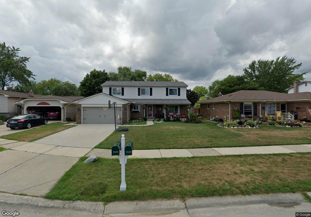
7549 Corbin Dr Unit Bldg-Unit Canton, MI 48187
Estimated Value: $442,251 - $496,000
Studio
3
Baths
2,378
Sq Ft
$197/Sq Ft
Est. Value
About This Home
This home is located at 7549 Corbin Dr Unit Bldg-Unit, Canton, MI 48187 and is currently estimated at $467,813, approximately $196 per square foot. 7549 Corbin Dr Unit Bldg-Unit is a home located in Wayne County with nearby schools including Canton High School, Salem High School, and Pioneer Middle School.
Ownership History
Date
Name
Owned For
Owner Type
Purchase Details
Closed on
Jan 12, 2018
Sold by
Hansen Christine A and Hansen Rodney B
Bought by
Shinske Drew
Current Estimated Value
Home Financials for this Owner
Home Financials are based on the most recent Mortgage that was taken out on this home.
Original Mortgage
$280,250
Outstanding Balance
$236,437
Interest Rate
3.93%
Mortgage Type
New Conventional
Estimated Equity
$231,376
Purchase Details
Closed on
May 22, 2015
Sold by
Hansen Christine A
Bought by
Hansen Christine A
Home Financials for this Owner
Home Financials are based on the most recent Mortgage that was taken out on this home.
Original Mortgage
$165,000
Interest Rate
3.65%
Mortgage Type
New Conventional
Purchase Details
Closed on
Jan 26, 2009
Sold by
Hansen Rodney Burr
Bought by
Hansen Christine A
Create a Home Valuation Report for This Property
The Home Valuation Report is an in-depth analysis detailing your home's value as well as a comparison with similar homes in the area
Home Values in the Area
Average Home Value in this Area
Purchase History
| Date | Buyer | Sale Price | Title Company |
|---|---|---|---|
| Shinske Drew | $302,000 | Reputation First Title Agenc | |
| Hansen Christine A | -- | Reputation First Title Agenc | |
| Hansen Christine A | -- | None Available |
Source: Public Records
Mortgage History
| Date | Status | Borrower | Loan Amount |
|---|---|---|---|
| Open | Shinske Drew | $280,250 | |
| Previous Owner | Hansen Christine A | $165,000 |
Source: Public Records
Tax History
| Year | Tax Paid | Tax Assessment Tax Assessment Total Assessment is a certain percentage of the fair market value that is determined by local assessors to be the total taxable value of land and additions on the property. | Land | Improvement |
|---|---|---|---|---|
| 2025 | $3,071 | $196,000 | $0 | $0 |
| 2024 | $2,983 | $177,300 | $0 | $0 |
| 2023 | $2,844 | $170,800 | $0 | $0 |
| 2022 | $6,170 | $150,000 | $0 | $0 |
| 2021 | $6,044 | $152,400 | $0 | $0 |
| 2020 | $5,969 | $146,200 | $0 | $0 |
| 2019 | $5,862 | $141,920 | $0 | $0 |
| 2018 | $1,714 | $134,510 | $0 | $0 |
| 2017 | $4,247 | $132,000 | $0 | $0 |
| 2016 | $3,784 | $127,900 | $0 | $0 |
| 2015 | $9,418 | $105,980 | $0 | $0 |
| 2013 | $9,124 | $96,700 | $0 | $0 |
| 2010 | -- | $97,390 | $44,061 | $53,329 |
Source: Public Records
Map
Nearby Homes
- 7925 N Sheldon Rd
- 44432 Newburyport Dr
- 44570 Tillotson Dr
- 6857 Bridgemont Dr
- 45900 Gainsborough Dr
- 6852 New Providence Way Unit 104
- 7459 Admiralty Dr
- 44805 Joy Rd
- 46490 Bartlett Dr
- 0 Joy Rd Unit Parcel 3
- 0 Joy Rd Unit Parcel 2
- 0 Joy Rd Unit Parcel B
- 0 Joy Rd Unit Parcel A
- 49772 Shoreline Dr
- 48590 Ford Rd
- 43529 Oakbrook Rd
- 43086 Versailles Rd
- 43009 Arlington Rd
- 8815 Marlowe Ave
- 835 Coldrose Way
- 7549 Corbin Dr
- 7571 Corbin Dr
- 7527 Corbin Dr
- 7593 Corbin Dr
- 7505 Corbin Dr
- 7576 Charrington Dr
- 7590 Charrington Dr
- 7562 Charrington Dr
- 7615 Corbin Dr
- 7604 Charrington Dr
- 7550 Corbin Dr
- 7548 Charrington Dr
- 7572 Corbin Dr
- 7618 Charrington Dr
- 44791 Windmill Dr
- 7637 Corbin Dr
- 7594 Corbin Dr
- 44767 Windmill Dr
- 7534 Charrington Dr
- 7632 Charrington Dr
Your Personal Tour Guide
Ask me questions while you tour the home.