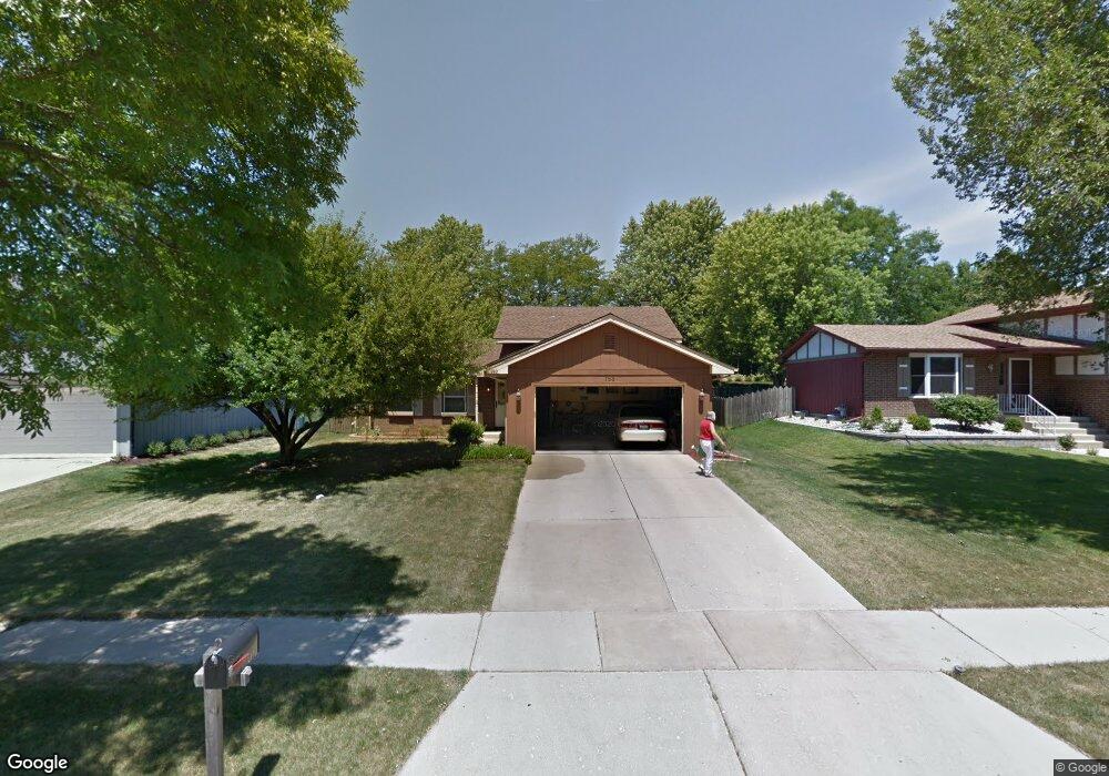
755 Devonshire Ln Wheaton, IL 60189
Southeast Wheaton NeighborhoodEstimated Value: $369,669 - $486,000
3
Beds
2
Baths
1,115
Sq Ft
$391/Sq Ft
Est. Value
About This Home
This home is located at 755 Devonshire Ln, Wheaton, IL 60189 and is currently estimated at $436,417, approximately $391 per square foot. 755 Devonshire Ln is a home located in DuPage County with nearby schools including Lincoln Elementary School, Edison Middle School, and Wheaton Warrenville South High School.
Ownership History
Date
Name
Owned For
Owner Type
Purchase Details
Closed on
Sep 8, 1995
Sold by
Mahmarian Robert R and Mahmarian Susan J
Bought by
Depratt Gerald J and Depratt Benita S
Current Estimated Value
Home Financials for this Owner
Home Financials are based on the most recent Mortgage that was taken out on this home.
Original Mortgage
$110,000
Interest Rate
7.76%
Create a Home Valuation Report for This Property
The Home Valuation Report is an in-depth analysis detailing your home's value as well as a comparison with similar homes in the area
Home Values in the Area
Average Home Value in this Area
Purchase History
| Date | Buyer | Sale Price | Title Company |
|---|---|---|---|
| Depratt Gerald J | $170,500 | -- |
Source: Public Records
Mortgage History
| Date | Status | Borrower | Loan Amount |
|---|---|---|---|
| Closed | Depratt Gerald J | $110,000 |
Source: Public Records
Tax History
| Year | Tax Paid | Tax Assessment Tax Assessment Total Assessment is a certain percentage of the fair market value that is determined by local assessors to be the total taxable value of land and additions on the property. | Land | Improvement |
|---|---|---|---|---|
| 2024 | -- | $116,930 | $35,493 | $81,437 |
| 2023 | -- | $107,630 | $32,670 | $74,960 |
| 2022 | $0 | $101,710 | $30,870 | $70,840 |
| 2021 | $6,249 | $99,300 | $30,140 | $69,160 |
| 2020 | $6,226 | $98,380 | $29,860 | $68,520 |
| 2019 | $6,070 | $95,780 | $29,070 | $66,710 |
| 2018 | $6,015 | $94,040 | $27,400 | $66,640 |
| 2017 | $5,905 | $90,570 | $26,390 | $64,180 |
| 2016 | $5,806 | $86,960 | $25,340 | $61,620 |
| 2015 | $5,735 | $82,960 | $24,170 | $58,790 |
| 2014 | $5,690 | $81,180 | $19,110 | $62,070 |
| 2013 | $5,546 | $81,430 | $19,170 | $62,260 |
Source: Public Records
Map
Nearby Homes
- 570 Riva Ct
- 1542 Castlewood Dr
- 840 Sheldon Ct Unit B
- 1026 Briarcliffe Blvd
- 1682 Monticello Ct Unit D
- 1230 Bunker Hill Ct Unit A
- 1135 Mount Vernon Ct Unit B
- 1675 Valley Forge Ct Unit A
- 1120 Mount Vernon Ct Unit C
- 1551 Briarcliffe Blvd
- 1581 Groton Ln
- 110 E Farnham Ln
- 302 Roscommon Ct
- 1344 S Lorraine Rd Unit C
- 1733 Harrow Ct Unit B
- 1500 Pershing Ave
- 715 S Naperville Rd
- 121 Brighton Dr
- 1000 S Lorraine Rd Unit 214
- 909 S Wheaton Ave
- 773 Devonshire Ln
- 737 Devonshire Ln
- 756 Queenswood Ln
- 774 Queenswood Ln
- 719 Devonshire Ln
- 1550 Haverhill Dr
- 738 Queenswood Ln
- 1538 Haverhill Dr
- 756 Devonshire Ln
- 738 Devonshire Ln
- 774 Devonshire Ln
- 720 Queenswood Ln
- 665 Devonshire Ln
- 720 Devonshire Ln
- 1526 Haverhill Dr
- 792 Devonshire Ln
- 649 Devonshire Ln
- 755 Tennyson Dr
- 737 Tennyson Dr
- 680 Queenswood Ln
Your Personal Tour Guide
Ask me questions while you tour the home.