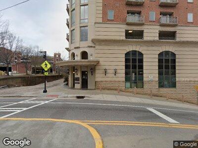
755 E Broad St Athens, GA 30601
Estimated Value: $602,499 - $773,000
--
Bed
--
Bath
1,032
Sq Ft
$659/Sq Ft
Est. Value
About This Home
This home is located at 755 E Broad St, Athens, GA 30601 and is currently estimated at $680,375, approximately $659 per square foot. 755 E Broad St is a home located in Clarke County with nearby schools including Barrow Elementary School, Clarke Middle School, and Clarke Central High School.
Ownership History
Date
Name
Owned For
Owner Type
Purchase Details
Closed on
May 20, 2019
Sold by
Calderon Vladimir
Bought by
Burkard Jeffrey
Current Estimated Value
Purchase Details
Closed on
May 26, 2017
Sold by
Tracy Milford
Bought by
Calderon Vladimir
Purchase Details
Closed on
Jul 9, 2008
Sold by
Georgia Traditions
Bought by
Milford Tracy and Milford Marion
Create a Home Valuation Report for This Property
The Home Valuation Report is an in-depth analysis detailing your home's value as well as a comparison with similar homes in the area
Home Values in the Area
Average Home Value in this Area
Purchase History
| Date | Buyer | Sale Price | Title Company |
|---|---|---|---|
| Burkard Jeffrey | $386,000 | -- | |
| Calderon Vladimir | $316,800 | -- | |
| Milford Tracy | -- | -- |
Source: Public Records
Mortgage History
| Date | Status | Borrower | Loan Amount |
|---|---|---|---|
| Previous Owner | M&P Burritos Inc | $280,000 |
Source: Public Records
Tax History Compared to Growth
Tax History
| Year | Tax Paid | Tax Assessment Tax Assessment Total Assessment is a certain percentage of the fair market value that is determined by local assessors to be the total taxable value of land and additions on the property. | Land | Improvement |
|---|---|---|---|---|
| 2024 | $8,427 | $261,302 | $21,120 | $240,182 |
| 2023 | $6,277 | $194,645 | $21,120 | $173,525 |
| 2022 | $5,802 | $176,349 | $21,120 | $155,229 |
| 2021 | $5,414 | $156,028 | $21,120 | $134,908 |
| 2020 | $5,127 | $147,742 | $21,120 | $126,622 |
| 2019 | $4,854 | $138,879 | $21,120 | $117,759 |
| 2018 | $4,429 | $129,426 | $21,120 | $108,306 |
| 2017 | $4,395 | $129,457 | $21,120 | $108,337 |
| 2016 | $4,243 | $124,974 | $21,120 | $103,854 |
| 2015 | $3,888 | $114,364 | $21,120 | $93,244 |
| 2014 | $3,432 | $100,800 | $28,000 | $72,800 |
Source: Public Records
Map
Nearby Homes
- 198 Flint St
- 143 Mulberry St
- 178 First St
- 1263 E Broad St
- 1284 E Broad St
- 1295 E Broad St Unit C-1
- 1295 E Broad St Unit C1
- 1295 E Broad St Unit C3
- 386 Rosa Nell Howard St
- 225 Oak St Unit 40
- 250 W Broad St Unit 515
- 137 N Peter St
- 157 Water Oak St
- 165 Vine St
- 546 Rosa Nell Howard St
- 125 Harper St
- 226 Vine St
- 320 First St
- 232 Vine St
- 755 E Broad St Unit 902
- 755 E Broad St Unit 820
- 755 E Broad St Unit 620
- 755 E Broad St Unit 816
- 755 E Broad St Unit 818
- 755 E Broad St Unit 606
- 755 E Broad St Unit 812
- 755 E Broad St Unit 3
- 755 E Broad St Unit 522
- 755 E Broad St Unit 706
- 755 E Broad St Unit 822
- 755 E Broad St Unit 808
- 755 E Broad St Unit 608
- 755 E Broad St Unit 803
- 755 E Broad St
- 755 E Broad St
- 755 E Broad St
- 755 E Broad St
- 755 E Broad St
- 755 E Broad St
