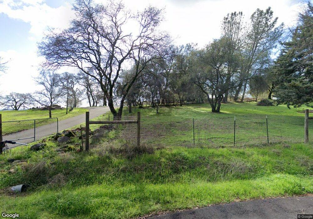
755 Hoyer Ln Newcastle, CA 95658
Estimated Value: $568,000 - $768,000
2
Beds
1
Bath
1,108
Sq Ft
$571/Sq Ft
Est. Value
About This Home
This home is located at 755 Hoyer Ln, Newcastle, CA 95658 and is currently estimated at $632,419, approximately $570 per square foot. 755 Hoyer Ln is a home located in Placer County with nearby schools including Del Oro High School, Harvest Ridge Charter School, and Newcastle Elementary Charter School.
Ownership History
Date
Name
Owned For
Owner Type
Purchase Details
Closed on
Sep 10, 2024
Sold by
Spargo Richard L and Spargo Susan J
Bought by
Richard And Susan Spargo Family Trust and Spargo
Current Estimated Value
Purchase Details
Closed on
Jan 13, 2009
Sold by
Spargo Richard L
Bought by
Spargo Richard L and Spargo Susan J
Home Financials for this Owner
Home Financials are based on the most recent Mortgage that was taken out on this home.
Original Mortgage
$412,500
Interest Rate
5.49%
Mortgage Type
Stand Alone Refi Refinance Of Original Loan
Purchase Details
Closed on
Mar 3, 2003
Sold by
Spargo Susan
Bought by
Spargo Richard L
Home Financials for this Owner
Home Financials are based on the most recent Mortgage that was taken out on this home.
Original Mortgage
$322,000
Interest Rate
5.85%
Mortgage Type
Purchase Money Mortgage
Create a Home Valuation Report for This Property
The Home Valuation Report is an in-depth analysis detailing your home's value as well as a comparison with similar homes in the area
Home Values in the Area
Average Home Value in this Area
Purchase History
| Date | Buyer | Sale Price | Title Company |
|---|---|---|---|
| Richard And Susan Spargo Family Trust | -- | None Listed On Document | |
| Spargo Richard L | -- | None Available | |
| Spargo Richard L | -- | Old Republic Title Company |
Source: Public Records
Mortgage History
| Date | Status | Borrower | Loan Amount |
|---|---|---|---|
| Previous Owner | Spargo Richard L | $412,500 | |
| Previous Owner | Spargo Richard L | $322,000 |
Source: Public Records
Tax History Compared to Growth
Tax History
| Year | Tax Paid | Tax Assessment Tax Assessment Total Assessment is a certain percentage of the fair market value that is determined by local assessors to be the total taxable value of land and additions on the property. | Land | Improvement |
|---|---|---|---|---|
| 2025 | $3,854 | $341,930 | $184,750 | $157,180 |
| 2023 | $3,854 | $328,655 | $177,577 | $151,078 |
| 2022 | $3,748 | $322,212 | $174,096 | $148,116 |
| 2021 | $3,647 | $315,895 | $170,683 | $145,212 |
| 2020 | $3,599 | $312,657 | $168,933 | $143,724 |
| 2019 | $3,531 | $306,527 | $165,621 | $140,906 |
| 2018 | $3,347 | $300,518 | $162,374 | $138,144 |
| 2017 | $3,284 | $294,627 | $159,191 | $135,436 |
| 2016 | $3,213 | $288,851 | $156,070 | $132,781 |
| 2015 | $3,136 | $284,513 | $153,726 | $130,787 |
| 2014 | $3,092 | $278,941 | $150,715 | $128,226 |
Source: Public Records
Map
Nearby Homes
- 822 Sunnyslope Way
- 10513 Indian Hill Rd
- 1700 Ridgeview Cir
- 980 MacHty Ct
- 1810 Gavin Cir
- 1605 Auburn Folsom Rd
- 592 Sawka Dr
- 1715 Auburn Folsom Rd
- 1342 Vintage Way
- 1107 Rough Rider Ct
- 1137 Lantern View Dr Unit 16
- 10917 Sunrise Ridge Cir
- 2045 Toscana Place
- 10650 Werner Rd
- 1950 Auburn Folsom Rd
- 2233 Toscana Place
- 9995 Powerhouse Rd
- 11017 Blue Wing Place
- 890 Supreme Ct
- 9623 Tunnel St
