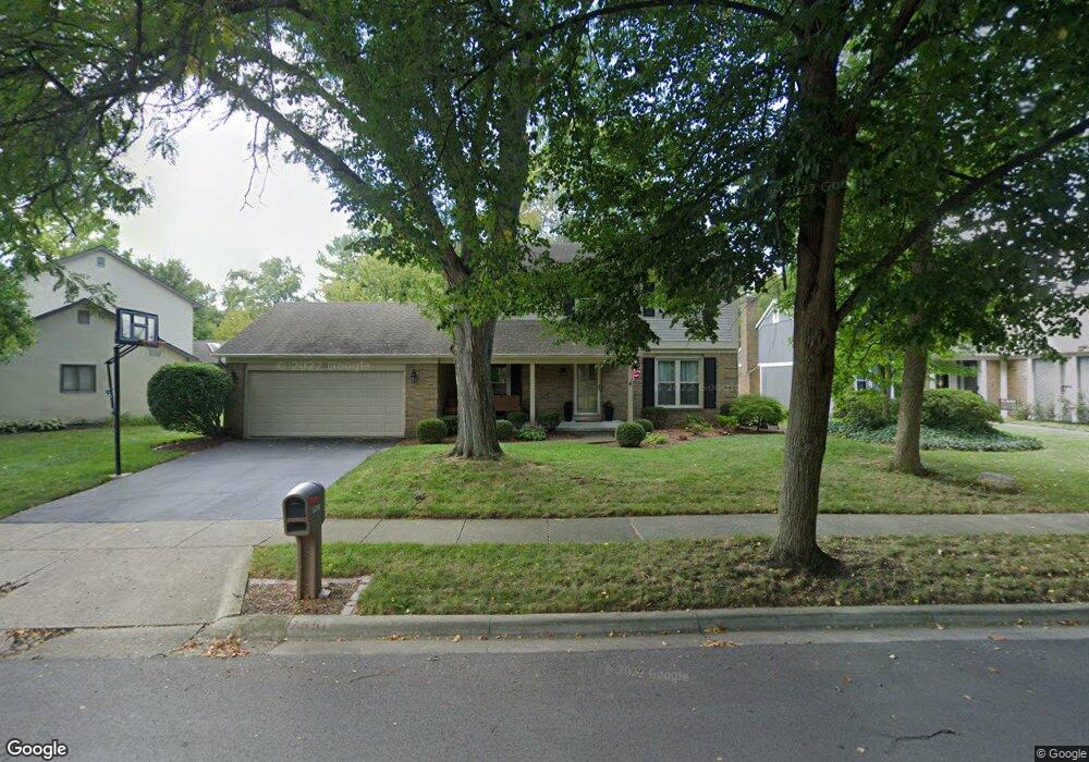
7551 Saunderlane Rd Columbus, OH 43235
Summerwood NeighborhoodEstimated Value: $379,406 - $453,000
3
Beds
3
Baths
1,648
Sq Ft
$256/Sq Ft
Est. Value
About This Home
This home is located at 7551 Saunderlane Rd, Columbus, OH 43235 and is currently estimated at $422,102, approximately $256 per square foot. 7551 Saunderlane Rd is a home located in Franklin County with nearby schools including Granby Elementary School, McCord Middle School, and Worthington Kilbourne High School.
Ownership History
Date
Name
Owned For
Owner Type
Purchase Details
Closed on
Oct 31, 1997
Sold by
Johnson Paul R and Johnson Carol L
Bought by
Phillips Brian R and Phillips Beth Ann
Current Estimated Value
Purchase Details
Closed on
May 21, 1996
Sold by
Allen Stanley B
Bought by
Johnson Paul R and Johnson Carol L
Home Financials for this Owner
Home Financials are based on the most recent Mortgage that was taken out on this home.
Original Mortgage
$125,100
Interest Rate
7.86%
Mortgage Type
Balloon
Purchase Details
Closed on
Aug 22, 1988
Create a Home Valuation Report for This Property
The Home Valuation Report is an in-depth analysis detailing your home's value as well as a comparison with similar homes in the area
Home Values in the Area
Average Home Value in this Area
Purchase History
| Date | Buyer | Sale Price | Title Company |
|---|---|---|---|
| Phillips Brian R | $145,000 | Chicago Title | |
| Johnson Paul R | $139,000 | -- | |
| -- | $113,000 | -- |
Source: Public Records
Mortgage History
| Date | Status | Borrower | Loan Amount |
|---|---|---|---|
| Closed | Johnson Paul R | $125,100 |
Source: Public Records
Tax History Compared to Growth
Tax History
| Year | Tax Paid | Tax Assessment Tax Assessment Total Assessment is a certain percentage of the fair market value that is determined by local assessors to be the total taxable value of land and additions on the property. | Land | Improvement |
|---|---|---|---|---|
| 2024 | $6,847 | $111,520 | $31,260 | $80,260 |
| 2023 | $6,547 | $111,520 | $31,260 | $80,260 |
| 2022 | $6,379 | $86,210 | $20,830 | $65,380 |
| 2021 | $5,885 | $86,210 | $20,830 | $65,380 |
| 2020 | $5,668 | $86,210 | $20,830 | $65,380 |
| 2019 | $5,202 | $71,400 | $17,360 | $54,040 |
| 2018 | $4,721 | $71,400 | $17,360 | $54,040 |
| 2017 | $4,532 | $71,400 | $17,360 | $54,040 |
| 2016 | $4,401 | $61,990 | $17,610 | $44,380 |
| 2015 | $4,402 | $61,990 | $17,610 | $44,380 |
| 2014 | $4,400 | $61,990 | $17,610 | $44,380 |
| 2013 | $2,189 | $61,985 | $17,605 | $44,380 |
Source: Public Records
Map
Nearby Homes
- 2220 Surreygate Dr
- 2074 Hard Rd
- 2001 Sawbury Blvd Unit 2001
- 2392 Dunsworth Dr
- 1889 Slaton Ct Unit 1889
- 2456 Sanford Dr
- 2469 Sandstrom Dr
- 1828 Gardenstone Dr
- 1930 Shallowford Ave
- 2488 Dunstan Dr
- 2161 Heatherfield Ave
- 1827 Watertower Dr Unit 1827
- 1825 Watertower Dr Unit 1825
- 2423 Sutter Pkwy
- 8108 Smoky Row Rd
- 6921 Spruce Pine Dr
- 1692 Weather Stone Ln
- 7373 Palmleaf Ln
- 1721 Worthington Run Dr Unit 1721-1731
- 2475 Slateshire Dr
- 7563 Saunderlane Rd
- 7543 Saunderlane Rd
- 2180 Shademont Ct
- 7571 Saunderlane Rd
- 2192 Shademont Ct
- 2168 Shademont Ct
- 2184 Shademont Ct
- 2178 Shademont Ct
- 2172 Shademont Ct
- 2166 Shademont Ct
- 2160 Shademont Ct
- 2152 Shademont Ct
- 2144 Shademont Ct
- 2136 Shademont Ct
- 2128 Shademont Ct
- 7554 Saunderlane Rd
- 7546 Saunderlane Rd
- 2137 Shademont Ct
- 7579 Saunderlane Rd
- 7562 Saunderlane Rd