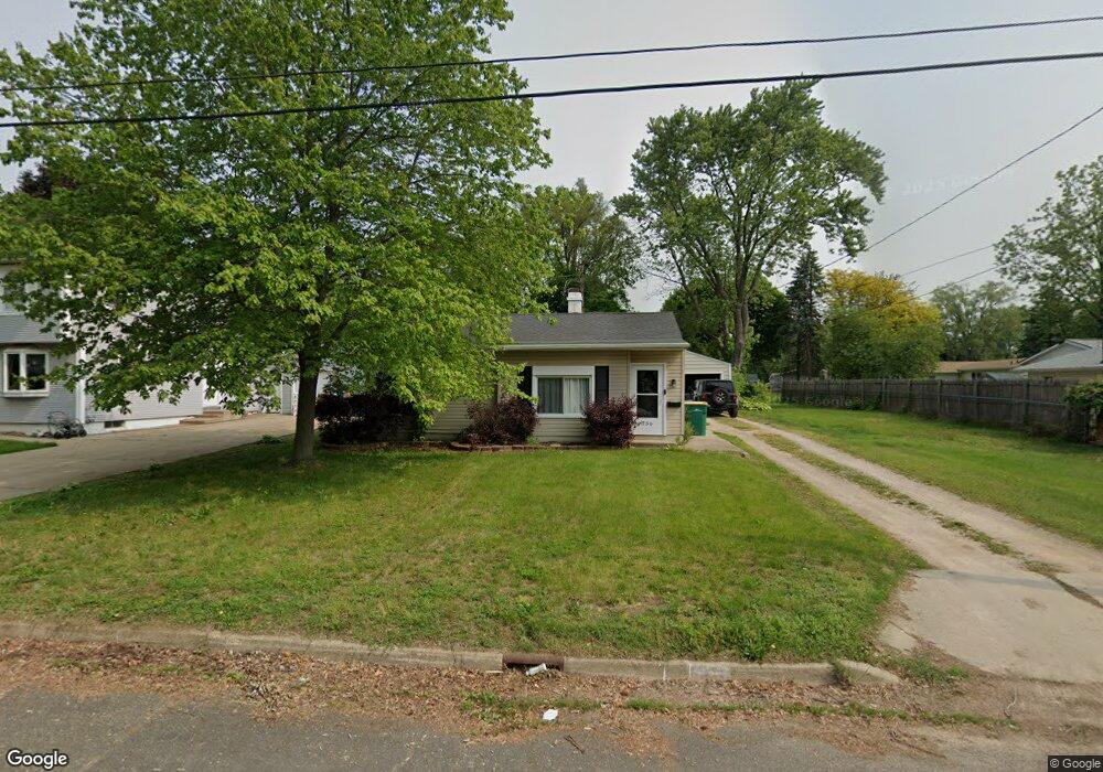
756 Ward St Battle Creek, MI 49015
Central Battle Creek NeighborhoodEstimated Value: $137,000 - $149,000
2
Beds
1
Bath
780
Sq Ft
$182/Sq Ft
Est. Value
About This Home
This home is located at 756 Ward St, Battle Creek, MI 49015 and is currently estimated at $141,596, approximately $181 per square foot. 756 Ward St is a home located in Calhoun County with nearby schools including Lakeview Middle School, Lakeview High School, and Arbor Academy.
Ownership History
Date
Name
Owned For
Owner Type
Purchase Details
Closed on
Jan 7, 2021
Sold by
Dubois Christopher D
Bought by
Begley Caitlyn
Current Estimated Value
Home Financials for this Owner
Home Financials are based on the most recent Mortgage that was taken out on this home.
Original Mortgage
$81,005
Outstanding Balance
$72,297
Interest Rate
2.71%
Mortgage Type
FHA
Estimated Equity
$69,299
Purchase Details
Closed on
Aug 17, 2001
Sold by
Robinson Kimberly A
Bought by
Du Bois Christopher D
Purchase Details
Closed on
Dec 8, 1997
Bought by
Robinson
Create a Home Valuation Report for This Property
The Home Valuation Report is an in-depth analysis detailing your home's value as well as a comparison with similar homes in the area
Home Values in the Area
Average Home Value in this Area
Purchase History
| Date | Buyer | Sale Price | Title Company |
|---|---|---|---|
| Begley Caitlyn | $82,500 | None Available | |
| Du Bois Christopher D | $50,500 | -- | |
| Robinson | $38,900 | -- |
Source: Public Records
Mortgage History
| Date | Status | Borrower | Loan Amount |
|---|---|---|---|
| Open | Begley Caitlyn | $81,005 | |
| Closed | Begley Caitlyn | $3,887 |
Source: Public Records
Tax History Compared to Growth
Tax History
| Year | Tax Paid | Tax Assessment Tax Assessment Total Assessment is a certain percentage of the fair market value that is determined by local assessors to be the total taxable value of land and additions on the property. | Land | Improvement |
|---|---|---|---|---|
| 2025 | -- | $54,900 | $0 | $0 |
| 2024 | $1,573 | $50,729 | $0 | $0 |
| 2023 | $1,857 | $43,776 | $0 | $0 |
| 2022 | $1,487 | $37,748 | $0 | $0 |
| 2021 | $1,174 | $35,087 | $0 | $0 |
| 2020 | $1,468 | $30,671 | $0 | $0 |
| 2019 | $1,468 | $26,436 | $0 | $0 |
| 2018 | $1,468 | $25,464 | $4,116 | $21,348 |
| 2017 | $1,421 | $23,615 | $0 | $0 |
| 2016 | $1,418 | $22,977 | $0 | $0 |
| 2015 | $977 | $21,631 | $4,585 | $17,046 |
| 2014 | $977 | $21,853 | $4,585 | $17,268 |
Source: Public Records
Map
Nearby Homes
- 715 Ingram St
- 760 Goguac St W
- 149 Cameron Dr
- 132 22nd St N
- 150 23rd St N
- 36 21st St N
- 49 N La Vista Blvd
- 38 22nd St N
- 17 20th St N
- 294 20th St N
- 893 W Territorial Rd
- 256 Burr St
- 387 Goguac St W
- 19 Ridge St
- 890 Fairfield Ave
- 1225 Territorial Rd W
- 155 Kirkwood Ave
- 1243 Territorial Rd W
- 349 Goguac St W
- 317 Catera Ct