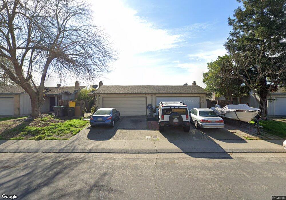
7564 Karlsberg Cir Stockton, CA 95207
Parkwoods NeighborhoodEstimated Value: $460,098 - $544,000
10
Beds
8
Baths
2,270
Sq Ft
$222/Sq Ft
Est. Value
About This Home
This home is located at 7564 Karlsberg Cir, Stockton, CA 95207 and is currently estimated at $504,025, approximately $222 per square foot. 7564 Karlsberg Cir is a home located in San Joaquin County with nearby schools including John R. Williams School, Sierra Middle School, and Lincoln High School.
Ownership History
Date
Name
Owned For
Owner Type
Purchase Details
Closed on
Oct 16, 1996
Sold by
Josephson Ronald W and Josephson Karen J
Bought by
Dao Sonny and Sor Ngoy S
Current Estimated Value
Home Financials for this Owner
Home Financials are based on the most recent Mortgage that was taken out on this home.
Original Mortgage
$69,332
Outstanding Balance
$6,524
Interest Rate
8.37%
Mortgage Type
FHA
Estimated Equity
$497,501
Create a Home Valuation Report for This Property
The Home Valuation Report is an in-depth analysis detailing your home's value as well as a comparison with similar homes in the area
Home Values in the Area
Average Home Value in this Area
Purchase History
| Date | Buyer | Sale Price | Title Company |
|---|---|---|---|
| Dao Sonny | $69,000 | Central Valley Title Company |
Source: Public Records
Mortgage History
| Date | Status | Borrower | Loan Amount |
|---|---|---|---|
| Open | Dao Sonny | $69,332 |
Source: Public Records
Tax History Compared to Growth
Tax History
| Year | Tax Paid | Tax Assessment Tax Assessment Total Assessment is a certain percentage of the fair market value that is determined by local assessors to be the total taxable value of land and additions on the property. | Land | Improvement |
|---|---|---|---|---|
| 2025 | $1,870 | $112,362 | $48,852 | $63,510 |
| 2024 | $1,839 | $110,160 | $47,895 | $62,265 |
| 2023 | $1,826 | $108,001 | $46,956 | $61,045 |
| 2022 | $1,668 | $105,885 | $46,036 | $59,849 |
| 2021 | $1,651 | $103,810 | $45,134 | $58,676 |
| 2020 | $1,651 | $102,747 | $44,672 | $58,075 |
| 2019 | $1,631 | $100,734 | $43,797 | $56,937 |
| 2018 | $1,595 | $98,760 | $42,939 | $55,821 |
| 2017 | $1,570 | $96,825 | $42,098 | $54,727 |
| 2016 | $1,558 | $94,927 | $41,273 | $53,654 |
| 2014 | $1,528 | $91,670 | $39,857 | $51,813 |
Source: Public Records
Map
Nearby Homes
- 7303 Southfield Way
- 7513 Richland Way
- 7626 Richland Way
- 3265 Shoreline Ct
- 7223 Westland Dr
- 7356 Lighthouse Dr
- 7011 Shoreham Place
- 7348 Lighthouse Dr
- 2708 Madrone Ave
- 8116 Montgomery Ave
- 2653 Jasmine Ave
- 2737 Birch Ave
- 2618 Buttonwillow Ave
- 8356 Yarmouth Dr
- 8360 Norfolk Way
- 2513 Hazelwood Ave
- 6947 Shiloh Place
- 8463 Yarmouth Dr
- 3038 Monticello Dr
- 3014 Monticello Dr
- 7556 Karlsberg Cir
- 7572 Karlsberg Cir
- 7513 Kelley Dr
- 7548 Karlsberg Cir
- 7508 Karlsberg Cir
- 7439 Kelley Dr
- 7565 Karlsberg Cir
- 7571 Karlsberg Cir
- 7466 Karlsberg Cir
- 7555 Karlsberg Cir
- 7579 Karlsberg Cir
- 7431 Kelley Dr
- 7518 Kelley Dr
- 7526 Kelley Dr
- 7547 Karlsberg Cir
- 7458 Karlsberg Cir
- 7534 Kelley Dr
- 7423 Kelley Dr
- 7614 Kelley Dr
- 7438 Kelley Dr