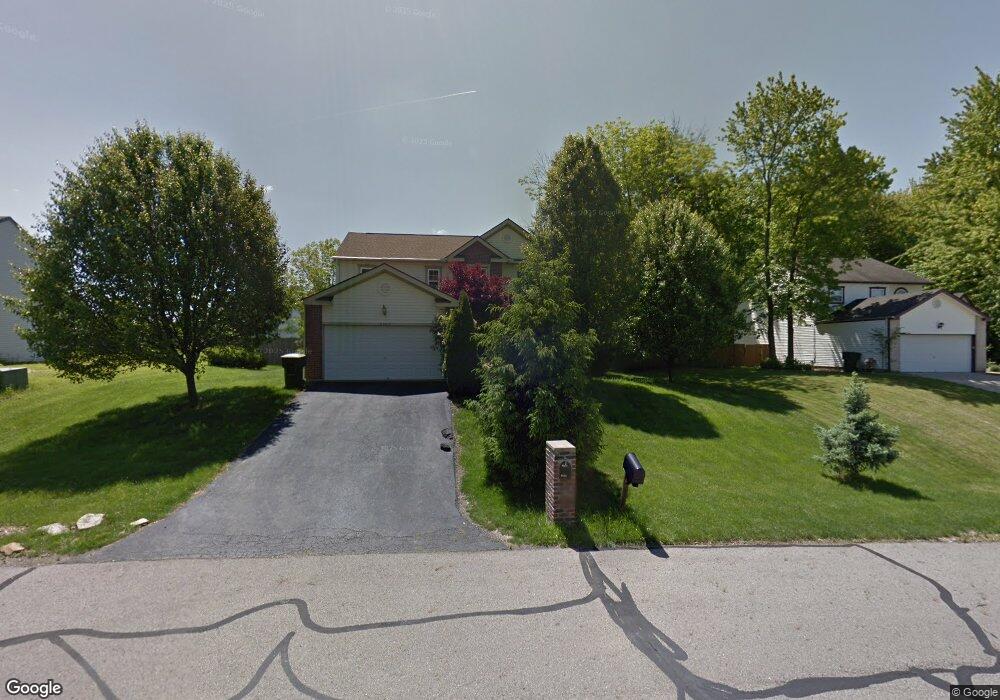
7565 Liddesdale Blvd Blacklick, OH 43004
East Broad NeighborhoodEstimated Value: $371,000 - $398,570
4
Beds
3
Baths
2,144
Sq Ft
$178/Sq Ft
Est. Value
About This Home
This home is located at 7565 Liddesdale Blvd, Blacklick, OH 43004 and is currently estimated at $381,643, approximately $178 per square foot. 7565 Liddesdale Blvd is a home located in Franklin County with nearby schools including Olde Orchard Elementary School, Sherwood Middle School, and Walnut Ridge High School.
Ownership History
Date
Name
Owned For
Owner Type
Purchase Details
Closed on
Aug 31, 1999
Sold by
Maronda Homes Inc
Bought by
Palmer Harold A and Palmer Brenda K
Current Estimated Value
Home Financials for this Owner
Home Financials are based on the most recent Mortgage that was taken out on this home.
Original Mortgage
$141,667
Outstanding Balance
$41,838
Interest Rate
7.77%
Mortgage Type
FHA
Estimated Equity
$339,805
Create a Home Valuation Report for This Property
The Home Valuation Report is an in-depth analysis detailing your home's value as well as a comparison with similar homes in the area
Home Values in the Area
Average Home Value in this Area
Purchase History
| Date | Buyer | Sale Price | Title Company |
|---|---|---|---|
| Palmer Harold A | $141,800 | Chicago Title |
Source: Public Records
Mortgage History
| Date | Status | Borrower | Loan Amount |
|---|---|---|---|
| Open | Palmer Harold A | $141,667 |
Source: Public Records
Tax History Compared to Growth
Tax History
| Year | Tax Paid | Tax Assessment Tax Assessment Total Assessment is a certain percentage of the fair market value that is determined by local assessors to be the total taxable value of land and additions on the property. | Land | Improvement |
|---|---|---|---|---|
| 2024 | $5,512 | $121,910 | $30,980 | $90,930 |
| 2023 | $5,401 | $121,905 | $30,975 | $90,930 |
| 2022 | $4,210 | $81,170 | $17,500 | $63,670 |
| 2021 | $4,217 | $81,170 | $17,500 | $63,670 |
| 2020 | $4,223 | $81,170 | $17,500 | $63,670 |
| 2019 | $3,983 | $65,660 | $14,000 | $51,660 |
| 2018 | $3,512 | $65,660 | $14,000 | $51,660 |
| 2017 | $3,669 | $65,660 | $14,000 | $51,660 |
| 2016 | $3,358 | $50,690 | $9,420 | $41,270 |
| 2015 | $3,048 | $50,690 | $9,420 | $41,270 |
| 2014 | $3,056 | $50,690 | $9,420 | $41,270 |
| 2013 | $1,674 | $56,315 | $10,465 | $45,850 |
Source: Public Records
Map
Nearby Homes
- 160 Strathsprey Dr
- 192 Strathsprey Dr
- 208 Glenkirk Dr Unit 104B
- 7452 Call Rd Unit 99F
- 7589 Swindon St
- 186 Malloy Ln Unit 25c
- 184 Malloy Ln Unit 25D
- 170 Malloy Ln Unit 24C
- 240 MacEnroe Dr Unit 71D
- 201 MacEnroe Dr Unit 66C
- 167 MacEnroe Dr Unit 32B
- 184 MacAndrews Way Unit 44E
- 417 Hannifin Dr
- 7204 Kirkdale Dr Unit 36C
- 466 Hannifin Dr
- 7831 Fairfax Loop Dr
- 625 Streamwater Dr
- 7883 Grandlin Park Ct
- 108 Kingsmeadow Ln
- 447 Grandlin Park Dr
- 7557 Liddesdale Blvd
- 185 Strathsprey Dr
- 193 Strathsprey Dr
- 177 Strathsprey Dr
- 7562 Liddesdale Blvd
- 7549 Liddesdale Blvd
- 7593 Liddesdale Blvd
- 7576 Liddesdale Blvd
- 201 Strathsprey Dr
- 7584 Liddesdale Blvd
- 169 Strathsprey Dr
- 7550 Liddesdale Blvd
- 200 Bannockburn Blvd
- 215 Strathsprey Dr
- 7592 Liddesdale Blvd
- 227 Strathsprey Dr
- 244 Westerkirk Dr
- 172 Strathsprey Dr
- 184 Strathsprey Dr
- 270 Streamwater Ct