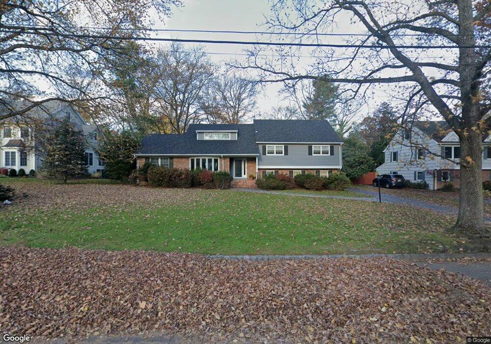
757 Norgate Westfield, NJ 07090
Estimated Value: $1,137,000 - $1,709,977
--
Bed
--
Bath
3,638
Sq Ft
$417/Sq Ft
Est. Value
About This Home
This home is located at 757 Norgate, Westfield, NJ 07090 and is currently estimated at $1,517,244, approximately $417 per square foot. 757 Norgate is a home located in Union County with nearby schools including Tamaques Elementary School, Edison Intermediate School, and Westfield Senior High School.
Ownership History
Date
Name
Owned For
Owner Type
Purchase Details
Closed on
Jul 29, 2010
Sold by
Schraff John J and Schraff Ellyn D
Bought by
Wancier Scott B and Lubitz Sara E
Current Estimated Value
Home Financials for this Owner
Home Financials are based on the most recent Mortgage that was taken out on this home.
Original Mortgage
$652,000
Outstanding Balance
$432,992
Interest Rate
4.63%
Mortgage Type
New Conventional
Estimated Equity
$1,084,252
Purchase Details
Closed on
May 9, 1994
Sold by
Fitzpatrick Brian T and Fitzpatrick Kathleen A
Bought by
Schraff John J and Schraff Ellyn D
Create a Home Valuation Report for This Property
The Home Valuation Report is an in-depth analysis detailing your home's value as well as a comparison with similar homes in the area
Home Values in the Area
Average Home Value in this Area
Purchase History
| Date | Buyer | Sale Price | Title Company |
|---|---|---|---|
| Wancier Scott B | $815,000 | Old Republic National Title | |
| Schraff John J | $500,000 | -- |
Source: Public Records
Mortgage History
| Date | Status | Borrower | Loan Amount |
|---|---|---|---|
| Open | Wancier Scott B | $652,000 |
Source: Public Records
Tax History Compared to Growth
Tax History
| Year | Tax Paid | Tax Assessment Tax Assessment Total Assessment is a certain percentage of the fair market value that is determined by local assessors to be the total taxable value of land and additions on the property. | Land | Improvement |
|---|---|---|---|---|
| 2025 | $22,847 | $1,014,500 | $512,600 | $501,900 |
| 2024 | $22,380 | $1,014,500 | $512,600 | $501,900 |
| 2023 | $22,380 | $1,014,500 | $512,600 | $501,900 |
| 2022 | $21,913 | $1,014,500 | $512,600 | $501,900 |
| 2021 | $21,574 | $997,400 | $512,600 | $484,800 |
| 2020 | $21,524 | $997,400 | $512,600 | $484,800 |
| 2019 | $21,444 | $997,400 | $512,600 | $484,800 |
| 2018 | $19,635 | $211,200 | $105,000 | $106,200 |
| 2017 | $19,528 | $211,200 | $105,000 | $106,200 |
| 2016 | $19,069 | $211,200 | $105,000 | $106,200 |
| 2015 | $18,689 | $211,200 | $105,000 | $106,200 |
| 2014 | $18,072 | $211,200 | $105,000 | $106,200 |
Source: Public Records
Map
Nearby Homes
- 779 Lamberts Mill Rd
- 676 Vermont St
- 1466 Lamberts Mill Rd
- 614 Dorian Rd
- 119 Lamberts Mill Rd
- 834 Tice Place
- 525 Edgar Rd
- 2154 W Broad St
- 524 Edgar Rd
- 1840 Lake Ave
- 2 Dutch Ln
- 2 Brookside Ct
- 814 Summit Ave
- 817 Summit Ave
- 1016 Tice Place
- 11 Mohawk Trail
- 538 Westfield Ave
- 522 Boulevard
- 603 Carleton Rd
- 1840 Raritan Rd