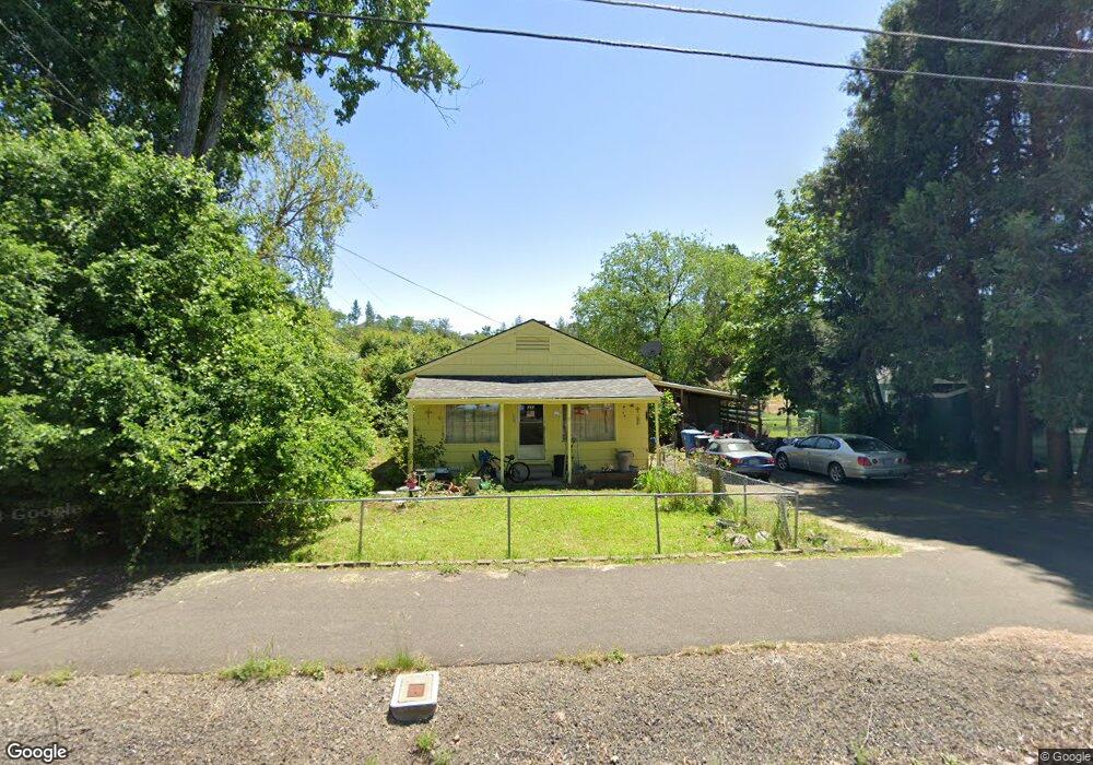
757 S Shasta Ave Eagle Point, OR 97524
Estimated Value: $301,615 - $360,000
3
Beds
2
Baths
1,404
Sq Ft
$235/Sq Ft
Est. Value
About This Home
This home is located at 757 S Shasta Ave, Eagle Point, OR 97524 and is currently estimated at $329,404, approximately $234 per square foot. 757 S Shasta Ave is a home located in Jackson County with nearby schools including Eagle Point Middle School, White Mountain Middle School, and Eagle Point High School.
Ownership History
Date
Name
Owned For
Owner Type
Purchase Details
Closed on
Aug 11, 2011
Sold by
Chenoweth Ann Louise
Bought by
Chenoweth Thomas F
Current Estimated Value
Home Financials for this Owner
Home Financials are based on the most recent Mortgage that was taken out on this home.
Original Mortgage
$46,675
Interest Rate
4.46%
Mortgage Type
Credit Line Revolving
Purchase Details
Closed on
Jun 20, 2007
Sold by
Chenoweth Thomas F
Bought by
Chenoweth Thomas F and Chenoweth Ann L
Purchase Details
Closed on
May 11, 2000
Sold by
Alford Robert
Bought by
Alford Robert and Alford Pamela
Create a Home Valuation Report for This Property
The Home Valuation Report is an in-depth analysis detailing your home's value as well as a comparison with similar homes in the area
Home Values in the Area
Average Home Value in this Area
Purchase History
| Date | Buyer | Sale Price | Title Company |
|---|---|---|---|
| Chenoweth Thomas F | -- | Amerititle | |
| Chenoweth Thomas F | -- | None Available | |
| Alford Robert | $79,500 | -- |
Source: Public Records
Mortgage History
| Date | Status | Borrower | Loan Amount |
|---|---|---|---|
| Closed | Chenoweth Thomas F | $46,675 |
Source: Public Records
Tax History Compared to Growth
Tax History
| Year | Tax Paid | Tax Assessment Tax Assessment Total Assessment is a certain percentage of the fair market value that is determined by local assessors to be the total taxable value of land and additions on the property. | Land | Improvement |
|---|---|---|---|---|
| 2025 | $1,747 | $127,670 | $74,270 | $53,400 |
| 2024 | $1,747 | $123,960 | $72,120 | $51,840 |
| 2023 | $1,688 | $120,350 | $70,020 | $50,330 |
| 2022 | $1,642 | $120,350 | $70,020 | $50,330 |
| 2021 | $1,593 | $116,850 | $67,990 | $48,860 |
| 2020 | $1,693 | $113,450 | $66,010 | $47,440 |
| 2019 | $1,667 | $106,950 | $62,230 | $44,720 |
| 2018 | $1,635 | $103,840 | $60,420 | $43,420 |
| 2017 | $1,595 | $103,840 | $60,420 | $43,420 |
| 2016 | $1,564 | $97,890 | $56,960 | $40,930 |
| 2015 | $1,513 | $97,890 | $56,960 | $40,930 |
| 2014 | $1,470 | $92,280 | $53,700 | $38,580 |
Source: Public Records
Map
Nearby Homes
- 804 S Shasta Ave
- 0 Sf Little Butte Unit 220204792
- 429 Arrowhead Trail
- 470 Old Highway 62 Unit 2
- 118 Pebble Creek Dr
- 416 S Royal Ave
- 650 Sarah Ln
- 522 Meadow Ln
- 323 S Shasta Ave
- 315 S Buchanan Ave
- 247 Lorraine Ave
- 888 Arrowhead Trail
- 828 St Andrews Way
- 1065 S Shasta Ave
- 10569 Hannon Rd
- 221 Ortega St
- 949 Arrowhead Trail
- 131 Bellerive Dr
- 964 Pumpkin Ridge
- 875 St Andrews Way
- 765 S Shasta Ave
- 771 S Shasta Ave
- 746 S Shasta Ave
- 16 Christa Ln
- 34 Christa Ln
- 740 S Shasta Ave
- 758 S Shasta Ave
- 58 Christa Ln
- 779 S Shasta Ave
- 772 S Shasta Ave
- 791 S Shasta Ave
- 787 S Shasta Ave
- 49 Christa Ln
- 780 S Shasta Ave
- 723 S Shasta Ave
- 90 Christa Ln
- 761 S Royal Ave
- 63 Christa Ln
- 0 Christa Ln
- 759 S Royal Ave