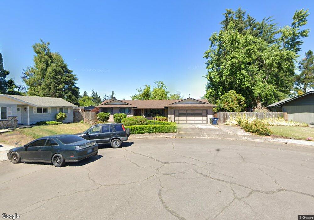
758 66th Place Springfield, OR 97478
Thurston NeighborhoodEstimated Value: $440,296 - $488,000
3
Beds
2
Baths
1,530
Sq Ft
$305/Sq Ft
Est. Value
About This Home
This home is located at 758 66th Place, Springfield, OR 97478 and is currently estimated at $466,824, approximately $305 per square foot. 758 66th Place is a home located in Lane County with nearby schools including Ridgeview Elementary School, Thurston Middle School, and Thurston High School.
Create a Home Valuation Report for This Property
The Home Valuation Report is an in-depth analysis detailing your home's value as well as a comparison with similar homes in the area
Home Values in the Area
Average Home Value in this Area
Tax History
| Year | Tax Paid | Tax Assessment Tax Assessment Total Assessment is a certain percentage of the fair market value that is determined by local assessors to be the total taxable value of land and additions on the property. | Land | Improvement |
|---|---|---|---|---|
| 2025 | $4,443 | $242,268 | -- | -- |
| 2024 | $4,371 | $235,212 | -- | -- |
| 2023 | $4,371 | $228,362 | -- | -- |
| 2022 | $4,048 | $221,711 | $0 | $0 |
| 2021 | $3,975 | $215,254 | $0 | $0 |
| 2020 | $3,859 | $208,985 | $0 | $0 |
| 2019 | $3,743 | $202,899 | $0 | $0 |
| 2018 | $3,529 | $191,252 | $0 | $0 |
| 2017 | $3,393 | $191,252 | $0 | $0 |
| 2016 | $3,322 | $185,682 | $0 | $0 |
| 2015 | $3,227 | $180,274 | $0 | $0 |
| 2014 | $3,178 | $175,023 | $0 | $0 |
Source: Public Records
Map
Nearby Homes
- 555 66th St
- 6898 Thurston Rd
- 6540 B St
- 250 68th St
- 6875 B St
- 7080 Thurston Rd Unit 2
- 6445 B St
- 0 71st St
- 353 71st St
- 0 Omlid Dr Unit 1 706471345
- 0 Omlid Dr Unit 11
- 0 Omlid Dr Unit 27 796722689
- 0 Omlid Dr Unit 26 256458253
- 0 Omlid Dr Unit 10
- 0 Omlid Dr Unit 3 154724851
- 0 Omlid Dr Unit 2 312357104
- 193 62nd Place
- 5982 G St
- 246 S 70th St
- 320 Mountaingate Dr
Your Personal Tour Guide
Ask me questions while you tour the home.