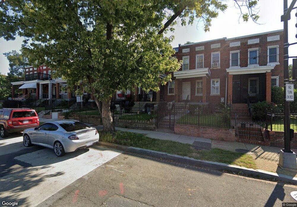
759 19th St NE Washington, DC 20002
Langston NeighborhoodEstimated Value: $534,602 - $571,000
3
Beds
2
Baths
1,200
Sq Ft
$467/Sq Ft
Est. Value
About This Home
This home is located at 759 19th St NE, Washington, DC 20002 and is currently estimated at $560,651, approximately $467 per square foot. 759 19th St NE is a home located in District of Columbia with nearby schools including Browne Education Campus, Eastern High School, and Two Rivers Public Charter School - Young Elementary.
Ownership History
Date
Name
Owned For
Owner Type
Purchase Details
Closed on
Nov 3, 2014
Sold by
Corley Andrew P
Bought by
Corley Gwenellen L
Current Estimated Value
Purchase Details
Closed on
May 1, 1996
Sold by
Swan Richard H
Bought by
Joyce Mary C
Home Financials for this Owner
Home Financials are based on the most recent Mortgage that was taken out on this home.
Original Mortgage
$97,100
Interest Rate
7.82%
Create a Home Valuation Report for This Property
The Home Valuation Report is an in-depth analysis detailing your home's value as well as a comparison with similar homes in the area
Home Values in the Area
Average Home Value in this Area
Purchase History
| Date | Buyer | Sale Price | Title Company |
|---|---|---|---|
| Corley Gwenellen L | -- | -- | |
| Joyce Mary C | $107,900 | -- |
Source: Public Records
Mortgage History
| Date | Status | Borrower | Loan Amount |
|---|---|---|---|
| Previous Owner | Joyce Mary C | $97,100 |
Source: Public Records
Tax History Compared to Growth
Tax History
| Year | Tax Paid | Tax Assessment Tax Assessment Total Assessment is a certain percentage of the fair market value that is determined by local assessors to be the total taxable value of land and additions on the property. | Land | Improvement |
|---|---|---|---|---|
| 2024 | $4,630 | $544,750 | $348,440 | $196,310 |
| 2023 | $4,485 | $527,670 | $348,290 | $179,380 |
| 2022 | $4,200 | $494,080 | $314,960 | $179,120 |
| 2021 | $3,939 | $463,450 | $303,710 | $159,740 |
| 2020 | $3,754 | $441,620 | $288,750 | $152,870 |
| 2019 | $3,448 | $405,610 | $268,540 | $137,070 |
| 2018 | $2,974 | $349,870 | $0 | $0 |
| 2017 | $2,753 | $323,930 | $0 | $0 |
| 2016 | $2,429 | $285,810 | $0 | $0 |
| 2015 | $2,057 | $241,990 | $0 | $0 |
| 2014 | $1,571 | $184,830 | $0 | $0 |
Source: Public Records
Map
Nearby Homes
- 1910 Benning Rd NE Unit 2
- 1919 Bennett Place NE
- 1915 Benning Rd NE Unit 302
- 1915 Benning Rd NE Unit 101
- 1915 Benning Rd NE Unit 3
- 1915 Benning Rd NE Unit 8
- 1915 Benning Rd NE Unit PH1
- 1926 Bennett Place NE
- 1917 H St NE
- 1915 H St NE Unit PH-1
- 1915 H St NE Unit PH-2
- 2023 2025-2027 Benning Rd NE
- 760 19th St NE
- 1814 Benning Rd NE Unit 1
- 728 19th St NE
- 1959 H St NE
- 771 18th St NE Unit B
- 804 20th St NE
- 777 18th St NE
- 719 18th St NE Unit 719-1
- 761 19th St NE
- 761 19th St NE
- 761 19th St NE Unit 4
- 761 19th St NE Unit 1
- 761 19th St NE Unit 3
- 761 19th St NE Unit 2
- 757 19th St NE
- 755 19th St NE
- 763 19th St NE
- 765 19th St NE
- 753 19th St NE
- 767 19th St NE
- 1910 Benning Rd NE
- 1910 Benning Rd NE Unit 4
- 1910 Benning Rd NE Unit 3
- 1910 Benning Rd NE Unit 1
- 1910 Benning Rd NE Unit 101
- 1910 Benning Rd NE Unit A
- 769 19th St NE
- 1915 Bennett Place NE