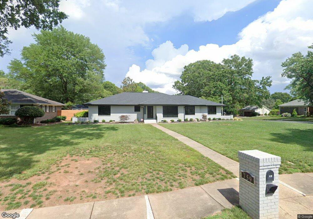
759 Lansdowne Rd Unit 1 Charlotte, NC 28270
Lansdowne NeighborhoodEstimated Value: $789,000 - $1,048,000
4
Beds
3
Baths
2,457
Sq Ft
$377/Sq Ft
Est. Value
About This Home
This home is located at 759 Lansdowne Rd Unit 1, Charlotte, NC 28270 and is currently estimated at $926,557, approximately $377 per square foot. 759 Lansdowne Rd Unit 1 is a home located in Mecklenburg County with nearby schools including Lansdowne Elementary, McClintock Middle School, and East Mecklenburg High.
Ownership History
Date
Name
Owned For
Owner Type
Purchase Details
Closed on
Jul 27, 2022
Sold by
Bischoff Scott C and Bischoff Katherine T
Bought by
Bischoff Family Revocable Living Trust
Current Estimated Value
Purchase Details
Closed on
Mar 18, 2019
Sold by
Burgess Weeter Katherine Jeanne and Burgess Almond Elizabeth
Bought by
Blachoff Scott C and Blachoff Katherine T
Purchase Details
Closed on
Jan 1, 1975
Bought by
Burgess Thomas E and Burgess Burgess
Create a Home Valuation Report for This Property
The Home Valuation Report is an in-depth analysis detailing your home's value as well as a comparison with similar homes in the area
Home Values in the Area
Average Home Value in this Area
Purchase History
| Date | Buyer | Sale Price | Title Company |
|---|---|---|---|
| Bischoff Family Revocable Living Trust | -- | Gorman & Asscoiates Pa | |
| Blachoff Scott C | $387,500 | Barristers Ttl Svcs Of Carol | |
| Burgess Thomas E | -- | -- |
Source: Public Records
Tax History Compared to Growth
Tax History
| Year | Tax Paid | Tax Assessment Tax Assessment Total Assessment is a certain percentage of the fair market value that is determined by local assessors to be the total taxable value of land and additions on the property. | Land | Improvement |
|---|---|---|---|---|
| 2025 | -- | $799,900 | $475,000 | $324,900 |
| 2024 | -- | $799,900 | $475,000 | $324,900 |
| 2023 | $6,006 | $799,900 | $475,000 | $324,900 |
| 2022 | $4,588 | $462,400 | $175,000 | $287,400 |
| 2021 | $4,577 | $462,400 | $175,000 | $287,400 |
| 2020 | $4,569 | $429,100 | $175,000 | $254,100 |
| 2019 | $4,232 | $429,100 | $175,000 | $254,100 |
| 2018 | $3,559 | $265,700 | $85,500 | $180,200 |
| 2017 | $3,502 | $265,700 | $85,500 | $180,200 |
| 2016 | $3,493 | $265,700 | $85,500 | $180,200 |
| 2015 | $3,481 | $265,700 | $85,500 | $180,200 |
| 2014 | $3,475 | $0 | $0 | $0 |
Source: Public Records
Map
Nearby Homes
- 719 Lansdowne Rd
- 823 Wingrave Dr
- 434 Lansdowne Rd
- 5010 Ohm Ln
- 331 Wingrave Dr
- 6505 Folger Dr
- 924 Jefferson Dr
- 1301 Old Farm Rd
- 1020 Jefferson Dr
- 227 Wingrave Dr
- 514 Jefferson Dr
- 144 Sardis Ln
- 150 Sardis Ln
- 6126 Creola Rd
- 200 Bentley Oaks Ln
- 1322 E Barden Rd
- 626 Shelton St
- 5129 Red Cedar Ln
- 131 Boyce Rd
- 215 Smithfield Dr
- 759 Lansdowne Rd
- 801 Lansdowne Rd
- 650 Wingrave Dr
- 743 Lansdowne Rd
- 642 Wingrave Dr
- 758 Lansdowne Rd
- 700 Wingrave Dr
- 750 Lansdowne Rd
- 800 Lansdowne Rd
- 634 Wingrave Dr
- 811 Lansdowne Rd
- 735 Lansdowne Rd
- 810 Lansdowne Rd
- 712 Wingrave Dr
- 626 Wingrave Dr
- 734 Lansdowne Rd
- 727 Lansdowne Rd
- 819 Lansdowne Rd
- 822 Lansdowne Rd
- 720 Wingrave Dr