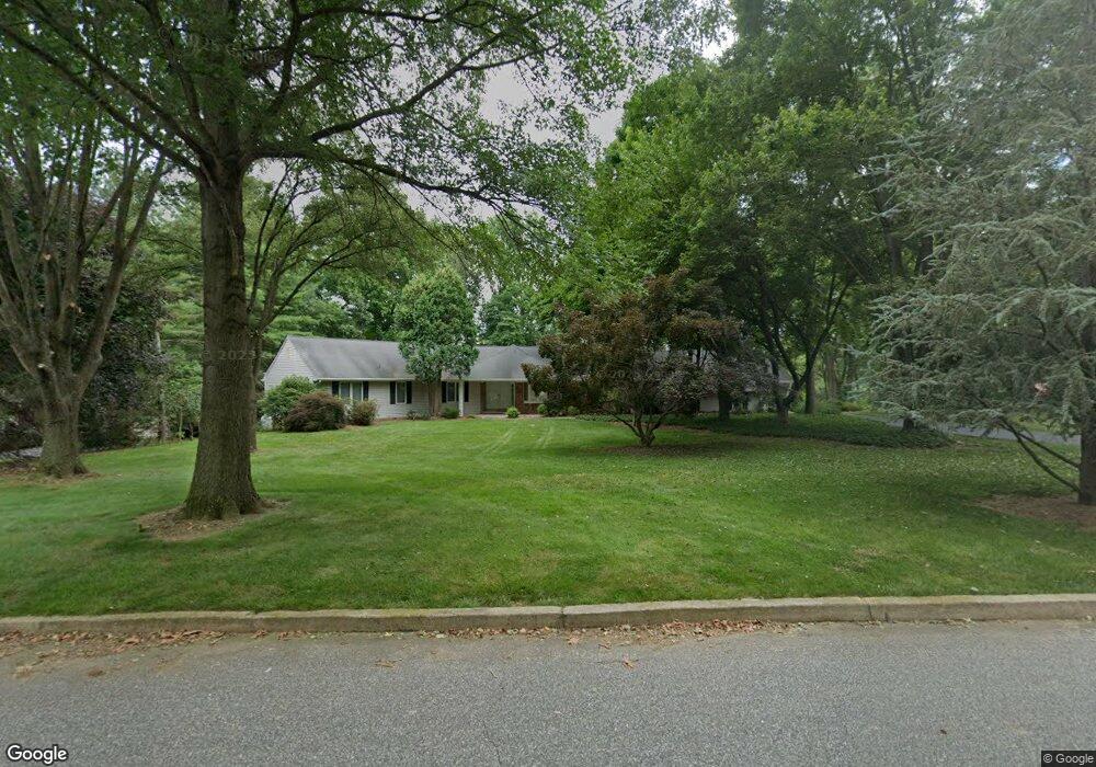
76 Carter Way Glen Mills, PA 19342
Concord Township Delaware NeighborhoodEstimated Value: $719,380 - $822,000
4
Beds
3
Baths
2,352
Sq Ft
$323/Sq Ft
Est. Value
About This Home
This home is located at 76 Carter Way, Glen Mills, PA 19342 and is currently estimated at $759,595, approximately $322 per square foot. 76 Carter Way is a home located in Delaware County with nearby schools including Garnet Valley High School, St Cornelius School, and The Pilot School.
Ownership History
Date
Name
Owned For
Owner Type
Purchase Details
Closed on
Oct 26, 2001
Sold by
Owens Kristy M
Bought by
Caramanico Thomas R and Caramanico Nancy M
Current Estimated Value
Home Financials for this Owner
Home Financials are based on the most recent Mortgage that was taken out on this home.
Original Mortgage
$100,000
Interest Rate
6.27%
Mortgage Type
Purchase Money Mortgage
Purchase Details
Closed on
Aug 22, 1994
Sold by
Owens Gary M and Owens Kristy M
Bought by
Owens Kristy M
Create a Home Valuation Report for This Property
The Home Valuation Report is an in-depth analysis detailing your home's value as well as a comparison with similar homes in the area
Home Values in the Area
Average Home Value in this Area
Purchase History
| Date | Buyer | Sale Price | Title Company |
|---|---|---|---|
| Caramanico Thomas R | $352,400 | Commonwealth Land Title Ins | |
| Owens Kristy M | -- | -- |
Source: Public Records
Mortgage History
| Date | Status | Borrower | Loan Amount |
|---|---|---|---|
| Closed | Caramanico Thomas R | $100,000 |
Source: Public Records
Tax History Compared to Growth
Tax History
| Year | Tax Paid | Tax Assessment Tax Assessment Total Assessment is a certain percentage of the fair market value that is determined by local assessors to be the total taxable value of land and additions on the property. | Land | Improvement |
|---|---|---|---|---|
| 2025 | $10,312 | $452,920 | $179,560 | $273,360 |
| 2024 | $10,312 | $452,920 | $179,560 | $273,360 |
| 2023 | $10,055 | $452,920 | $179,560 | $273,360 |
| 2022 | $9,944 | $452,920 | $179,560 | $273,360 |
| 2021 | $16,720 | $452,920 | $179,560 | $273,360 |
| 2020 | $9,004 | $227,870 | $75,470 | $152,400 |
| 2019 | $8,871 | $227,870 | $75,470 | $152,400 |
| 2018 | $8,734 | $227,870 | $0 | $0 |
| 2017 | $8,557 | $227,870 | $0 | $0 |
| 2016 | $1,276 | $227,870 | $0 | $0 |
| 2015 | $1,251 | $227,870 | $0 | $0 |
| 2014 | $1,251 | $227,870 | $0 | $0 |
Source: Public Records
Map
Nearby Homes
- 990 Smithbridge Rd
- 995 Smithbridge Rd
- 9 Molly Ln
- 88 Summit Ave
- 86 Summit Ave
- 138 S Buck Tavern Way
- 134 S Buck Tavern Way Unit 10803
- 124 S Buck Tavern Way Unit 10903
- 119 S Buck Tavern Way
- 135 S Buck Tavern Way Unit 11501
- 129 S Buck Tavern Way Unit 11504
- 210 N Buck Tavern Way Unit 10603
- 43 Sharpley Dr
- 4 Rigby Ct
- 920 Lamberhurst Close
- 904 Quarter Mile Post
- 1604 E Fox Brushs Way
- 1402 S Hunting Horn Turn Unit 383
- 312 Winterset Rd
- 136A State Line Rd