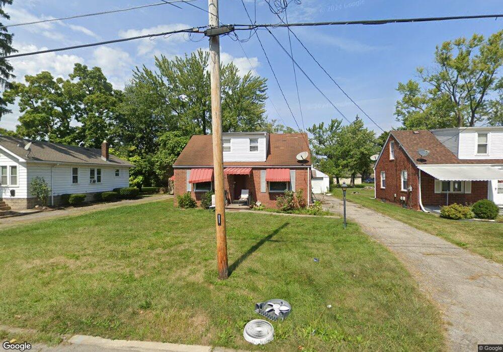
76 Gertrude Ave Youngstown, OH 44512
Estimated Value: $96,000 - $115,000
2
Beds
1
Bath
1,123
Sq Ft
$97/Sq Ft
Est. Value
About This Home
This home is located at 76 Gertrude Ave, Youngstown, OH 44512 and is currently estimated at $108,666, approximately $96 per square foot. 76 Gertrude Ave is a home located in Mahoning County with nearby schools including Boardman Glenwood Junior High School, Boardman High School, and Horizon Science Academy - Youngstown.
Ownership History
Date
Name
Owned For
Owner Type
Purchase Details
Closed on
Jun 23, 2010
Sold by
Estate Of Melvin C Bailey
Bought by
Christian Darren
Current Estimated Value
Purchase Details
Closed on
Aug 3, 2005
Sold by
Petrich Damon J and Petrich Joseph A
Bought by
Stigall Marvin
Home Financials for this Owner
Home Financials are based on the most recent Mortgage that was taken out on this home.
Original Mortgage
$80,750
Interest Rate
8.85%
Mortgage Type
Fannie Mae Freddie Mac
Create a Home Valuation Report for This Property
The Home Valuation Report is an in-depth analysis detailing your home's value as well as a comparison with similar homes in the area
Home Values in the Area
Average Home Value in this Area
Purchase History
| Date | Buyer | Sale Price | Title Company |
|---|---|---|---|
| Christian Darren | -- | None Available | |
| Stigall Marvin | -- | Foundation Title Agency Ltd |
Source: Public Records
Mortgage History
| Date | Status | Borrower | Loan Amount |
|---|---|---|---|
| Previous Owner | Stigall Marvin | $80,750 | |
| Closed | Stigall Marvin | $9,500 |
Source: Public Records
Tax History Compared to Growth
Tax History
| Year | Tax Paid | Tax Assessment Tax Assessment Total Assessment is a certain percentage of the fair market value that is determined by local assessors to be the total taxable value of land and additions on the property. | Land | Improvement |
|---|---|---|---|---|
| 2024 | $1,384 | $26,970 | $4,290 | $22,680 |
| 2023 | $1,366 | $26,970 | $4,290 | $22,680 |
| 2022 | $1,301 | $19,630 | $4,280 | $15,350 |
| 2021 | $1,301 | $19,630 | $4,280 | $15,350 |
| 2020 | $1,308 | $19,630 | $4,280 | $15,350 |
| 2019 | $1,304 | $17,220 | $3,760 | $13,460 |
| 2018 | $1,124 | $17,220 | $3,760 | $13,460 |
| 2017 | $1,113 | $17,220 | $3,760 | $13,460 |
| 2016 | $1,119 | $17,240 | $4,080 | $13,160 |
| 2015 | $1,097 | $17,240 | $4,080 | $13,160 |
| 2014 | $1,100 | $17,240 | $4,080 | $13,160 |
| 2013 | $1,086 | $17,240 | $4,080 | $13,160 |
Source: Public Records
Map
Nearby Homes
- 44 Gertrude Ave
- 149 Argyle Ave
- 81 Melrose Ave
- 167 Afton Ave
- 127 Melrose Ave
- 197 Mathews Rd Unit B
- 0 Mathews Rd Unit 5038026
- 169 Wolcott Dr
- 6001 Applecrest Dr
- 103 Wildwood Dr
- 329 Afton Ave
- 235 Wolcott Dr
- 175 Homestead Dr
- 26 Marlindale Ave
- 28 Terrace Dr
- 0 Indianola Rd
- 6511 Pembrooke Place
- 642 Oakridge Dr
- 83 Beechwood Dr
- 148 Clifton Dr
- 72 Gertrude Ave
- 80 Gertrude Ave
- 84 Gertrude Ave
- 68 Gertrude Ave
- 88 Gertrude Ave
- 79 Meadowbrook Ave
- 83 Meadowbrook Ave
- 64 Gertrude Ave
- 92 Gertrude Ave
- 87 Meadowbrook Ave
- 71 Meadowbrook Ave
- 89 Meadowbrook Ave
- 77 Gertrude Ave
- 73 Gertrude Ave
- 79 Gertrude Ave
- 71 Gertrude Ave
- 58 Gertrude Ave
- 83 Gertrude Ave
- 69 Meadowbrook Ave
- 69 Meadowbrook Ave