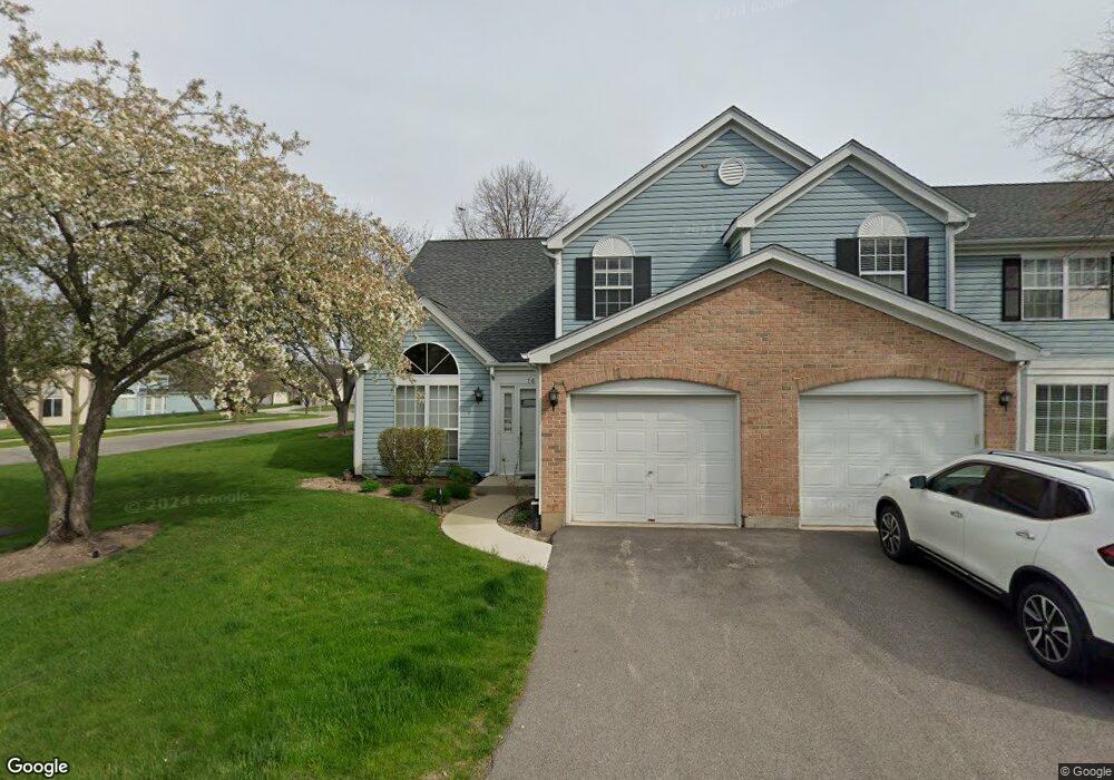
76 Lancaster Cir Unit A Gurnee, IL 60031
Estimated Value: $229,740 - $247,000
2
Beds
2
Baths
1,364
Sq Ft
$173/Sq Ft
Est. Value
About This Home
This home is located at 76 Lancaster Cir Unit A, Gurnee, IL 60031 and is currently estimated at $236,435, approximately $173 per square foot. 76 Lancaster Cir Unit A is a home located in Lake County with nearby schools including Spaulding Elementary School, Viking Middle School, and Warren Township High School.
Ownership History
Date
Name
Owned For
Owner Type
Purchase Details
Closed on
Apr 26, 1995
Sold by
Yeung Tim Tin Shing and Yeung Dahlia Flor
Bought by
Huff Dwayne and Huff Divina
Current Estimated Value
Home Financials for this Owner
Home Financials are based on the most recent Mortgage that was taken out on this home.
Original Mortgage
$90,300
Interest Rate
8.42%
Create a Home Valuation Report for This Property
The Home Valuation Report is an in-depth analysis detailing your home's value as well as a comparison with similar homes in the area
Home Values in the Area
Average Home Value in this Area
Purchase History
| Date | Buyer | Sale Price | Title Company |
|---|---|---|---|
| Huff Dwayne | $107,500 | -- |
Source: Public Records
Mortgage History
| Date | Status | Borrower | Loan Amount |
|---|---|---|---|
| Closed | Huff Dwayne | $90,300 |
Source: Public Records
Tax History
| Year | Tax Paid | Tax Assessment Tax Assessment Total Assessment is a certain percentage of the fair market value that is determined by local assessors to be the total taxable value of land and additions on the property. | Land | Improvement |
|---|---|---|---|---|
| 2024 | $4,620 | $60,603 | $8,227 | $52,376 |
| 2023 | $4,412 | $53,555 | $7,270 | $46,285 |
| 2022 | $4,412 | $49,900 | $7,271 | $42,629 |
| 2021 | $3,999 | $47,898 | $6,979 | $40,919 |
| 2020 | $3,870 | $46,720 | $6,807 | $39,913 |
| 2019 | $3,769 | $45,363 | $6,609 | $38,754 |
| 2018 | $3,417 | $41,396 | $4,331 | $37,065 |
| 2017 | $3,378 | $40,210 | $4,207 | $36,003 |
| 2016 | $3,264 | $38,420 | $4,020 | $34,400 |
| 2015 | $3,157 | $36,438 | $3,813 | $32,625 |
| 2014 | $3,613 | $42,002 | $3,740 | $38,262 |
| 2012 | $3,434 | $42,324 | $3,769 | $38,555 |
Source: Public Records
Map
Nearby Homes
- 134 Heritage Ct Unit B
- 287 Kensington Ct Unit 4
- 4232 Kenwood Ave
- 450 Tanglewood Dr
- 468 Tanglewood Dr
- 3861 Sutherland Dr
- 33718 N Oplaine Rd
- 546 Thorndale Ave
- 387 Long Hill Rd
- 995 Norman Ave
- 3877 Grandview Ave
- 4185 Eastwood Place
- 3810 1st St
- 4437-4495 W Kennedy Dr
- 4520 W Lawn Ave
- 963 Belle Plaine Ave
- 968 S Darla Ct
- 1070 Belle Plaine Ave
- 4390 W Parkway Ave
- 4447 W Lawn Ave
- 74 Lancaster Cir
- 72 Lancaster Cir Unit C
- 263 Knoxbury Ct Unit D
- 267 Knoxbury Ct Unit C
- 70 Lancaster Cir Unit D
- 271 Knoxbury Ct Unit B
- 75 Lancaster Cir Unit D
- 77 Lancaster Cir
- 73 Lancaster Cir
- 275 Knoxbury Ct Unit A
- 71 Lancaster Cir Unit B
- 67 Lancaster Cir Unit A
- 80 Wiltshire Ct Unit E
- 80 Wiltshire Ct Unit 80
- 79 Wiltshire Ct Unit A
- 4321 Buckingham Dr Unit A
- 82 Wiltshire Ct Unit D
- 266 Knoxbury Ct Unit B
- 262 Knoxbury Ct Unit A
- 270 Knoxbury Ct
Your Personal Tour Guide
Ask me questions while you tour the home.