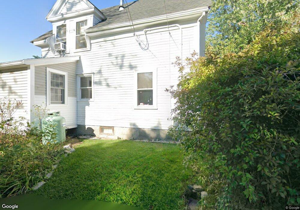
76 Langsford St Gloucester, MA 01930
Estimated Value: $698,866 - $1,029,000
2
Beds
2
Baths
1,574
Sq Ft
$559/Sq Ft
Est. Value
About This Home
This home is located at 76 Langsford St, Gloucester, MA 01930 and is currently estimated at $879,467, approximately $558 per square foot. 76 Langsford St is a home located in Essex County with nearby schools including Plum Cove School, Ralph B O'maley Middle School, and Gloucester High School.
Ownership History
Date
Name
Owned For
Owner Type
Purchase Details
Closed on
Aug 31, 2020
Sold by
Crotty Anne M and Gibson Celia C
Bought by
Crotty Anne M and Gibson Gregory A
Current Estimated Value
Home Financials for this Owner
Home Financials are based on the most recent Mortgage that was taken out on this home.
Original Mortgage
$275,000
Interest Rate
2.9%
Mortgage Type
New Conventional
Purchase Details
Closed on
Jul 14, 2020
Sold by
Crotty Anne-Marie and Gibson Gregory A
Bought by
Crotty Anne-Marie and Gibson Gregory A
Home Financials for this Owner
Home Financials are based on the most recent Mortgage that was taken out on this home.
Original Mortgage
$275,000
Interest Rate
2.9%
Mortgage Type
New Conventional
Purchase Details
Closed on
Sep 1, 1978
Bought by
Gibson Gregory A and Gibson Crotty A
Create a Home Valuation Report for This Property
The Home Valuation Report is an in-depth analysis detailing your home's value as well as a comparison with similar homes in the area
Purchase History
| Date | Buyer | Sale Price | Title Company |
|---|---|---|---|
| Crotty Anne M | -- | None Available | |
| Crotty Anne-Marie | -- | None Available | |
| Gibson Gregory A | -- | -- |
Source: Public Records
Mortgage History
| Date | Status | Borrower | Loan Amount |
|---|---|---|---|
| Previous Owner | Crotty Anne M | $275,000 | |
| Previous Owner | Gibson Gregory A | $225,000 | |
| Previous Owner | Gibson Gregory A | $200,000 | |
| Previous Owner | Gibson Gregory A | $200,000 |
Source: Public Records
Tax History
| Year | Tax Paid | Tax Assessment Tax Assessment Total Assessment is a certain percentage of the fair market value that is determined by local assessors to be the total taxable value of land and additions on the property. | Land | Improvement |
|---|---|---|---|---|
| 2025 | $5,816 | $598,400 | $246,700 | $351,700 |
| 2024 | $5,709 | $586,700 | $235,000 | $351,700 |
| 2023 | $5,476 | $517,100 | $209,800 | $307,300 |
| 2022 | $5,252 | $447,700 | $178,400 | $269,300 |
| 2021 | $5,067 | $407,300 | $162,100 | $245,200 |
| 2020 | $4,991 | $404,800 | $162,100 | $242,700 |
| 2019 | $4,806 | $378,700 | $162,100 | $216,600 |
| 2018 | $4,654 | $359,900 | $162,100 | $197,800 |
| 2017 | $4,511 | $342,000 | $154,400 | $187,600 |
| 2016 | $4,388 | $322,400 | $154,900 | $167,500 |
| 2015 | $4,226 | $309,600 | $154,900 | $154,700 |
Source: Public Records
Map
Nearby Homes
- 10 Emerald St
- 43 High St Unit B
- 94 Phillips Ave
- 7 Colburn St
- 13 Phillips Ave
- 32 Haven Ave
- 33 Quarry Ridge Ln Unit 33
- 5 Smith St Unit R
- 1 Main St Unit R
- 1 Main St Unit C
- 1 Charte Ct
- 177 Main St
- 4 Norwood Ave
- 672 Washington St
- 16 Hodgkins Rd Unit 2
- 27 Hodgkins Rd
- 34R Summer St
- 226 Atlantic St
- 2 Breezy Point Rd
- 2 Finch Ln
- 78 Langsford St
- 74 Langsford St
- 3 Rockwood Ln
- 3 Rockwood Ln Unit 1
- 8 Coggeshall Rd
- 10 Coggeshall Rd
- 75 Langsford St
- 12 Coggeshall Rd
- 82 Langsford St
- 73 Langsford St
- 68 Langsford St
- 83 Langsford St
- 7 & 17 Coggeshall Rd
- 7 Coggeshall Rd
- 1174 Washington St
- 85 Langsford St
- 8 Rockwood Ln
- 67 Langsford St
- 66 Langsford St Unit 2
- 66 Langsford St Unit 1
Your Personal Tour Guide
Ask me questions while you tour the home.