Estimated Value: $263,000 - $279,000
2
Beds
3
Baths
1,916
Sq Ft
$140/Sq Ft
Est. Value
About This Home
This home is located at 76 Portside Cir Unit 82, Akron, OH 44319 and is currently estimated at $268,429, approximately $140 per square foot. 76 Portside Cir Unit 82 is a home located in Summit County with nearby schools including Greenwood Elementary School, Green Intermediate Elementary School, and Green Primary School.
Ownership History
Date
Name
Owned For
Owner Type
Purchase Details
Closed on
Sep 27, 2006
Sold by
Callen Demaris Al Verna
Bought by
Kepler Barbara A
Current Estimated Value
Create a Home Valuation Report for This Property
The Home Valuation Report is an in-depth analysis detailing your home's value as well as a comparison with similar homes in the area
Home Values in the Area
Average Home Value in this Area
Purchase History
| Date | Buyer | Sale Price | Title Company |
|---|---|---|---|
| Kepler Barbara A | $153,000 | First Security Title Corp |
Source: Public Records
Mortgage History
| Date | Status | Borrower | Loan Amount |
|---|---|---|---|
| Open | Kepler Barbara A | $78,000 | |
| Closed | Kepler Barbara A | $87,000 | |
| Closed | Kepler Barbara A | $94,900 | |
| Closed | Kepler Barbara | $50,000 | |
| Previous Owner | Callen Demaris Al Verna | $120,145 |
Source: Public Records
Tax History Compared to Growth
Tax History
| Year | Tax Paid | Tax Assessment Tax Assessment Total Assessment is a certain percentage of the fair market value that is determined by local assessors to be the total taxable value of land and additions on the property. | Land | Improvement |
|---|---|---|---|---|
| 2025 | $3,026 | $72,503 | $7,511 | $64,992 |
| 2024 | $3,026 | $72,503 | $7,511 | $64,992 |
| 2023 | $3,026 | $72,503 | $7,511 | $64,992 |
| 2022 | $2,557 | $56,645 | $5,870 | $50,775 |
| 2021 | $2,401 | $56,645 | $5,870 | $50,775 |
| 2020 | $2,355 | $56,650 | $5,870 | $50,780 |
| 2019 | $2,252 | $51,640 | $5,870 | $45,770 |
| 2018 | $2,303 | $51,640 | $4,670 | $46,970 |
| 2017 | $2,168 | $51,640 | $4,670 | $46,970 |
| 2016 | $2,158 | $46,610 | $4,670 | $41,940 |
| 2015 | $2,168 | $46,610 | $4,670 | $41,940 |
| 2014 | $2,155 | $46,610 | $4,670 | $41,940 |
| 2013 | $2,226 | $47,620 | $4,670 | $42,950 |
Source: Public Records
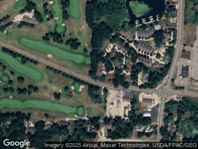
Map
Nearby Homes
- 23 Forest Cove Dr Unit 14
- 62 Starboard Cir Unit 71
- 119 Magua Dr
- 132 Magua Dr
- 196 Lake Front Dr
- 216 Lake Front Dr
- TBD Heron Watch Dr
- 153 Lake Front Dr
- 4298 S Main St Unit 4302
- 3751 Butterfield Dr
- 3809 N Glenridge Rd
- 3859 S Turkeyfoot Rd
- 229 Flynn Ave
- 228 Olden Ave
- V/L Whitefriars Dr
- 232 Olden Ave
- 440 Abbyshire Rd
- 265 E Pace Ave
- 552 Kruger Ave
- 395 W Olden Ave
- 19 Starboard Cir Unit 54
- 74 Portside Cir
- 76 Portside Cir Unit 82
- 82 Portside Cir Unit 79
- 74 Portside Cir Unit 83
- 80 Portside Cir
- 67 Starboard Cir Unit 65
- 63 Starboard Cir Unit 64
- 59 Starboard Cir
- 55 Starboard Cir
- 51 Starboard Cir Unit 61
- 47 Forest Cove Dr
- 37 Starboard Cir
- 48 Forest Cove Dr Unit 36
- 45 Forest Cove Dr Unit 24
- 46 Forest Cove Dr Unit 35
- 46 Forest Cove Dr Unit 15
- 45 Starboard Cir
- 41 Starboard Cir
- 37 Starboard Cir Unit 58