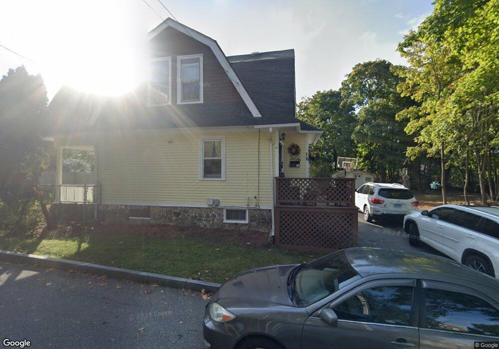
76 Riverside Heights New London, CT 06320
Riverside NeighborhoodEstimated Value: $285,000 - $324,000
3
Beds
2
Baths
1,344
Sq Ft
$223/Sq Ft
Est. Value
About This Home
This home is located at 76 Riverside Heights, New London, CT 06320 and is currently estimated at $299,561, approximately $222 per square foot. 76 Riverside Heights is a home located in New London County with nearby schools including Harbor Elementary School, Bennie Dover Jackson Middle School, and New London High School.
Ownership History
Date
Name
Owned For
Owner Type
Purchase Details
Closed on
Dec 28, 2023
Sold by
Delgrosso Daniel
Bought by
Delrusso Richard
Current Estimated Value
Purchase Details
Closed on
Apr 3, 2018
Sold by
Delrusso Richard and Delgrosso Daniel
Bought by
Delrusso Richard and Delgrosso Daniel
Purchase Details
Closed on
Dec 28, 2009
Sold by
Deutsche Bk
Bought by
Delrosso Richard and Delrosso Daniel
Create a Home Valuation Report for This Property
The Home Valuation Report is an in-depth analysis detailing your home's value as well as a comparison with similar homes in the area
Home Values in the Area
Average Home Value in this Area
Purchase History
| Date | Buyer | Sale Price | Title Company |
|---|---|---|---|
| Delrusso Richard | -- | None Available | |
| Delrusso Richard | -- | None Available | |
| Delrusso Richard | -- | None Available | |
| Delrusso Richard | -- | -- | |
| Delrusso Richard | -- | -- | |
| Delrosso Richard | $44,900 | -- | |
| Natixis He2 | -- | -- | |
| Delrusso Richard | -- | -- | |
| Natixis He2 | -- | -- |
Source: Public Records
Mortgage History
| Date | Status | Borrower | Loan Amount |
|---|---|---|---|
| Previous Owner | Natixis He2 | $169,577 | |
| Previous Owner | Natixis He2 | $78,000 |
Source: Public Records
Tax History Compared to Growth
Tax History
| Year | Tax Paid | Tax Assessment Tax Assessment Total Assessment is a certain percentage of the fair market value that is determined by local assessors to be the total taxable value of land and additions on the property. | Land | Improvement |
|---|---|---|---|---|
| 2025 | $3,955 | $145,400 | $50,700 | $94,700 |
| 2024 | $3,999 | $145,400 | $50,700 | $94,700 |
| 2023 | $3,264 | $87,640 | $33,250 | $54,390 |
| 2022 | $3,270 | $87,640 | $33,250 | $54,390 |
| 2021 | $3,326 | $87,640 | $33,250 | $54,390 |
| 2020 | $3,347 | $87,640 | $33,250 | $54,390 |
| 2019 | $3,497 | $87,640 | $33,250 | $54,390 |
| 2018 | $3,913 | $89,460 | $37,030 | $52,430 |
| 2017 | $3,959 | $89,460 | $37,030 | $52,430 |
| 2016 | $3,620 | $89,460 | $37,030 | $52,430 |
| 2015 | $3,533 | $89,460 | $37,030 | $52,430 |
| 2014 | $3,066 | $89,460 | $37,030 | $52,430 |
Source: Public Records
Map
Nearby Homes
- 271 Crystal Ave
- 265 Crystal Ave
- 19 Hawthorne Dr Unit 104
- 23 Whittlesey St
- 30 Margaret St
- 139 Vauxhall St
- 140 Norwood Ave
- 171 Norwood Ave
- 68 Raymond St
- 385 Broad St
- 141 Starr Hill Rd
- 21 Grove Ave
- 1 E Lake Dr
- 38 Mountain Ave
- 132 Thames St Unit R
- 40 Pearl St
- 47 Phillips St
- 59 Connecticut Ave
- 55 Connecticut Ave
- 621 Military Hwy
- 321 Crystal Ave
- 307 Crystal Ave Unit 6A
- 330 Crystal Ave Unit 12
- 330 Crystal Ave Unit 15
- 330 Crystal Ave Unit 18
- 330 Crystal Ave Unit 17
- 330 Crystal Ave Unit 13
- 330 Crystal Ave Unit 16
- 330 Crystal Ave Unit 14
- 330 Crystal Ave Unit 10
- 330 Crystal Ave Unit 9
- 330 Crystal Ave Unit 8
- 330 Crystal Ave Unit 7
- 330 Crystal Ave Unit 6
- 330 Crystal Ave Unit 5
- 330 Crystal Ave Unit 4
- 330 Crystal Ave Unit 3
- 330 Crystal Ave Unit 2
- 330 Crystal Ave Unit 1
- 330 Crystal Ave