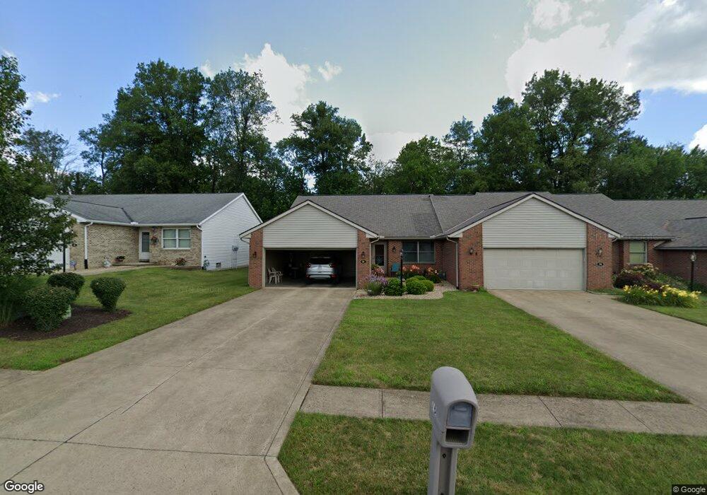
76 Shaffner Blvd Mansfield, OH 44907
Estimated Value: $218,000 - $234,000
2
Beds
2
Baths
1,460
Sq Ft
$154/Sq Ft
Est. Value
About This Home
This home is located at 76 Shaffner Blvd, Mansfield, OH 44907 and is currently estimated at $225,502, approximately $154 per square foot. 76 Shaffner Blvd is a home located in Richland County with nearby schools including Mansfield Christian School, St. Peter's Elementary/Montessori School, and St. Peter's Junior High / High School.
Ownership History
Date
Name
Owned For
Owner Type
Purchase Details
Closed on
Nov 8, 2021
Sold by
Adams Kay A
Bought by
Adams Kay A and Kay A Adams Revocable Living T
Current Estimated Value
Purchase Details
Closed on
May 27, 1997
Sold by
Shaffner Ernest L
Bought by
Kay A Adams
Home Financials for this Owner
Home Financials are based on the most recent Mortgage that was taken out on this home.
Original Mortgage
$37,000
Interest Rate
8.24%
Mortgage Type
New Conventional
Create a Home Valuation Report for This Property
The Home Valuation Report is an in-depth analysis detailing your home's value as well as a comparison with similar homes in the area
Home Values in the Area
Average Home Value in this Area
Purchase History
| Date | Buyer | Sale Price | Title Company |
|---|---|---|---|
| Adams Kay A | -- | Milestone | |
| Kay A Adams | $105,900 | -- |
Source: Public Records
Mortgage History
| Date | Status | Borrower | Loan Amount |
|---|---|---|---|
| Closed | Kay A Adams | $37,000 |
Source: Public Records
Tax History
| Year | Tax Paid | Tax Assessment Tax Assessment Total Assessment is a certain percentage of the fair market value that is determined by local assessors to be the total taxable value of land and additions on the property. | Land | Improvement |
|---|---|---|---|---|
| 2024 | $2,208 | $58,630 | $5,640 | $52,990 |
| 2023 | $2,286 | $58,630 | $5,640 | $52,990 |
| 2022 | $1,999 | $44,520 | $4,770 | $39,750 |
| 2021 | $2,012 | $44,520 | $4,770 | $39,750 |
| 2020 | $2,058 | $44,520 | $4,770 | $39,750 |
| 2019 | $1,847 | $37,720 | $4,040 | $33,680 |
| 2018 | $1,822 | $37,720 | $4,040 | $33,680 |
| 2017 | $1,773 | $37,720 | $4,040 | $33,680 |
| 2016 | $1,451 | $31,750 | $1,970 | $29,780 |
| 2015 | $1,914 | $31,750 | $1,970 | $29,780 |
| 2014 | $1,889 | $31,750 | $1,970 | $29,780 |
| 2012 | $720 | $31,750 | $1,970 | $29,780 |
Source: Public Records
Map
Nearby Homes
- 104 Elmridge Rd
- 33 Rambleside Dr
- 1179 Burkwood Rd
- 65 Logan Rd
- 0 Lexington Ave Unit 224009661
- 101 Chilton Ave
- 50 Lilac Ct E
- 400 James Ave
- 0 George Ave
- 1599 S Main St
- 489 Clifton Blvd
- 810 Lexington Ave
- 575 Crescent Rd
- 470 Lexington Ave
- 466 Lexington Ave
- 456 Lexington Ave
- 794 Mansfield Washington Rd
- 716 Mansfield Washington Rd
- 537 Woodville Rd
- 695 S Andover Rd
- 74 Shaffner Blvd Unit 4
- 82 Shaffner Blvd
- 72 Shaffner Blvd
- 84 Shaffner Blvd Unit 16
- 70 Shaffner Blvd
- 86 Shaffner Blvd Unit 17
- 68 Shaffner Blvd Unit 1
- 1079 Malabar Ln
- 73 Shaffner Blvd Unit 13
- 1081 Malabar Ln
- 71 Shaffner Blvd Unit 12
- 88 Shaffner Blvd
- 69 Shaffner Blvd
- 1083 Malabar Ln Unit 30
- 92 Shaffner Blvd
- 65 Shaffner Blvd Unit 10
- 94 Shaffner Blvd Unit 20
- 1076 Malabar Ln
- 63 Shaffner Blvd Unit 9
- 1085 Malabar Ln Unit 31
Your Personal Tour Guide
Ask me questions while you tour the home.