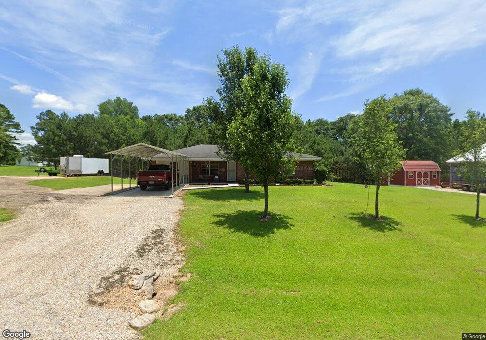
76 Stringer Rd Seminary, MS 39479
Estimated Value: $150,488 - $227,000
Studio
--
Bath
1,498
Sq Ft
$129/Sq Ft
Est. Value
About This Home
This home is located at 76 Stringer Rd, Seminary, MS 39479 and is currently estimated at $193,163, approximately $128 per square foot. 76 Stringer Rd is a home with nearby schools including Seminary Elementary, Seminary Middle School, and Seminary High School.
Ownership History
Date
Name
Owned For
Owner Type
Purchase Details
Closed on
Jan 2, 2014
Sold by
Not Provided
Bought by
Burnham Joseph S
Current Estimated Value
Home Financials for this Owner
Home Financials are based on the most recent Mortgage that was taken out on this home.
Original Mortgage
$81,534
Interest Rate
4.38%
Mortgage Type
New Conventional
Purchase Details
Closed on
Dec 3, 2007
Sold by
Dunn Ricky D and Dunn Suzanne
Bought by
Thrash Michael J
Home Financials for this Owner
Home Financials are based on the most recent Mortgage that was taken out on this home.
Original Mortgage
$80,000
Interest Rate
6.22%
Create a Home Valuation Report for This Property
The Home Valuation Report is an in-depth analysis detailing your home's value as well as a comparison with similar homes in the area
Purchase History
| Date | Buyer | Sale Price | Title Company |
|---|---|---|---|
| Burnham Joseph S | -- | -- | |
| Thrash Michael J | -- | -- |
Source: Public Records
Mortgage History
| Date | Status | Borrower | Loan Amount |
|---|---|---|---|
| Closed | Burnham Joseph S | $81,534 | |
| Previous Owner | Thrash Michael J | $80,000 |
Source: Public Records
Tax History
| Year | Tax Paid | Tax Assessment Tax Assessment Total Assessment is a certain percentage of the fair market value that is determined by local assessors to be the total taxable value of land and additions on the property. | Land | Improvement |
|---|---|---|---|---|
| 2025 | $475 | $8,067 | $0 | $0 |
| 2024 | $475 | $8,067 | $0 | $0 |
| 2023 | $411 | $8,053 | $0 | $0 |
| 2022 | $423 | $8,053 | $0 | $0 |
| 2021 | $356 | $7,698 | $0 | $0 |
| 2020 | $356 | $7,698 | $0 | $0 |
| 2019 | $294 | $7,330 | $0 | $0 |
| 2018 | $310 | $7,289 | $0 | $0 |
| 2017 | $310 | $6,841 | $0 | $0 |
| 2015 | $284 | $6,855 | $0 | $0 |
| 2014 | $271 | $6,852 | $0 | $0 |
Source: Public Records
Map
Nearby Homes
- 258 Charlie Sanford Rd
- 48 J Shows Dr
- 270 Ray Harvey Rd
- 879 Ms-590
- 204 Mississippi 535
- 00 Pine St
- 102 Holly St
- 106 N Oak St
- 668 Evergreen Church Rd
- 121 Acres Old Highway 49
- 0 Old Highway 49 Unit LotWP005 14874583
- 0 Old Highway 49 Unit LotWP004
- 0 Old Highway 49 Unit LotWP003 14874579
- 206 Sycamore St
- 2710 U S 49
- 300 Seminary Lake Mike Conner Rd
- 158 Woodbridge Ln
- 16.27 +/- Acres Shirley Sanford Rd
- 1581 Seminary-Mike Conner Rd
- 22.5 Acres Noel Townsend Rd
- 135 Frank Speed Rd
- 64 Stringer Rd
- 151 Frank Speed Rd
- 000 Frank Speed Rd
- 00 Frank Speed Rd
- 107A Frank Speed Rd
- 107 Frank Speed Rd
- 118 Frank Speed Rd
- 91 Frank Speed Rd
- 102 Frank Speed Rd
- 159 Haley Knight Rd
- 65 Frank Speed Rd
- 253 Frank Speed Rd
- 263 Frank Speed Rd
- 9 Myron Stringer Rd
- 275 Frank Speed Rd
- 46 Myron Stringer Rd
- 1001 Highway 535
- 5 Frank Speed Rd
- 222 Charlie Sanford Rd
Your Personal Tour Guide
Ask me questions while you tour the home.