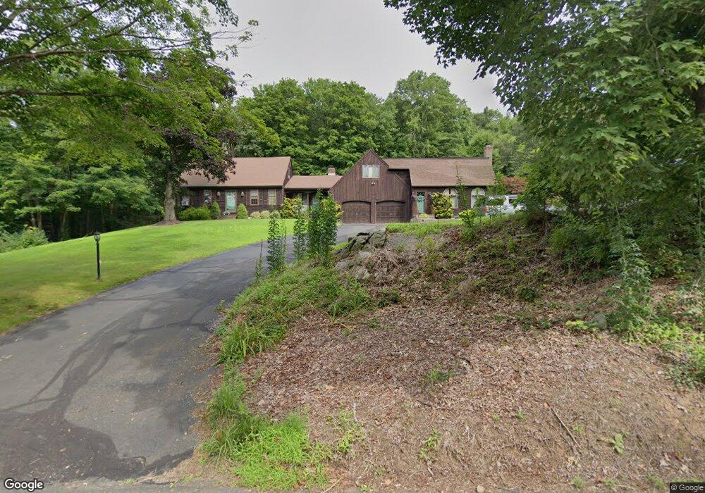
76 Wiese Albert Rd Higganum, CT 06441
Estimated Value: $356,000 - $648,461
5
Beds
4
Baths
3,920
Sq Ft
$114/Sq Ft
Est. Value
About This Home
This home is located at 76 Wiese Albert Rd, Higganum, CT 06441 and is currently estimated at $447,615, approximately $114 per square foot. 76 Wiese Albert Rd is a home located in Middlesex County with nearby schools including Haddam-Killingworth High School.
Ownership History
Date
Name
Owned For
Owner Type
Purchase Details
Closed on
Jan 5, 2017
Sold by
Pitruzello Emanuel J and Pitruzzello Ann K
Bought by
Pitruzello Joseph E and Lombardo Michele J
Current Estimated Value
Purchase Details
Closed on
Jan 30, 2014
Sold by
Pitruzzello Emanuel J
Bought by
Pitruzzello Michele J
Purchase Details
Closed on
Dec 3, 2009
Sold by
Est Ross Marie C
Bought by
Pitruzzello Ann K
Create a Home Valuation Report for This Property
The Home Valuation Report is an in-depth analysis detailing your home's value as well as a comparison with similar homes in the area
Home Values in the Area
Average Home Value in this Area
Purchase History
| Date | Buyer | Sale Price | Title Company |
|---|---|---|---|
| Pitruzello Joseph E | -- | -- | |
| Pitruzzello Michele J | -- | -- | |
| Pitruzzello Ann K | -- | -- | |
| Pitruzzello Ann K | $15,000 | -- |
Source: Public Records
Mortgage History
| Date | Status | Borrower | Loan Amount |
|---|---|---|---|
| Previous Owner | Pitruzzello Ann K | $50,000 | |
| Previous Owner | Pitruzzello Ann K | $81,000 |
Source: Public Records
Tax History Compared to Growth
Tax History
| Year | Tax Paid | Tax Assessment Tax Assessment Total Assessment is a certain percentage of the fair market value that is determined by local assessors to be the total taxable value of land and additions on the property. | Land | Improvement |
|---|---|---|---|---|
| 2025 | $9,695 | $282,230 | $69,300 | $212,930 |
| 2024 | $9,695 | $282,230 | $69,300 | $212,930 |
| 2023 | $9,559 | $282,230 | $69,300 | $212,930 |
| 2022 | $9,124 | $282,230 | $69,300 | $212,930 |
| 2021 | $9,077 | $282,230 | $69,300 | $212,930 |
| 2020 | $9,543 | $301,130 | $82,810 | $218,320 |
| 2019 | $9,543 | $301,130 | $82,810 | $218,320 |
| 2018 | $9,543 | $301,130 | $82,810 | $218,320 |
| 2017 | $9,543 | $301,130 | $82,810 | $218,320 |
| 2016 | $9,395 | $301,130 | $82,810 | $218,320 |
| 2015 | $9,844 | $315,500 | $82,810 | $232,690 |
| 2014 | $9,746 | $315,500 | $82,810 | $232,690 |
Source: Public Records
Map
Nearby Homes
- 521 Foot Hills Rd
- 209 Wiese Albert Rd
- 63 Laurel Grove Dr
- 7 Little Fawn Trail
- 52 Sima Rd
- 215 Chamberlain Hill Rd
- 32 Maple Ave W
- 0 S Dish Mill Rd Unit 24082788
- 523 Chamberlain Hill Rd
- 120 Chamberlain Hill Rd
- 86 Christian Hill Rd
- 0 Mountain Laurel Dr
- 279 Pokorny Rd
- 74R Stone Bridge Dr
- 12 Jackson Rd
- 16 Hidden Lake Rd
- 42 Pine Ledge Trail
- 955 Chamberlain Hill Rd
- 63 Burr Rd
- 204 Old Blue Hills Rd
- 66 Wiese Albert Rd
- 84 Wiese Albert Rd
- 73 Wiese Albert Rd
- 81 Wiese Albert Rd
- 60 Wiese Albert Rd
- 90 Wiese Albert Rd
- 89 Wiese Albert Rd
- 61 Wiese Albert Rd
- 55 Wiese Albert Rd
- 102 Wiese Albert Rd
- 48 Wiese Albert Rd
- 49 Wiese Albert Rd
- 77 Wiese Albert Rd
- 110 Wiese Albert Rd
- 29 Wiese Albert Rd
- 118 Wiese Albert Rd
- 107 Wiese Albert Rd
- 120 Wiese Albert Rd
- 555 Candlewood Hill Rd
- 583 Candlewood Hill Rd