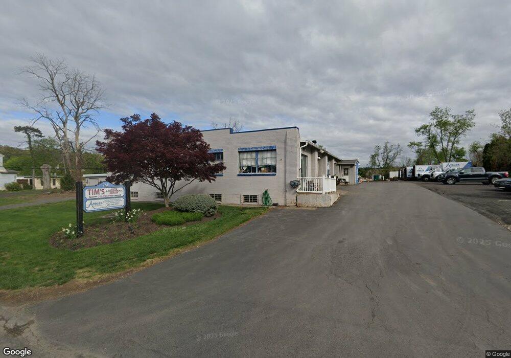
760 Edison Furlong Rd Furlong, PA 18925
Estimated Value: $790,115
--
Bed
--
Bath
4,190
Sq Ft
$189/Sq Ft
Est. Value
About This Home
This home is located at 760 Edison Furlong Rd, Furlong, PA 18925 and is currently estimated at $790,115, approximately $188 per square foot. 760 Edison Furlong Rd is a home located in Bucks County with nearby schools including Kutz Elementary School, Lenape Middle School, and Central Bucks High School-West.
Ownership History
Date
Name
Owned For
Owner Type
Purchase Details
Closed on
May 24, 2011
Sold by
Guertin Timothy J and Guertin Maria F
Bought by
Rla Real Estate Llc
Current Estimated Value
Purchase Details
Closed on
Aug 2, 2002
Sold by
Taylor Michael
Bought by
Philip Conrad Enterprises Inc
Purchase Details
Closed on
Nov 14, 1997
Sold by
Conrad Philip E
Bought by
Taylor Michael
Home Financials for this Owner
Home Financials are based on the most recent Mortgage that was taken out on this home.
Original Mortgage
$155,000
Interest Rate
7.17%
Mortgage Type
Seller Take Back
Purchase Details
Closed on
Jan 14, 1994
Sold by
Bucks County Bank & Trust Company
Bought by
Conrad Philip E
Create a Home Valuation Report for This Property
The Home Valuation Report is an in-depth analysis detailing your home's value as well as a comparison with similar homes in the area
Home Values in the Area
Average Home Value in this Area
Purchase History
| Date | Buyer | Sale Price | Title Company |
|---|---|---|---|
| Rla Real Estate Llc | $420,575 | None Available | |
| Philip Conrad Enterprises Inc | $1,045 | -- | |
| Taylor Michael | $160,000 | -- | |
| Conrad Philip E | $50,000 | -- |
Source: Public Records
Mortgage History
| Date | Status | Borrower | Loan Amount |
|---|---|---|---|
| Previous Owner | Taylor Michael | $155,000 |
Source: Public Records
Tax History Compared to Growth
Tax History
| Year | Tax Paid | Tax Assessment Tax Assessment Total Assessment is a certain percentage of the fair market value that is determined by local assessors to be the total taxable value of land and additions on the property. | Land | Improvement |
|---|---|---|---|---|
| 2025 | $5,521 | $31,200 | $9,400 | $21,800 |
| 2024 | $5,521 | $31,200 | $9,400 | $21,800 |
| 2023 | $5,265 | $31,200 | $9,400 | $21,800 |
| 2022 | $5,206 | $31,200 | $9,400 | $21,800 |
| 2021 | $5,099 | $31,200 | $9,400 | $21,800 |
| 2020 | $5,075 | $31,200 | $9,400 | $21,800 |
| 2019 | $5,021 | $31,200 | $9,400 | $21,800 |
| 2018 | $5,005 | $31,200 | $9,400 | $21,800 |
| 2017 | $4,966 | $31,200 | $9,400 | $21,800 |
| 2016 | $4,935 | $31,200 | $9,400 | $21,800 |
| 2015 | -- | $31,200 | $9,400 | $21,800 |
| 2014 | -- | $31,200 | $9,400 | $21,800 |
Source: Public Records
Map
Nearby Homes
- 2209 Swamp Rd
- 106 Saddle Dr
- lot #3 next to 3739 York Rd
- 3772 Powder Horn Dr
- 3657 Powder Horn Dr
- 2080 Bedfordshire Rd
- 2372 Dorchester St W Unit W
- 3060 Cloverly Dr
- 2443 Sugar Bottom Rd
- 3017 Dorchester St E Unit 125
- 2479 Wheatfield Ln
- 547 Mccarty Dr
- 3889 Robin Rd
- 0 Old York Rd Unit PABU2103356
- 1948 Forest Grove Rd
- 152 Watercrest Dr
- 21 Shady Springs Dr
- 150 Watercrest Dr
- 223 Cherry Ln
- 000 Cherry Ln
- 754 Edison Furlong Rd
- 748 Edison Furlong Rd
- 3445 Edison Furlong Rd
- 3488 York Rd Unit B2
- 3488 York Rd Unit D2
- 3488 York Rd Unit BLDG B, F1
- 3488 York Rd Unit F1
- 3488 York Rd Unit BLDG A, D1
- 3488 York Rd Unit BLDG A, C1
- 3488 York Rd Unit BLDG A, B1
- 3488 York Rd Unit BLDG A, 2ND FLR F2
- 3488 York Rd Unit BLDG A, 2ND FLOOR G2
- 3488 York Rd Unit BLDG A, B&C, 2ND FLR
- 3488 York Rd Unit BLDG A, 2ND FLOOR, C
- 3488 York Rd Unit BLDG A, 2ND FLOOR, B
- 3488, Bldg B York Rd Unit E1
- 3488 BLDG A York Rd Unit D2
- 3488 BLDG A D2 York Rd Unit D2
- 3437 Edison Furlong Rd
- 50 Old York Rd