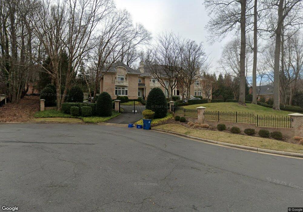
7607 Swinks Ct McLean, VA 22102
Estimated Value: $4,632,000 - $6,541,000
5
Beds
10
Baths
12,565
Sq Ft
$439/Sq Ft
Est. Value
About This Home
This home is located at 7607 Swinks Ct, McLean, VA 22102 and is currently estimated at $5,514,463, approximately $438 per square foot. 7607 Swinks Ct is a home located in Fairfax County with nearby schools including Spring Hill Elementary School, Cooper Middle School, and Langley High School.
Ownership History
Date
Name
Owned For
Owner Type
Purchase Details
Closed on
Nov 30, 1998
Sold by
Gupta Yudh V
Bought by
Narang Chander
Current Estimated Value
Home Financials for this Owner
Home Financials are based on the most recent Mortgage that was taken out on this home.
Original Mortgage
$675,000
Outstanding Balance
$153,987
Interest Rate
6.83%
Mortgage Type
Purchase Money Mortgage
Estimated Equity
$5,360,476
Create a Home Valuation Report for This Property
The Home Valuation Report is an in-depth analysis detailing your home's value as well as a comparison with similar homes in the area
Home Values in the Area
Average Home Value in this Area
Purchase History
| Date | Buyer | Sale Price | Title Company |
|---|---|---|---|
| Narang Chander | $670,000 | -- |
Source: Public Records
Mortgage History
| Date | Status | Borrower | Loan Amount |
|---|---|---|---|
| Open | Narang Chander | $675,000 |
Source: Public Records
Tax History
| Year | Tax Paid | Tax Assessment Tax Assessment Total Assessment is a certain percentage of the fair market value that is determined by local assessors to be the total taxable value of land and additions on the property. | Land | Improvement |
|---|---|---|---|---|
| 2025 | $62,493 | $5,406,240 | $1,176,000 | $4,230,240 |
| 2024 | $62,493 | $5,289,290 | $1,142,000 | $4,147,290 |
| 2023 | $60,906 | $5,289,290 | $1,142,000 | $4,147,290 |
| 2022 | $57,302 | $4,912,260 | $1,142,000 | $3,770,260 |
| 2021 | $46,582 | $3,893,200 | $993,000 | $2,900,200 |
| 2020 | $50,859 | $4,215,440 | $993,000 | $3,222,440 |
| 2019 | $50,184 | $4,159,440 | $937,000 | $3,222,440 |
| 2018 | $48,447 | $4,212,740 | $937,000 | $3,275,740 |
| 2017 | $49,666 | $4,194,740 | $919,000 | $3,275,740 |
| 2016 | $49,561 | $4,194,740 | $919,000 | $3,275,740 |
Source: Public Records
Map
Nearby Homes
- 1106 Mill Ridge
- 1003 Gelston Cir
- 7400 Churchill Rd
- 1109 Old Cedar Rd
- 8011 Lewinsville Rd
- 1052 Balls Hill Rd
- 1112 Balls Hill Rd
- 1314 Macbeth St
- 8023 Lewinsville Rd
- 7818 Georgetown Pike
- 1400 Gower Ct
- 7925 Falstaff Rd
- 942 Dead Run Dr
- 7351 Nicole Marie Ct
- 1228 Providence Terrace
- 8111 Georgetown Pike
- 1105 Carper St
- 7022 Hector Rd
- 8340 Springhaven Garden Ln
- 7374 Eldorado St
- 1103 Mill Ridge
- 1120 Swinks Mill
- 1120 Swinks Mill Rd
- 7601 Swinks Ct
- 1105 Mill Ridge
- 1101 Mill Ridge
- 7606 Swinks Ct
- 1122 Swinks Mill Rd
- 7600 Swinks Ct
- 7700 Old Dominion Dr
- 7608 Swinks Ct
- 7602 Swinks Ct
- 1107 Mill Ridge
- 7610 Swinks Ct
- 1121 Swinks Mill Rd
- 1100 Mill Ridge
- 1102 Mill Ridge
- 1056 Swinks Mill Rd
- 1104 Mill Ridge
- 1098 Mill Ridge
Your Personal Tour Guide
Ask me questions while you tour the home.