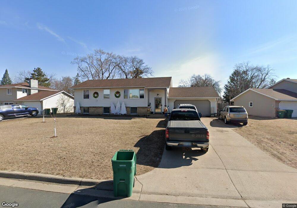
7608 Unity Ave N Brooklyn Park, MN 55443
Estimated Value: $322,000 - $353,162
5
Beds
2
Baths
1,196
Sq Ft
$286/Sq Ft
Est. Value
About This Home
This home is located at 7608 Unity Ave N, Brooklyn Park, MN 55443 and is currently estimated at $342,541, approximately $286 per square foot. 7608 Unity Ave N is a home located in Hennepin County with nearby schools including Zanewood Community School, North View Middle School, and Park Center Senior High.
Ownership History
Date
Name
Owned For
Owner Type
Purchase Details
Closed on
Oct 15, 2008
Sold by
Deutsche Bank Nat Trust Co
Bought by
Sweeny Nicoles M
Current Estimated Value
Purchase Details
Closed on
Feb 6, 2006
Sold by
Kingoina Peter A and Kingoina Joyce M
Bought by
Bryant Saundra
Purchase Details
Closed on
Jan 26, 2000
Sold by
Reynolds Leslie J
Bought by
Kingoina Peter A and Kingoina Joyce M
Purchase Details
Closed on
Sep 4, 1998
Sold by
Reynolds Leslie J
Bought by
Kingoinn Peter A and Kingoinn Joyce M
Purchase Details
Closed on
Aug 26, 1998
Sold by
Brunn Gerald A and Brunn Carol J
Bought by
Reynolds Leslie J
Create a Home Valuation Report for This Property
The Home Valuation Report is an in-depth analysis detailing your home's value as well as a comparison with similar homes in the area
Home Values in the Area
Average Home Value in this Area
Purchase History
| Date | Buyer | Sale Price | Title Company |
|---|---|---|---|
| Sweeny Nicoles M | $120,000 | -- | |
| Bryant Saundra | $251,000 | -- | |
| Kingoina Peter A | $123,000 | -- | |
| Kingoinn Peter A | $123,000 | -- | |
| Reynolds Leslie J | $123,000 | -- |
Source: Public Records
Mortgage History
| Date | Status | Borrower | Loan Amount |
|---|---|---|---|
| Closed | Kingoinn Peter A | -- |
Source: Public Records
Tax History Compared to Growth
Tax History
| Year | Tax Paid | Tax Assessment Tax Assessment Total Assessment is a certain percentage of the fair market value that is determined by local assessors to be the total taxable value of land and additions on the property. | Land | Improvement |
|---|---|---|---|---|
| 2024 | $3,999 | $288,900 | $120,000 | $168,900 |
| 2023 | $3,814 | $284,600 | $120,000 | $164,600 |
| 2022 | $3,511 | $287,000 | $120,000 | $167,000 |
| 2021 | $3,278 | $260,800 | $58,000 | $202,800 |
| 2020 | $3,182 | $245,600 | $58,000 | $187,600 |
| 2019 | $2,961 | $228,300 | $58,000 | $170,300 |
| 2018 | $3,305 | $204,400 | $50,500 | $153,900 |
| 2017 | $2,769 | $175,000 | $50,500 | $124,500 |
| 2016 | $2,594 | $158,200 | $50,500 | $107,700 |
| 2015 | $2,414 | $158,200 | $40,400 | $117,800 |
| 2014 | -- | $135,800 | $40,400 | $95,400 |
Source: Public Records
Map
Nearby Homes
- 7740 Arlington Ave N
- 5664 Brookdale Dr N
- 5648 Brookdale Dr N
- 5636 Brookdale Dr N
- 5624 Brookdale Dr N
- 7509 Xenia Ln N
- 7880 Yates Ave N
- 5729 75th Ln N
- 5905 Garwood Rd N
- 7337 Unity Ln N
- 7308 Unity Ln N
- 7936 Yates Ave N
- 5333 80th Ave N
- 5717 80th Ave N
- 7441 Major Ave N
- 8040 Xenia Ave N
- 8033 Quail Ave N
- 7201 Perry Ct E
- 7700 Tessman Dr N
- 6034 72nd Ln N
- 7600 Unity Ave N
- 7608 7608 N Unity-Avenue-n
- 7608 7608 Unity-Avenue-n
- 7633 Scott Ave N
- 7580 Unity Ave N
- 7625 Scott Ave N
- 7624 Unity Ave N
- 5325 76th Place N
- 7609 Unity Ave N
- 7601 Unity Ave N
- 7624 7624 Unity Ave N
- 7617 Scott Ave N
- 7572 Imperial Dr N
- 7641 Scott Ave N
- 7617 Unity Ave N
- 7589 Unity Ave N
- 7589 7589 Unity-Avenue-n
- 7581 Unity Ave N
- 7625 Unity Ave N
- 7564 Imperial Dr N