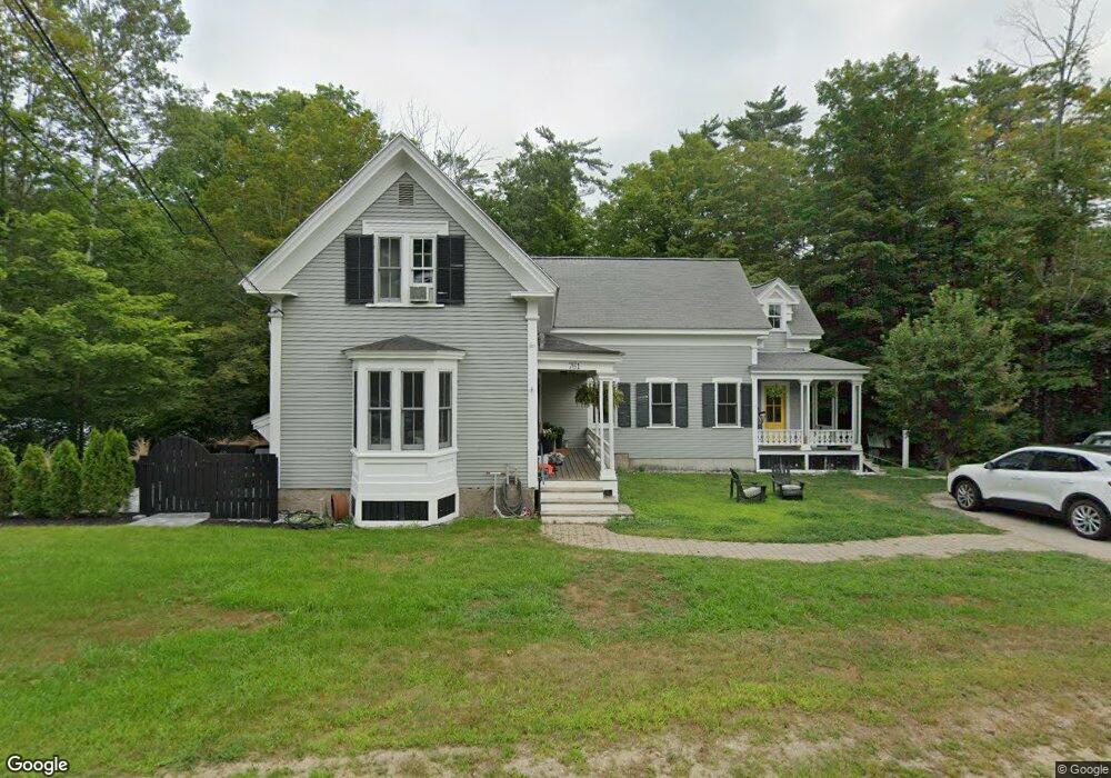
761 Kearsarge Rd North Conway, NH 03860
Estimated Value: $686,262 - $895,000
5
Beds
3
Baths
2,737
Sq Ft
$294/Sq Ft
Est. Value
About This Home
This home is located at 761 Kearsarge Rd, North Conway, NH 03860 and is currently estimated at $805,566, approximately $294 per square foot. 761 Kearsarge Rd is a home with nearby schools including A. Crosby Kennett Middle School, Kennett High School, and The Lilliputian School.
Ownership History
Date
Name
Owned For
Owner Type
Purchase Details
Closed on
Apr 30, 1999
Sold by
Murphy Robert J and Murphy Jean Potter
Bought by
Murphy Patrick D and Murphy Kelley R
Current Estimated Value
Home Financials for this Owner
Home Financials are based on the most recent Mortgage that was taken out on this home.
Original Mortgage
$75,000
Outstanding Balance
$19,234
Interest Rate
6.95%
Mortgage Type
Purchase Money Mortgage
Estimated Equity
$786,332
Create a Home Valuation Report for This Property
The Home Valuation Report is an in-depth analysis detailing your home's value as well as a comparison with similar homes in the area
Home Values in the Area
Average Home Value in this Area
Purchase History
| Date | Buyer | Sale Price | Title Company |
|---|---|---|---|
| Murphy Patrick D | $95,000 | -- |
Source: Public Records
Mortgage History
| Date | Status | Borrower | Loan Amount |
|---|---|---|---|
| Open | Murphy Patrick D | $75,000 |
Source: Public Records
Tax History Compared to Growth
Tax History
| Year | Tax Paid | Tax Assessment Tax Assessment Total Assessment is a certain percentage of the fair market value that is determined by local assessors to be the total taxable value of land and additions on the property. | Land | Improvement |
|---|---|---|---|---|
| 2024 | $7,238 | $631,000 | $140,000 | $491,000 |
| 2023 | $7,370 | $631,000 | $140,000 | $491,000 |
| 2022 | $6,486 | $330,900 | $80,000 | $250,900 |
| 2021 | $5,404 | $330,700 | $79,800 | $250,900 |
| 2020 | $5,586 | $330,700 | $79,800 | $250,900 |
| 2019 | $5,728 | $330,700 | $79,800 | $250,900 |
| 2018 | $5,988 | $263,200 | $59,800 | $203,400 |
| 2017 | $5,259 | $263,200 | $59,800 | $203,400 |
| 2016 | $5,082 | $263,200 | $59,800 | $203,400 |
| 2015 | $5,024 | $263,200 | $59,800 | $203,400 |
| 2014 | $4,964 | $263,200 | $59,800 | $203,400 |
| 2013 | $4,835 | $270,700 | $59,800 | $210,900 |
Source: Public Records
Map
Nearby Homes
- 679 Kearsarge Rd
- 50 Drachenfels Rd
- 970 Kearsarge Rd
- 72 Cranmore Woods Ln Unit 2
- 72 Cranmore Woods Ln Unit 4
- 45 Wildflower Trail Unit 9
- 168 Old Bartlett Rd Unit A
- 46 Crestwood Dr
- 243 Skimobile Rd Unit 352
- 243 Skimobile Rd Unit 252
- 243 Skimobile Rd Unit 355
- 243 Skimobile Rd Unit 255
- 235 Skimobile Rd Unit 1404
- 239 Skimobile Rd Unit 314
- 239 Skimobile Rd Unit 305
- 239 Skimobile Rd Unit 304
- 17 Purple Finch Rd Unit 73
- 137 Skimobile Rd Unit 3
- 15 Black Diamond Rd Unit 4
- 11 Black Diamond Rd Unit 3
- 771 Kearsarge Rd
- 781 Kearsarge
- 760 Kearsarge Rd
- 640 Intervale Cross Rd
- 568 Old Bartlett Rd
- 734 Kearsarge Rd Unit 5
- 734 Kearsarge Rd Unit 3
- 734 Kearsarge Rd Unit 4
- 734 Kearsarge Rd Unit 8
- 734 Kearsarge Rd Unit 6
- 734 Kearsarge Rd Unit 7
- 734 Kearsarge Rd
- 538 Old Bartlett Rd
- 774 Kearsarge Rd
- 565 Old Bartlett Rd
- 1000 Kearsarge Rd
- 624 Intervale Cross Rd
- 623 Intervale Cross Rd
- 623 Intervale Crossroad
- 720 Kearsarge Rd