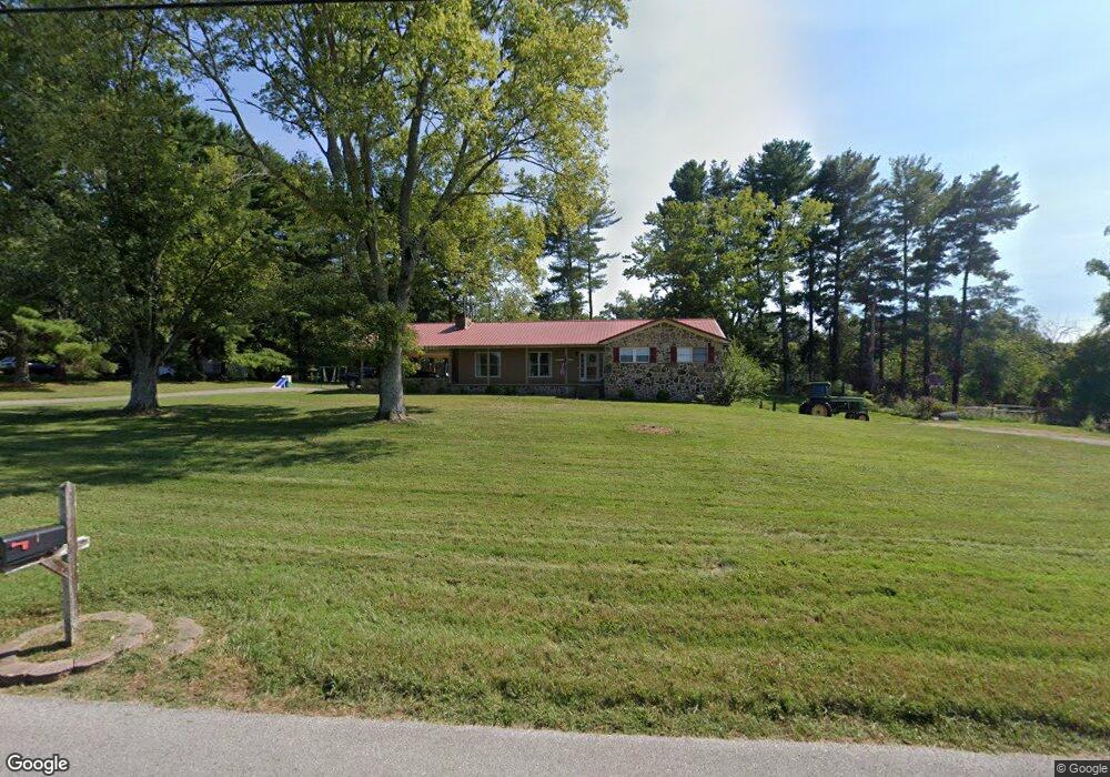
761 Mason Grissom Rd Rock Island, TN 38581
Estimated Value: $184,000 - $350,000
--
Bed
2
Baths
2,014
Sq Ft
$125/Sq Ft
Est. Value
About This Home
This home is located at 761 Mason Grissom Rd, Rock Island, TN 38581 and is currently estimated at $251,451, approximately $124 per square foot. 761 Mason Grissom Rd is a home located in Warren County with nearby schools including Eastside Elementary School and Warren County High School.
Ownership History
Date
Name
Owned For
Owner Type
Purchase Details
Closed on
Feb 11, 2020
Sold by
Hill Paula
Bought by
Hill Logan and Wells Hannah
Current Estimated Value
Home Financials for this Owner
Home Financials are based on the most recent Mortgage that was taken out on this home.
Original Mortgage
$113,729
Outstanding Balance
$100,484
Interest Rate
3.6%
Mortgage Type
New Conventional
Estimated Equity
$150,967
Purchase Details
Closed on
Oct 2, 2019
Sold by
Hill Paula
Bought by
Hill Logan
Home Financials for this Owner
Home Financials are based on the most recent Mortgage that was taken out on this home.
Original Mortgage
$34,285
Interest Rate
3.4%
Mortgage Type
New Conventional
Purchase Details
Closed on
Apr 17, 1997
Sold by
Sandra Crawford
Bought by
Tim Hill
Purchase Details
Closed on
Feb 23, 1983
Bought by
Crawford Sandra
Purchase Details
Closed on
Aug 29, 1975
Create a Home Valuation Report for This Property
The Home Valuation Report is an in-depth analysis detailing your home's value as well as a comparison with similar homes in the area
Home Values in the Area
Average Home Value in this Area
Purchase History
| Date | Buyer | Sale Price | Title Company |
|---|---|---|---|
| Hill Logan | $100,000 | -- | |
| Hill Logan | -- | -- | |
| Tim Hill | $113,000 | -- | |
| Crawford Sandra | -- | -- | |
| -- | -- | -- |
Source: Public Records
Mortgage History
| Date | Status | Borrower | Loan Amount |
|---|---|---|---|
| Open | Hill Logan | $113,729 | |
| Previous Owner | Hill Logan | $34,285 |
Source: Public Records
Tax History Compared to Growth
Tax History
| Year | Tax Paid | Tax Assessment Tax Assessment Total Assessment is a certain percentage of the fair market value that is determined by local assessors to be the total taxable value of land and additions on the property. | Land | Improvement |
|---|---|---|---|---|
| 2025 | $750 | $61,700 | $0 | $0 |
| 2024 | $750 | $38,100 | $3,850 | $34,250 |
| 2023 | $750 | $38,100 | $3,850 | $34,250 |
| 2022 | $750 | $38,100 | $3,850 | $34,250 |
| 2021 | $750 | $38,100 | $3,850 | $34,250 |
| 2020 | $583 | $38,100 | $3,850 | $34,250 |
| 2019 | $667 | $29,675 | $3,150 | $26,525 |
| 2018 | $583 | $29,675 | $3,150 | $26,525 |
| 2017 | $583 | $29,675 | $3,150 | $26,525 |
| 2016 | $583 | $29,675 | $3,150 | $26,525 |
| 2015 | $592 | $29,675 | $3,150 | $26,525 |
| 2014 | $521 | $29,675 | $3,150 | $26,525 |
| 2013 | $521 | $26,133 | $0 | $0 |
Source: Public Records
Map
Nearby Homes
- 98 Lakeside Dr
- 239 Pine Bluff Rd
- 0 Rock Station Rd
- 371 Rock Station Rd
- 0 Goodbar Rd Unit RTC2866377
- 0 Goodbar Rd Unit RTC2990114
- 0 Goodbar Rd Unit RTC2866387
- 0 Goodbar Rd Unit RTC2866833
- 0 Goodbar Rd Unit RTC2990108
- 0 Goodbar Rd Unit RTC2990119
- 676 George Rd
- 1.50 AC Rock Island Shores Dr
- 3426 Old Rock Island Rd
- 0 Anchor Bend Dr Unit RTC2904354
- 115 Long Point Dr
- 1149 Camp Overton Rd
- 622 Bone Cave Rd
- 0 Bone Cave Rd Unit RTC3048650
- 0 Bone Cave Rd Unit 1518019
- 2 Hidden River Rd
- 697 Mason Grissom Rd
- 718 Mason Grissom Rd
- 883 Mason Grissom Rd
- 554 Mason Grissom Rd
- 529 Mason Grissom Rd
- 647 Depot Rd
- 660 Mason Grissom Rd
- 500 Mason Grissom Rd
- 105 McGiboney Rd
- 722 Depot Rd
- 545 Depot Rd
- 736 Depot Rd
- 448 Mason Grissom Rd
- 421 Mason Grissom Rd
- 364 Lakeside Dr
- 303 Mason Grissom Rd
- 253 McGiboney Rd
- 374 Mason Grissom Rd
- 283 Mason Grissom Rd
- 1115 Mason Grissom Rd