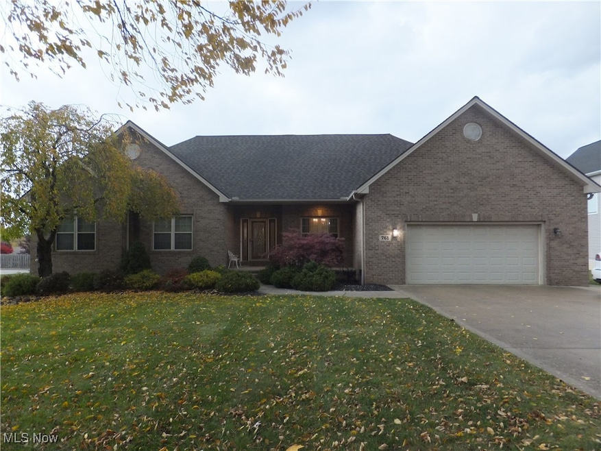
761 Rockside Rd Independence, OH 44131
Estimated payment $2,877/month
Highlights
- Open Floorplan
- Cape Cod Architecture
- High Ceiling
- Bullard Elementary School Rated A-
- Deck
- Granite Countertops
About This Home
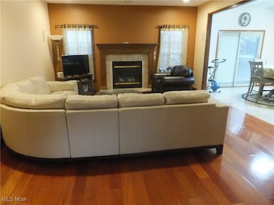
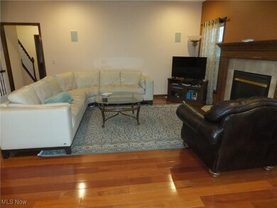
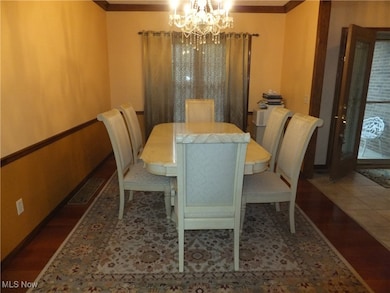
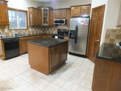
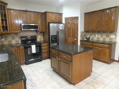
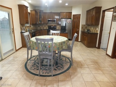
Your Dream Home Awaits, Welcome to a beautifully maintained residence located in the hearth of desirable Seven Hills community, this inviting home combines comfort, convenience and timeless style, on the first floor you have a huge kitchen w/granite counter, tile floor, pantry and all appliances staying, family room with fireplace, 1st floor laundry room, 3 large bedrooms, 2 full bathrooms, 2nd floor you have an extremely large 4th bedroom or play/game room and full bathroom, phenomenal lower level consist of rec room, full kitchen w/appliances staying, exercise room, utility area and a walk-out to your backyard patio, gazebo deck and deep back yard, lower level great for entertaining and also would be perfect for in-law suite, attached garage that will fit 3 cars, minutes to shopping, major freeways, downtown, airport
Listing Agent
Regal Realty, Inc. Brokerage Email: 440-888-2727, rhpregal@aol.com License #203807 Listed on: 11/03/2025
Home Details
Home Type
- Single Family
Est. Annual Taxes
- $7,647
Year Built
- Built in 2003
Lot Details
- 0.52 Acre Lot
- Lot Dimensions are 114x196
Parking
- 3 Car Attached Garage
- Garage Door Opener
Home Design
- Cape Cod Architecture
- Brick Exterior Construction
- Fiberglass Roof
- Asphalt Roof
- Vinyl Siding
Interior Spaces
- 1-Story Property
- Open Floorplan
- Tray Ceiling
- High Ceiling
- Ceiling Fan
- Gas Fireplace
- Entrance Foyer
- Family Room with Fireplace
- Finished Basement
- Basement Fills Entire Space Under The House
Kitchen
- Eat-In Kitchen
- Range
- Microwave
- Dishwasher
- Kitchen Island
- Granite Countertops
Bedrooms and Bathrooms
- 4 Bedrooms | 3 Main Level Bedrooms
- Walk-In Closet
- 4 Full Bathrooms
Laundry
- Laundry Room
- Dryer
Outdoor Features
- Deck
- Patio
- Front Porch
Utilities
- Forced Air Heating and Cooling System
- Heating System Uses Gas
Community Details
- No Home Owners Association
- Skyline Heights 01 Subdivision
Listing and Financial Details
- Assessor Parcel Number 551-02-015
Map
Home Values in the Area
Average Home Value in this Area
Tax History
| Year | Tax Paid | Tax Assessment Tax Assessment Total Assessment is a certain percentage of the fair market value that is determined by local assessors to be the total taxable value of land and additions on the property. | Land | Improvement |
|---|---|---|---|---|
| 2024 | $7,647 | $127,750 | $15,610 | $112,140 |
| 2023 | $7,736 | $110,670 | $16,170 | $94,500 |
| 2022 | $7,867 | $110,670 | $16,170 | $94,500 |
| 2021 | $8,115 | $110,670 | $16,170 | $94,500 |
| 2020 | $7,437 | $89,990 | $13,160 | $76,830 |
| 2019 | $7,258 | $257,100 | $37,600 | $219,500 |
| 2018 | $7,122 | $89,990 | $13,160 | $76,830 |
| 2017 | $7,733 | $88,940 | $11,550 | $77,390 |
| 2016 | $7,499 | $88,940 | $11,550 | $77,390 |
| 2015 | $6,620 | $88,940 | $11,550 | $77,390 |
| 2014 | $6,620 | $79,630 | $11,200 | $68,430 |
Property History
| Date | Event | Price | List to Sale | Price per Sq Ft |
|---|---|---|---|---|
| 11/11/2025 11/11/25 | Pending | -- | -- | -- |
| 11/03/2025 11/03/25 | For Sale | $425,000 | -- | -- |
Purchase History
| Date | Type | Sale Price | Title Company |
|---|---|---|---|
| Warranty Deed | $267,500 | Prosource Title |
Mortgage History
| Date | Status | Loan Amount | Loan Type |
|---|---|---|---|
| Open | $214,000 | New Conventional |
Source: MLS Now
MLS Number: 5170109
APN: 551-02-015
Disclaimer: Certain information contained herein is derived from information provided by parties other than Homes.com. All information provided is deemed reliable, but is not guaranteed to be accurate and should be independently verified.
![]() IDX information is provided exclusively for personal, non-commercial use, and may not be used for any purpose other than to identify prospective properties consumers may be interested in purchasing. Information is deemed reliable but not guaranteed.
IDX information is provided exclusively for personal, non-commercial use, and may not be used for any purpose other than to identify prospective properties consumers may be interested in purchasing. Information is deemed reliable but not guaranteed.
- 281 Crescent Ridge Dr
- 1184 Mayfair Dr
- 664 E Dawnwood Dr
- 650 E Dartmoor Ave
- 900 N Skyline Dr
- 181 E Hillsdale Ave
- 5981 Northview Dr
- 5658 N Circle View Dr
- 1319 Dartmoor Ave
- 874 E Meadowlawn Blvd
- 5833 Kuenzer Dr
- 100 E Decker Dr
- 5554 Landover Ct Unit 282
- 1207 Parkleigh Dr
- 2430 Rockside Rd
- 5553 Sunset Ln Unit A15-F
- 5870 N Crossview Rd
- 941 Meadview Dr
- 2621 Belmont Dr
- 6145 Winchester Dr
