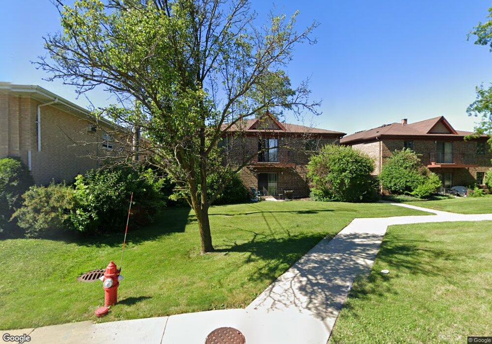
7610 W 26th St Unit 2 Riverside, IL 60546
Estimated Value: $193,000 - $322,000
2
Beds
2
Baths
1,046
Sq Ft
$227/Sq Ft
Est. Value
About This Home
This home is located at 7610 W 26th St Unit 2, Riverside, IL 60546 and is currently estimated at $237,277, approximately $226 per square foot. 7610 W 26th St Unit 2 is a home located in Cook County with nearby schools including A F Ames Elementary School, L J Hauser Jr High School, and Riverside Brookfield High School.
Ownership History
Date
Name
Owned For
Owner Type
Purchase Details
Closed on
Oct 24, 1997
Sold by
Radys Ella L
Bought by
Leuzzi Antoinette C
Current Estimated Value
Home Financials for this Owner
Home Financials are based on the most recent Mortgage that was taken out on this home.
Original Mortgage
$45,000
Outstanding Balance
$6,454
Interest Rate
7.51%
Estimated Equity
$230,823
Create a Home Valuation Report for This Property
The Home Valuation Report is an in-depth analysis detailing your home's value as well as a comparison with similar homes in the area
Home Values in the Area
Average Home Value in this Area
Purchase History
| Date | Buyer | Sale Price | Title Company |
|---|---|---|---|
| Leuzzi Antoinette C | $73,333 | Chicago Title Insurance Co |
Source: Public Records
Mortgage History
| Date | Status | Borrower | Loan Amount |
|---|---|---|---|
| Open | Leuzzi Antoinette C | $45,000 |
Source: Public Records
Tax History
| Year | Tax Paid | Tax Assessment Tax Assessment Total Assessment is a certain percentage of the fair market value that is determined by local assessors to be the total taxable value of land and additions on the property. | Land | Improvement |
|---|---|---|---|---|
| 2025 | $14 | $16,599 | $3,740 | $12,859 |
| 2024 | $14 | $16,599 | $3,740 | $12,859 |
| 2023 | $17 | $16,599 | $3,740 | $12,859 |
| 2022 | $17 | $14,836 | $1,963 | $12,873 |
| 2021 | $16 | $14,835 | $1,963 | $12,872 |
| 2020 | $14 | $14,835 | $1,963 | $12,872 |
| 2019 | $15 | $12,799 | $1,776 | $11,023 |
| 2018 | $15 | $12,799 | $1,776 | $11,023 |
| 2017 | $14 | $12,799 | $1,776 | $11,023 |
| 2016 | $667 | $14,275 | $1,495 | $12,780 |
| 2015 | $683 | $14,275 | $1,495 | $12,780 |
| 2014 | $668 | $14,275 | $1,495 | $12,780 |
| 2013 | $634 | $14,915 | $1,495 | $13,420 |
Source: Public Records
Map
Nearby Homes
- 7610 W 26th St Unit 6
- 472 Northgate Ct
- 2527 Keystone Ave
- 2252 Northgate Ave
- 2311 Park Ave
- 315 Bartram Rd
- 562 Byrd Rd
- 2230 Keystone Ave
- 525 Berkeley Rd
- 499 Longcommon Rd
- 339 Eastgrove Rd
- 727 Selborne Rd
- 395 N Delaplaine Rd Unit 1W
- 2914 Maple Ave
- 475 Shenstone Rd Unit 304
- 475 Shenstone Rd Unit 303
- 3032 Wisconsin Ave
- 2532 Clinton Ave
- 6921 26th St
- 2508 Kenilworth Ave
- 7610 W 26th St Unit 3
- 7610 W 26th St Unit 1
- 7610 W 26th St Unit 7
- 7610 W 26th St Unit 5
- 7610 W 26th St Unit 4
- 7636 W 26th St Unit 2-W
- 7636 W 26th St
- 7638 W 26th St
- 7638 W 26th St Unit 2W
- 7638 W 26th St Unit 1W
- 2527 Hainsworth Ave
- 2525 Hainsworth Ave
- 2523 Hainsworth Ave
- 2521 Hainsworth Ave
- 2519 Hainsworth Ave
- 7625 W 25th St
- 468 Northgate Ct
- 2515 Hainsworth Ave
- 2513 Hainsworth Ave
- 473 Northgate Ct