Estimated Value: $111,000 - $165,000
3
Beds
1
Bath
1,256
Sq Ft
$105/Sq Ft
Est. Value
About This Home
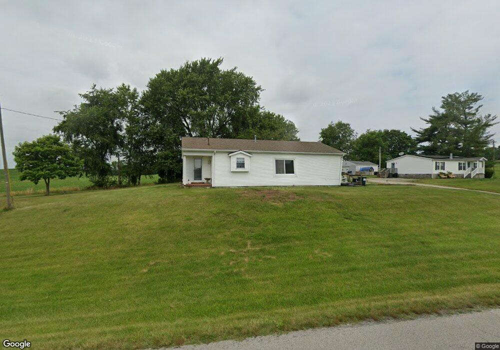
This home is located at 7611 State Route 1389, Maceo, KY 42355 and is currently estimated at $132,443, approximately $105 per square foot. 7611 State Route 1389 is a home with nearby schools including East View Elementary School, Daviess County Middle School, and Daviess County High School.
Ownership History
Date
Name
Owned For
Owner Type
Purchase Details
Closed on
Apr 5, 2024
Sold by
Mangelluzzi Michael A and Mangelluzzi Bridget R
Bought by
Richards Jacob A
Current Estimated Value
Home Financials for this Owner
Home Financials are based on the most recent Mortgage that was taken out on this home.
Original Mortgage
$117,826
Outstanding Balance
$116,229
Interest Rate
7.7%
Mortgage Type
FHA
Estimated Equity
$16,214
Create a Home Valuation Report for This Property
The Home Valuation Report is an in-depth analysis detailing your home's value as well as a comparison with similar homes in the area
Home Values in the Area
Average Home Value in this Area
Purchase History
| Date | Buyer | Sale Price | Title Company |
|---|---|---|---|
| Richards Jacob A | $120,000 | First American Mtg Solutions |
Source: Public Records
Mortgage History
| Date | Status | Borrower | Loan Amount |
|---|---|---|---|
| Open | Richards Jacob A | $117,826 | |
| Closed | Richards Jacob A | $10,000 |
Source: Public Records
Tax History Compared to Growth
Tax History
| Year | Tax Paid | Tax Assessment Tax Assessment Total Assessment is a certain percentage of the fair market value that is determined by local assessors to be the total taxable value of land and additions on the property. | Land | Improvement |
|---|---|---|---|---|
| 2025 | $1,237 | $120,000 | $0 | $0 |
| 2024 | $622 | $59,000 | $0 | $0 |
| 2023 | $643 | $59,000 | $0 | $0 |
| 2022 | $658 | $59,000 | $0 | $0 |
| 2021 | $567 | $50,000 | $0 | $0 |
| 2020 | $571 | $50,000 | $0 | $0 |
| 2019 | $560 | $50,000 | $0 | $0 |
| 2018 | $449 | $37,100 | $0 | $0 |
| 2017 | $30 | $30,800 | $0 | $0 |
| 2016 | $30 | $0 | $0 | $0 |
| 2015 | -- | $30,800 | $0 | $0 |
| 2014 | -- | $30,800 | $0 | $0 |
Source: Public Records
Map
Nearby Homes
- 7912 Kentucky 405
- 6453 Roy Wells Rd
- 6201 Kentucky 405
- 6613 Barcroft
- 1440 Kingsbrooke
- 1400 Kingsbrooke
- 6217 Sullivan Loop
- 1084 Pleasure Point E
- 6208 Kentucky 144
- 7815 Kentucky 2830
- 6584 Pleasant Valley Rd
- 8835 Knottsville-Mount Zion Rd
- 8969 Cr-1072m
- 167 Irene Ave
- 2118 Arlington Park Blvd
- 1907 Sturbridge Place
- 5110 Sturbridge Place
- 5106 Sturbridge Place
- 5009 Sturbridge Place
- 5141 Pleasant Valley Rd
- 7611 Kentucky 1389
- 7627 Kentucky 1389
- 1781 Graves Ln
- 1850 Graves Ln
- 1794 Graves Ln
- 1782 Graves Ln
- 1819 Graves Ln
- 7853 State Route 1389
- 7903 State Route 1389
- 1771 Graves Ln
- 7958 State Route 1389
- 1693 Graves Ln
- 1700 Graves Ln
- 6774 Kentucky 1389
- 0 Kentucky 1389
- 1619 Graves Ln
- 1599 Graves Ln
- 1585 Graves Ln
- 1571 Graves Ln