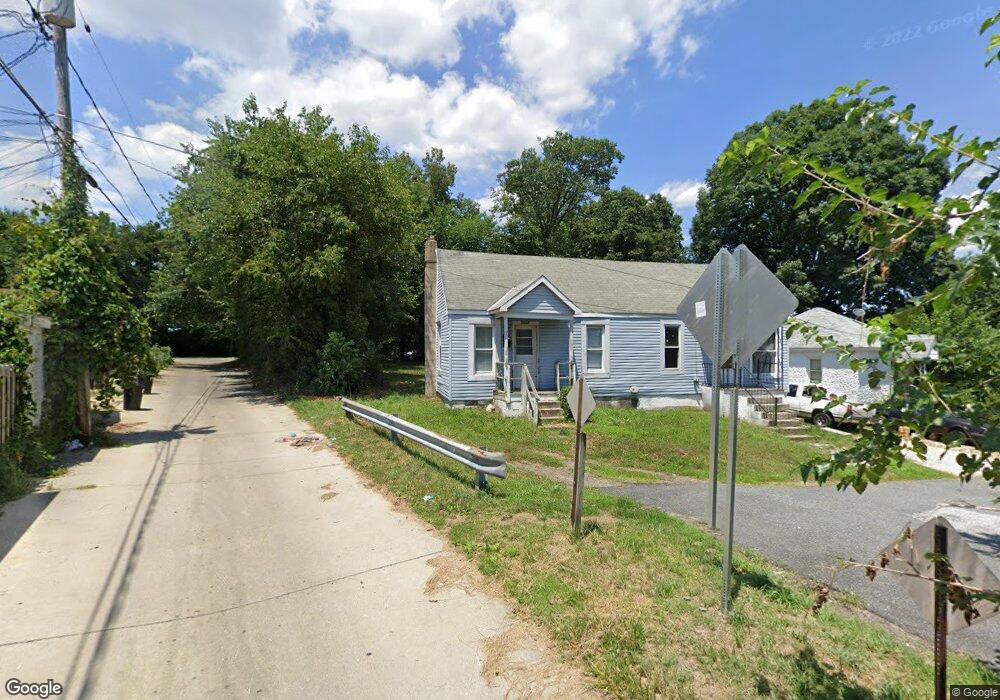
7612 Hackett Ave Baltimore, MD 21224
Estimated Value: $198,000 - $658,000
Studio
2
Baths
880
Sq Ft
$408/Sq Ft
Est. Value
About This Home
This home is located at 7612 Hackett Ave, Baltimore, MD 21224 and is currently estimated at $358,944, approximately $407 per square foot. 7612 Hackett Ave is a home located in Baltimore County with nearby schools including Berkshire Elementary School, Holabird Middle School, and Patapsco High & Center for Arts.
Ownership History
Date
Name
Owned For
Owner Type
Purchase Details
Closed on
Oct 29, 2025
Sold by
Hackett Ave Llc
Bought by
Tanwnd Llc
Current Estimated Value
Home Financials for this Owner
Home Financials are based on the most recent Mortgage that was taken out on this home.
Original Mortgage
$171,875
Outstanding Balance
$171,554
Interest Rate
6.34%
Mortgage Type
New Conventional
Estimated Equity
$187,390
Purchase Details
Closed on
Feb 28, 2025
Sold by
Beautiful Investment Properties Llc
Bought by
Hackett Ave Llc
Create a Home Valuation Report for This Property
The Home Valuation Report is an in-depth analysis detailing your home's value as well as a comparison with similar homes in the area
Home Values in the Area
Average Home Value in this Area
Purchase History
| Date | Buyer | Sale Price | Title Company |
|---|---|---|---|
| Tanwnd Llc | -- | Terrain Title | |
| Hackett Ave Llc | $600,000 | Terrain Title | |
| Hackett Ave Llc | $600,000 | Terrain Title |
Source: Public Records
Mortgage History
| Date | Status | Borrower | Loan Amount |
|---|---|---|---|
| Open | Tanwnd Llc | $171,875 |
Source: Public Records
Tax History
| Year | Tax Paid | Tax Assessment Tax Assessment Total Assessment is a certain percentage of the fair market value that is determined by local assessors to be the total taxable value of land and additions on the property. | Land | Improvement |
|---|---|---|---|---|
| 2025 | $2,403 | $124,633 | -- | -- |
| 2024 | $2,403 | $113,267 | -- | -- |
| 2023 | $3,301 | $101,900 | $54,100 | $47,800 |
| 2022 | $2,089 | $99,967 | $0 | $0 |
| 2021 | $4,277 | $98,033 | $0 | $0 |
| 2020 | $4,277 | $96,100 | $54,100 | $42,000 |
| 2019 | $4,298 | $96,000 | $0 | $0 |
| 2018 | $5,337 | $95,900 | $0 | $0 |
| 2017 | $4,901 | $95,800 | $0 | $0 |
| 2016 | $2,373 | $95,300 | $0 | $0 |
| 2015 | $2,373 | $94,800 | $0 | $0 |
| 2014 | $2,373 | $94,300 | $0 | $0 |
Source: Public Records
Map
Nearby Homes
- 1006 Dalton Ave
- 7515 Belmont Ave
- 7428 Poplar Ave
- 7506 Belmont Ave
- 7525 Lange St
- 7627 Carson Ave
- 7412 Belmont Ave
- 7483 Berkshire Rd
- 7406 Poplar Ave
- 7404 Poplar Ave
- 619 N Point Rd
- 7503 Cypress Ave
- 7503 Riddle Ave
- 8031 Bank St
- 1213 Willow Rd
- 1205 N Point Rd
- 7475 Rabon Ave
- 8049 Lansdale Rd
- 874 Mildred Ave
- 8012 Wynbrook Rd
- 7615 Hackett Ave
- 7617 Hackett Ave
- 7619 Hackett Ave
- 1006 S North Point Rd
- 7616 Hackett Ave
- 927 Elton Ave
- 925 Elton Ave
- 929 Elton Ave
- 923 Elton Ave
- 1004 Northpoint Rd
- 931 Elton Ave
- 921 Elton Ave
- 1008 S North Point Rd
- 933 Elton Ave
- 919 Elton Ave
- 1002 N Point Rd
- 1008 Northpoint Rd
- 935 Elton Ave
- 1002 Old North Point Rd
- 1002 S North Point Rd
Your Personal Tour Guide
Ask me questions while you tour the home.